9 Bev Callender Close, Lambeth, London, SW8 3DF
2 planning records
About 9 Bev Callender Close
A plain-English summary derived from public records, EPC certificates, sold prices and local data.
9 Bev Callender Close is a one-bedroom end-of-terrace house in Lambeth, London, London (SW8 3DF). It has a recorded floor area of 44 m² (around 474 sq ft), construction records dating it to 1983-1990 and council tax band B. At 44 m² this is the 2nd smallest of 9 units on EPC record in the building, where floor areas span 34–101 m². The building's EPC ratings span E to C, with this unit at the bottom. On EPC score it ranks last in the building (50 versus a best of 74). The latest certificate (April 2022) shows an E (score 50), well below the UK norm with real room to improve. The recommended improvements would push it to D (score 64).
Untraded for 16 years, with the last transfer in March 2010. Sale prices here have outpaced London HPI: 6.2% per year against 0% for the wider region. Today's modelled estimate of £311,000 sits 68.1% above the 2010 sale of £185,000. At 44 m² it sits well below the postcode median (83 m² across 8 EPCs), making it one of the more compact homes locally. On energy efficiency it sits in the bottom 10% of properties in this postcode — significant headroom for improvement. 2 planning records sit against the property, 2 approved, 0 refused. Past consents include new windows, meaningful when judging how the property has evolved.
What this property has
Pulled from EPC certificates, claim submissions and our property model. Empty categories are hidden — we only show what's known.
Inside
- Bedrooms1
Energy performance
Every EPC certificate filed against this property — current rating, recorded improvements, and where there's headroom to reach a higher band.
9 Bev Callender Close sits at the bottom of the postcode for energy efficiency — meaningful headroom to improve.
EPC Rating
A
B
C
D
E
E50
F
G
Main Heating
Gas
Main Fuel
Gas
Hot Water
Very Poor
Windows
Average
CO2 Emissions
2.7 t/year
Occupancy
Rented
Planning history
Applications and permits filed against 9 Bev Callender Close, Lambeth, London, SW8 3DF, sourced from the PlanIt planning register.
- Feb 2010AmendmentGrant Permission
Application for a Certificate of Lawful Development (Existing) with respect to the installation of replacement windows and doors.
Sales history & valuation
Recorded transactions, our model's current estimate, and a quick read on what neighbouring properties have sold for.
Current estimate
See how we calculated this£311,000
Modelled from EPC, postcode comparables and a sale-price growth of 6.2% per year over 5 years.
Last sold (2010)
£185,000
Growth on file: 6.2% per year over 5 years.
Sales timeline
Launch offer · 33% off
The complete analysis of 9 Bev Callender Close, Lambeth, London, SW8 3DF
Everything we know about this property, compiled into one in-depth, downloadable report.
Detailed analysis
A written breakdown of everything that matters
Similar properties nearby
A handful of close matches in the same postcode area, ranked by likeness on bedrooms, type and floor area.
The neighbourhood at a glance
A condensed read of the local area. Each tile links through to the full breakdown on the London district page.
Rail-style transport is unusually close for this postcode.
Crime
12/mo
Rising year-on-year across the wider district.
Nearest stop
0.1 km
Lambourn Road — bus stop.
Road noise across the postcode
Modelled day and night-time noise levels around SW8 3DF from Defra's strategic mapping. The pin marks this postcode's centroid.
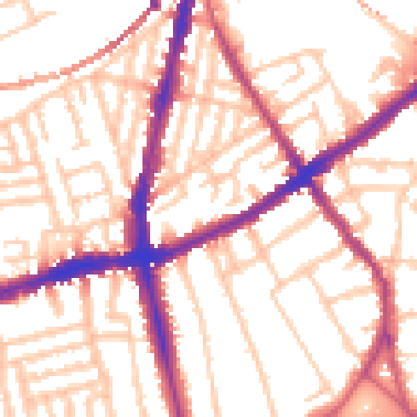
Daytime· 07:00 – 23:00
54.4dB

Everything within walking distance
Schools, transport stops and scenic spots near this property — 107 points of interest in total.
Common questions
The questions buyers, sellers and homeowners most often ask about 9 Bev Callender Close, Lambeth, London, SW8 3DF. Each answer is also embedded as structured data for search engines.
