Are you a property professional?Get qualified leads from motivated homeowners.
Get started6 Bobbin Close, Lambeth, London, SW4 0LL
1 planning record
About 6 Bobbin Close
A plain-English summary derived from public records, EPC certificates, sold prices and local data.
6 Bobbin Close is a one-bedroom detached house in Lambeth, London, London (SW4 0LL). It has a recorded floor area of 52 m² (around 560 sq ft), construction records dating it to 1967-1975 and council tax band C. At 52 m² this is the 10th smallest of 20 units on EPC record in the building, where floor areas span 48–98 m². The building's EPC ratings span D to C, with this unit at the bottom. The latest certificate (January 2021) shows a D (score 65), on the cusp of jumping into the C band. Earlier certificates rated it C (January 2011); the latest reading is one band lower. Between certificates, wall efficiency dropped from Average to Poor and roof efficiency dropped from Good to Average. The recommended improvements would push it to C (score 76).
Sale prices here have outpaced London HPI: 5.3% per year against 0% for the wider region. On a £-per-square-foot basis, the last sale (£736/sq ft) was about 45.6% above the typical sold price in the postcode. One planning record on file: new windows approved in 2019. Past consents include new windows, meaningful when judging how the property has evolved. Sold December 2021 for £412,000. That sale was during the post-pandemic price surge, when transactions cleared materially above pre-2020 trend.
What this property has
Pulled from EPC certificates, claim submissions and our property model. Empty categories are hidden — we only show what's known.
Inside
- Bedrooms1
- Bathrooms1
Energy performance
Every EPC certificate filed against this property — current rating, recorded improvements, and where there's headroom to reach a higher band.
Current Certificate(1 of 2)
Jan 2021
EPC Rating
A
B
C
D
D65
E
F
G
Main Heating
Gas
Main Fuel
Gas
Hot Water
Good
Windows
Very Poor
CO2 Emissions
2.3 t/year
Occupancy
Rented
Planning history
Applications and permits filed against 6 Bobbin Close, Lambeth, London, SW4 0LL, sourced from the PlanIt planning register.
- Jan 2019RenovationFullGrant Permission
Replacement of existing timber-framed windows and doors with timber framed windows and doors. (To 4-7 Bobbin Close)
Sales history & valuation
Recorded transactions, our model's current estimate, and a quick read on what neighbouring properties have sold for.
Sale price has at least doubled since 2002.
Current estimate
See how we calculated this£423,000
Modelled from EPC, postcode comparables and a sale-price growth of 5.3% per year over 20 years.
Last sold (2021)
£412,000
Growth on file: 5.3% per year over 20 years.
Sales timeline
Versus other Bobbin Close homes
Four headline reads against 12 similar flats on this street, drawn from the latest EPC and Land Registry data.
6 Bobbin Close outperforms the street on floor area by a wide margin.
EPC Rating
65 (D)
Street avg 70 (C)
Floor Area
52 m²
Street avg 50 m²
CO₂ Emissions
2.3 t/year
Similar properties nearby
A handful of close matches in the same postcode area, ranked by likeness on bedrooms, type and floor area.
The neighbourhood at a glance
A condensed read of the local area. Each tile links through to the full breakdown on the London district page.
Rail-style transport is unusually close for this postcode.
Crime
9/mo
Rising year-on-year across the wider district.
Nearest stop
0.1 km
Silverthorne Road Clapham — bus stop.
Road noise across the postcode
Modelled day and night-time noise levels around SW4 0LL from Defra's strategic mapping. The pin marks this postcode's centroid.
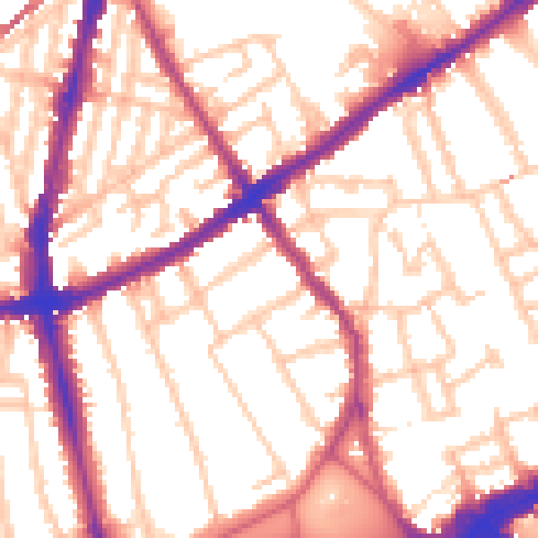
Daytime· 07:00 – 23:00
54.8dB

Everything within walking distance
Schools, transport stops and scenic spots near this property — 107 points of interest in total.
Beautiful places to visit nearby
Curated scenic spots within reach of this postcode, served by Beautifulplaces.ai. Photography and tagging come from their open dataset.
Common questions
The questions buyers, sellers and homeowners most often ask about 6 Bobbin Close, Lambeth, London, SW4 0LL. Each answer is also embedded as structured data for search engines.