Are you a property professional?Get qualified leads from motivated homeowners.
Get started2 Colclough Avenue, Newcastle, ST5 8JP
2 planning records
About 2 Colclough Avenue
A plain-English summary derived from public records, EPC certificates, sold prices and local data.
2 Colclough Avenue is a four-bedroom semi-detached house in Newcastle (ST5 8JP). It has a recorded floor area of 171 m² (around 1841 sq ft), construction records dating it to 1930-1949 and council tax band A. The latest certificate (November 2016) shows a C (score 69), just inside the C band. The rating has held steady at C across 2 certificates since October 2013. Between certificates, roof efficiency dropped from Average to Very Poor and window efficiency dropped from Good to Average. Other recorded features include attached land beyond the plot. Records show the property has been extended at some point in its history.
It hasn't traded since February 2000, a hold of 26 years that's notably long for the area. Only one transfer is on record with HM Land Registry, suggesting it has stayed in the same hands for a long time. At 171 m² the property is well over the postcode median (92 m² across 3 EPCs), placing it in the larger end of the local stock. Today's modelled estimate of £269,000 sits 512.1% above the 2000 sale of £43,950. On a £-per-square-foot basis, the last sale (£24/sq ft) was about 85.2% below the postcode norm. 2 planning records sit against the property, 2 approved, 0 refused. Past consents include an extension, meaningful when judging how the property has evolved.
What this property has
Pulled from EPC certificates, claim submissions and our property model. Empty categories are hidden — we only show what's known.
Inside
- Bedrooms4
- Bathrooms2
Outside
- Parkingoff_road
- Land
Energy performance
Every EPC certificate filed against this property — current rating, recorded improvements, and where there's headroom to reach a higher band.
2 Colclough Avenue's carbon output runs well above what efficient homes in the postcode produce.
Current Certificate(1 of 2)
Nov 2016
EPC Rating
A
B
C
C69
D
E
F
G
Main Heating
Gas
Main Fuel
Gas
Hot Water
Good
Windows
Average
CO2 Emissions
6.1 t/year
Occupancy
Owner Occupied
Planning history
Applications and permits filed against 2 Colclough Avenue, Newcastle, ST5 8JP, sourced from the PlanIt planning register.
Multiple extension applications run across more than a decade of planning history at 2 Colclough Avenue.
- Dec 2022ExtensionFullPermit
Extension: Single storey
Single storey extension to front and rear of existing property
Sales history & valuation
Recorded transactions, our model's current estimate, and a quick read on what neighbouring properties have sold for.
2 Colclough Avenue's modelled value sits at over four times its earliest registered sale price (2000).
Current estimate
See how we calculated this£269,000
Modelled from EPC, postcode comparables.
Last sold (2000)
£43,950
Recorded with HM Land Registry.
Sales timeline
Versus other Colclough Avenue homes
Three headline reads against 3 similar houses on this street, drawn from the latest EPC and Land Registry data.
Floor Area for 2 Colclough Avenue runs comfortably ahead of the street norm.
EPC Rating
69 (C)
Street avg 74 (C)
Floor Area
171 m²
Street avg 91 m²
CO₂ Emissions
6.1 t/year
Similar properties nearby
A handful of close matches in the same postcode area, ranked by likeness on bedrooms, type and floor area.
The neighbourhood at a glance
A condensed read of the local area. Each tile links through to the full breakdown on the Newcastle district page.
Crime
3/mo
Steady year-on-year across the wider district.
Nearest stop
0.2 km
Cardway — bus stop.
Road noise across the postcode
Modelled day and night-time noise levels around ST5 8JP from Defra's strategic mapping. The pin marks this postcode's centroid.
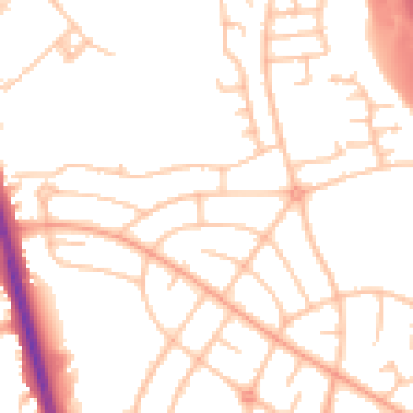
Daytime· 07:00 – 23:00
50.4dB

Everything within walking distance
Schools, transport stops and scenic spots near this property — 48 points of interest in total.
Beautiful places to visit nearby
Curated scenic spots within reach of this postcode, served by Beautifulplaces.ai. Photography and tagging come from their open dataset.
Common questions
The questions buyers, sellers and homeowners most often ask about 2 Colclough Avenue, Newcastle, ST5 8JP. Each answer is also embedded as structured data for search engines.