The Goods Yard, Unit 1, Goods Station Lane, Penkridge, Stafford, ST19 5AU
About The Goods Yard
The Goods Yard is a two-bedroom semi-detached house in Penkridge, Stafford, Stafford (ST19 5AU). It has a recorded floor area of 66 m² (around 710 sq ft), construction records dating it to 1900-1929 and council tax band D. The latest certificate (October 2018) shows a D (score 59), a step below the typical UK home. The recommended improvements would lift it to B (score 86), a 2-band jump. The home occupies a corner plot.
Today's modelled estimate of £276,000 is 65.1% below the 2023 sale of £790,000, running counter to the wider postcode trend, which makes the EPC and condition history especially worth a look. On a £-per-square-foot basis, the last sale (£1,112/sq ft) was about 391.4% above the typical sold price in the postcode. 3 planning records sit against the property, 2 approved, 0 refused. At 66 m² it's 27.5% smaller than the typical home in the postcode (91 m² median across 17 EPCs). Most recent transfer: March 2023 at £790,000.
What this property has
Inside
- Bedrooms2
- Bathrooms2
- Utility roomYes
- StudyYes
Outside
- Corner plotYes
Building
- RefurbishedYes
Everything you need to know about The Goods Yard
The true value, the hidden risks and the full sale history, in one report.
Pick your report · from £14.99
One time fee only - money back guarantee

The data behind every report


Energy performance
Recommended upgrades on file would lift this property by multiple EPC bands.
EPC Rating
Certificate validity
Valid until 23 October 2028

Get a survey for this property
Level 3 Building Survey
Because the property was built before 1919 and has solid (non-cavity) walls, we believe a Level 3 building survey should be considered.
From £885 · Includes VAT
Planning history
3 applications on record at The Goods Yard, Unit 1, Goods Station Lane, Penkridge, Stafford, ST19 5AU
1 live now- Apr 2024FullOutcome in report
Use of the site for the siting of containers for storage purposes
- Documents
- 10 docs on file
- Reference
- 23/00862/FUL
- More recent applications — locked
- FullApr 2026Decision
- ConditionsSept 2024Decision
Unlock The Goods Yard, Unit 1, Goods Station Lane, Penkridge, Stafford, ST19 5AU's full planning history
You're seeing the shape of it. The report has the substance.
- Every decision — granted, refused or withdrawn (2 on record)
- All 3 applications on this property in full, plus 1 notable nearby
- The 22 documents, officer reports & conditions
- What the pattern means for extending or converting here
One time fee only - money back guarantee
Sales history & valuation
Latest sale on The Goods Yard was the highest on Land Registry record across the postcode.
£276,000
Modelled from EPC, postcode comparables.
£790,000
Recorded with HM Land Registry.
Sales timeline
6 March 2023Most recent
£790,000
Median price across the last 5 sales in ST19 5AU: £282,500 (2025–2023).
Nearby sales in ST19 5AU
7 Goods Station Lane, Penkridge, Stafford, ST19 5AU
Sold Sept 2025
£425,000Highfield, Goods Station Lane, Penkridge, Stafford, ST19 5AU
Sold Feb 2025
£410,0002 Railway Cottages, Goods Station Lane, Penkridge, Stafford, ST19 5AU
Sold Jul 2024
£230,00011 Goods Station Lane, Penkridge, Stafford, ST19 5AU
Sold Jan 2024
£282,50032 Goods Station Lane, Penkridge, Stafford, ST19 5AU
Sold Sept 2023
£245,000
Versus other Goods Station Lane homes
The Goods Yard outperforms the street on price per m² by a wide margin.
Price per m²
£11,970
Street avg £2,837
Floor Area
66 m²
Street avg 101 m²
Habitable Rooms
4 rooms
Street avg 5 rooms
CO₂ Emissions
3.9 t/year
Street avg 4.2 t/year
Everything you need to know about The Goods Yard
The true value, the hidden risks and the full sale history, in one report.
Pick your report · from £14.99
One time fee only - money back guarantee
The data behind every report
Similar properties nearby
1 Broc Close, Penkridge
ST19 5EY
1 Bellbrook, Penkridge
ST19 5DL
1 Bungham Lane, Penkridge
ST19 5NH
1 Chelford Close, Penkridge
ST19 5EJ
1 Ash Close, Penkridge
ST19 5FP
1 Birch Court, Penkridge
ST19 5FT
1 Boscomoor Lane, Penkridge
ST19 5NU
1 Beverley Close, Penkridge
ST19 5SS
The neighbourhood at a glance
Rail-style transport is unusually close for this postcode.
Crime
75/mo
Steady year-on-year across the wider district.
Nearest stop
0.2 km
Goods Station Lane — bus stop.
Closest school
0.5 km
Marshbrook First School. 5 schools nearby.
Go deeper on the local area
A Local Area report breaks down crime, transport links, schools and air quality in depth.
Road noise across the postcode
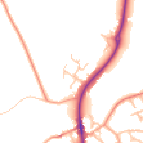
Daytime· 07:00 – 23:00
50.5dB
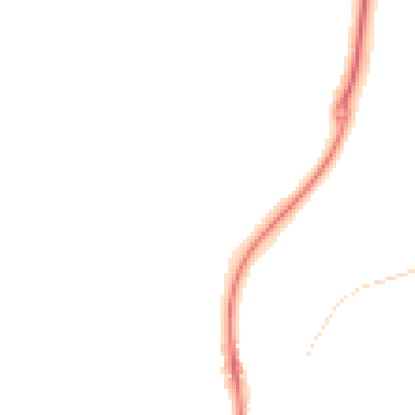
Night-time· 23:00 – 07:00
42.8dB