53 Villiers Street, Sunderland, SR1 1HA
We're still gathering data on this property. Claim it to add details and complete this page.
About 53 Villiers Street
A plain-English summary derived from public records, EPC certificates, sold prices and local data.
53 Villiers Street is a property in Sunderland (SR1 1HA).
Energy performance
Every EPC certificate filed against this property — current rating, recorded improvements, and where there's headroom to reach a higher band.
No EPC on record
This property doesn't have an Energy Performance Certificate yet. An EPC is required to sell or let — and unlocks our automated valuation.
Planning history
Applications and permits filed against 53 Villiers Street, Sunderland, SR1 1HA, sourced from the PlanIt planning register.
No planning applications are recorded against 53 Villiers Street, Sunderland, SR1 1HA. The full report also covers planning activity across the surrounding area.
Similar properties nearby
A handful of close matches in the same postcode area, ranked by likeness on bedrooms, type and floor area.
The neighbourhood at a glance
A condensed read of the local area. Each tile links through to the full breakdown on the Sunderland district page.
Rail-style transport is unusually close for this postcode.
Crime
10/mo
Rising year-on-year across the wider district.
Nearest stop
0.2 km
High Street West-Frederick Road — bus stop.
Closest school
0.4 km
Hudson Road Primary School. 25 schools nearby.
Road noise across the postcode
Modelled day and night-time noise levels around SR1 1HA from Defra's strategic mapping. The pin marks this postcode's centroid.
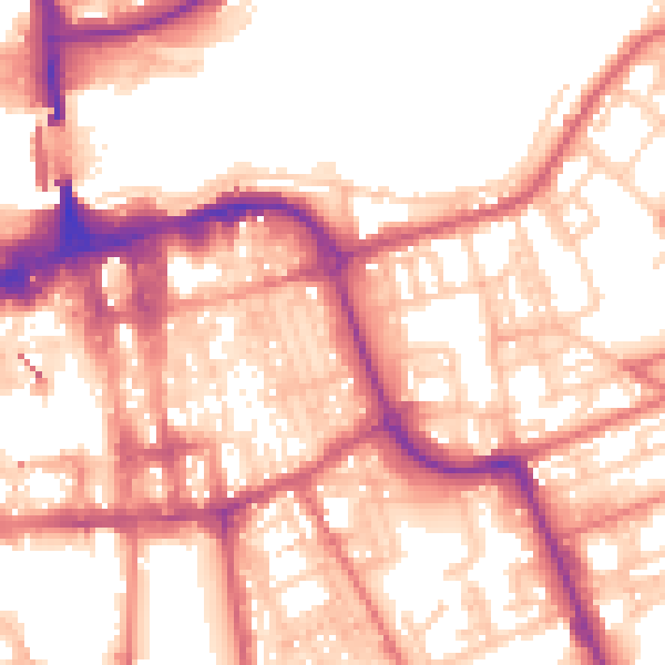
Daytime· 07:00 – 23:00
56.9dB

Night-time· 23:00 – 07:00
46.1dB
55 dB
60 dB
65 dB
70 dB
75 dB
80 dB
Defra Road Noise Strategic Mapping, Round 4Common questions
The questions buyers, sellers and homeowners most often ask about 53 Villiers Street, Sunderland, SR1 1HA. Each answer is also embedded as structured data for search engines.