Maritime Buildings, Flat 5, St Thomas Street, Sunderland, SR1 1BL
About Maritime Buildings
Maritime Buildings is a mid-terrace house in Sunderland (SR1 1BL). It has a recorded floor area of 54 m² (around 581 sq ft), construction records dating it to before 1900 and council tax band B. At 54 m² this is the 3rd smallest of 12 units on EPC record in Maritime Buildings, where floor areas span 46–85 m². The building's EPC ratings span E to C, with this unit at the top. On EPC score it ranks first in the building (80 versus a worst of 41). The latest certificate (March 2024) shows a C (score 80), near the top of the C band. The rating has held steady at C across 2 certificates since January 2009. Between certificates, hot-water efficiency went from Poor to Average, lighting went from Very Poor to Good and main heating went from Very Poor to Average; while wall efficiency dropped from Good to Very Poor. The recommended improvements would push it to B (score 85). Main heating runs on electricity.
Across 2005–2024, sale prices on this property compounded at -3% per year. Today's modelled estimate of £115,000 sits 113% above the 2024 sale of £54,000. On a £-per-square-foot basis, the last sale (£93/sq ft) was about 35% below the postcode norm. Most recent transfer: November 2024 at £54,000. Across the public record there are 4 sales, relatively high churn for a single property. At 54 m² it's 22.9% smaller than the typical home in the postcode (70 m² median across 11 EPCs). Its energy rating outperforms most of the postcode (better than 82% of similar EPCs).
Everything you need to know about Maritime Buildings
The true value, the hidden risks and the full sale history, in one report.
30-day money-back guarantee

The data behind every report


Energy performance
For a compact home of this size, this rating sits in the top tier locally.
EPC Rating
Property Improvements
Changes detected from historical EPC data
Heating system upgraded to a more efficient system
Hot water efficiency improved
More low energy lighting installed
Planning history
Maritime Buildings has no planning applications on record.
Notable planning nearby
5applications of note in the surrounding area
We flagged 1 thing worth checking at Maritime Buildings
Independent checks surfaced things a buyer would want to understand before offering. The report explains each one in full, with the underlying data and what to ask.
- Larger development activity nearby
30-day money-back guarantee
Sales history & valuation
Maritime Buildings's sale-price growth has lagged the wider UK trajectory across its history on file.
£115,000
Modelled from EPC, postcode comparables and a sale-price growth of -3.0% per year over 20 years.
£54,000
Growth on file: -3.0% per year over 20 years.
Sales timeline
12 November 2024Most recent
£54,000
-46.0%over 17 years13 September 2007
£100,001
-42.9%over 1 year2 May 2006
£175,000
+76.8%over 1 year2 February 2005
£99,000
Median price across the last 5 sales in SR1 1BL: £62,500 (2023–2021).
Nearby sales in SR1 1BL
Maritime Buildings, Flat 7, St Thomas Street, Sunderland, SR1 1BL
Sold Oct 2023
£62,500Maritime Buildings, Flat 11, St Thomas Street, Sunderland, SR1 1BL
Sold Aug 2022
£63,600Maritime Buildings, Flat 3, St Thomas Street, Sunderland, SR1 1BL
Sold Aug 2022
£30,000Maritime Buildings, Flat 10, St Thomas Street, Sunderland, SR1 1BL
Sold Jun 2021
£57,000Maritime Buildings, Flat 4, St Thomas Street, Sunderland, SR1 1BL
Sold Dec 2018
£60,000
Versus other St Thomas Street homes
On years held, Maritime Buildings runs well behind the street norm.
Price per m²
£1,000
Street avg £1,086
Floor Area
54 m²
Street avg 66 m²
Habitable Rooms
2 rooms
Street avg 3 rooms
CO₂ Emissions
2.3 t/year
Street avg 3.7 t/year
Everything you need to know about Maritime Buildings
The true value, the hidden risks and the full sale history, in one report.
30-day money-back guarantee
The data behind every report
Similar properties nearby
220 221, Flat 12, High Street West
SR1 1TZ
220 221, Flat 5, High Street West
SR1 1TZ
29b, Flat 2, East Cross Street
SR1 1XB
220 221, Flat 11, High Street West
SR1 1TZ
40 41, Flat 10, Frederick Street
SR1 1LN
220 221, Flat 3, High Street West
SR1 1TZ
220 221, Flat 7, High Street West
SR1 1TZ
220 221, Flat 8, High Street West
SR1 1TZ
The neighbourhood at a glance
Rail-style transport is unusually close for this postcode.
Crime
10/mo
Rising year-on-year across the wider district.
Nearest stop
0.1 km
John Street — bus stop.
Closest school
0.5 km
Hudson Road Primary School. 25 schools nearby.
Go deeper on the local area
The full report breaks down crime, transport links, schools and air quality in depth.
Road noise across the postcode
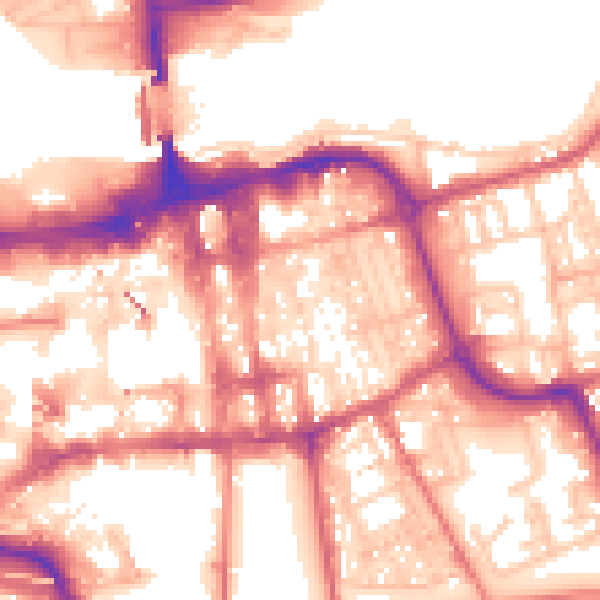
Daytime· 07:00 – 23:00
57.2dB

Night-time· 23:00 – 07:00
46.9dB