1 Chestnut Gardens, Shrivenham, Swindon, SN6 8DE
About 1 Chestnut Gardens
1 Chestnut Gardens is a three-bedroom detached house in Shrivenham, Swindon, Swindon (SN6 8DE). It has a recorded floor area of 123 m² (around 1324 sq ft) and council tax band F. Tenure is freehold. The latest certificate (May 2017) returns a B (score 83), comfortably above the UK average. The recommended improvements would push it to A (score 92). The property has underfloor heating on record, all of which lower running costs and tend to lift resale appeal.
Across 2017–2019, sale prices on this property compounded at 1% per year. Today's modelled estimate of £563,000 is 23.7% above the 2019 sale price. Most recent transfer: October 2019 at £455,000.
What this property has
Inside
- Bedrooms3
- Bathrooms3
Outside
- Private gardenRear
- GarageSingle
- Summer houseYes
Building
- TenureFreehold
- Underfloor heatingYes
- RefurbishedYes
Everything you need to know about 1 Chestnut Gardens
The true value, the hidden risks and the full sale history, in one report.
Pick your report · every report is £14.99
One time fee only - money back guarantee

The data behind every report


Energy performance
EPC Rating
Get a survey for this property
Level 2 HomeBuyer Report
We've checked 10 risk factors against the available data for this property and believe a Level 2 HomeBuyer Report could be a suitable option for you.
From £795 · Includes VAT
Planning history
1 Chestnut Gardens has no planning applications on record.
But the area is active
3 notable applications nearby — larger schemes and conversions that could reshape the street. The report maps them all.
Sales history & valuation
£563,000
Modelled from EPC, postcode comparables and a sale-price growth of 1.0% per year over 2 years.
£455,000
Growth on file: 1.0% per year over 2 years.
Sales timeline
15 October 2019Most recent
£455,000
+2.2%over 2 years13 July 2017
£445,000
Median price across the last 5 sales in SN6 8DE: £467,500 (2018–2017).
Nearby sales in SN6 8DE
12 Chestnut Gardens, Shrivenham, Swindon, SN6 8DE
Sold Jul 2018
£412,5003 Chestnut Gardens, Shrivenham, Swindon, SN6 8DE
Sold Mar 2018
£445,0005 Chestnut Gardens, Shrivenham, Swindon, SN6 8DE
Sold Jun 2017
£500,0002 Chestnut Gardens, Shrivenham, Swindon, SN6 8DE
Sold Jun 2017
£504,66011 Chestnut Gardens, Shrivenham, Swindon, SN6 8DE
Sold Jun 2017
£467,500
Versus other Chestnut Gardens homes
Years Held for 1 Chestnut Gardens lags the street by a wide margin.
Price per m²
£3,699
Street avg £3,710
Floor Area
123 m²
Street avg 129 m²
CO₂ Emissions
2.1 t/year
Street avg 2.1 t/year
Years Held
7 years
Street avg 9 years
Everything you need to know about 1 Chestnut Gardens
The true value, the hidden risks and the full sale history, in one report.
Pick your report · every report is £14.99
One time fee only - money back guarantee
The data behind every report
Similar properties nearby
1 Catherine Close, Shrivenham
SN6 8ER
1 Buckland Drive, Shrivenham
SN6 8FR
1 Church Row, Bourton
SN6 8JG
1 Chapelwick Close, Shrivenham
SN6 8EF
1 Alexander Way, Shrivenham
SN6 8FD
1 Charlesby Drive, Watchfield
SN6 8RT
1 Bowlers Green, Martens Road, Shrivenham
SN6 8AX
1 Beckett Avenue, Shrivenham
SN6 8HA
The neighbourhood at a glance
Crime
2/mo
Steady year-on-year across the wider district.
Nearest stop
0.5 km
High Street Surgery — bus stop.
Closest school
0.1 km
Shrivenham Church of England School. 2 schools nearby.
Go deeper on the local area
A Local Area report breaks down crime, transport links, schools and air quality in depth.
Road noise across the postcode
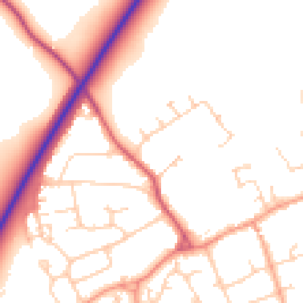
Daytime· 07:00 – 23:00
52.3dB

Night-time· 23:00 – 07:00
44.1dB