9 Castleton Road, Hazel Grove, Stockport, SK7 6LB
About 9 Castleton Road
9 Castleton Road is a four-bedroom detached house in Hazel Grove, Stockport, Stockport (SK7 6LB). It has a recorded floor area of 134 m² (around 1442 sq ft), construction records dating it to 1930-1949 and council tax band E. The latest certificate (June 2021) shows a D (score 57), a step below the typical UK home. The recommended improvements would push it to C (score 72). Other recorded features include a conservatory. Period features are noted in the property record.
One planning record on file: an extension approved in 2023. Past consents include an extension and a garage conversion, meaningful when judging how the property has evolved. At 134 m² it's 27.1% larger than the typical home in the postcode (105 m² median across 9 EPCs). Across 1997–2021, sale prices on this property compounded at 6.1% per year. Today's modelled estimate of £628,000 is 19.4% above the 2021 sale price. On a £-per-square-foot basis, the last sale (£365/sq ft) was about 125.5% above the typical sold price in the postcode. Sold August 2021 for £526,000. That sale was during the post-pandemic price surge, when transactions cleared materially above pre-2020 trend.
What this property has
Inside
- Bedrooms4
- Bathrooms1
- Dining roomYes
- ConservatoryYes
Outside
- Private gardenYes
- GarageYes
Building
- Period featuresYes
- RefurbishedYes
Everything you need to know about 9 Castleton Road
The true value, the hidden risks and the full sale history, in one report.
Pick your report · every report is £14.99
One time fee only - money back guarantee

The data behind every report


Energy performance
9 Castleton Road's carbon output runs well above what efficient homes in the postcode produce.
EPC Rating
Get a survey for this property
Level 2 HomeBuyer Report
We've checked 10 risk factors against the available data for this property and believe a Level 2 HomeBuyer Report could be a suitable option for you.
From £895 · Includes VAT
Planning history
1 application on record at 9 Castleton Road, Hazel Grove, Stockport, SK7 6LB
- May 2023Garage ConversionFullOutcome in report
Extension: Single storey
Conversion of garage with a side extension, single storey front extension and dormer to rear
Extension- Documents
- 7 docs on file
- Reference
- DC/088280
Unlock 9 Castleton Road, Hazel Grove, Stockport, SK7 6LB's full planning history
You're seeing the shape of it. The report has the substance.
- Every decision — granted, refused or withdrawn (1 on record)
- All 1 application on this property in full
- The 7 documents, officer reports & conditions
- What the pattern means for extending or converting here
One time fee only - money back guarantee
Sales history & valuation
Latest sale on 9 Castleton Road was the highest on Land Registry record across the postcode.
£628,000
Modelled from EPC, postcode comparables and a sale-price growth of 6.1% per year over 24 years.
£526,000
Growth on file: 6.1% per year over 24 years.
Sales timeline
12 August 2021Most recent
£526,000
+315.8%over 23 years13 August 1997
£126,500
Median price across the last 5 sales in SK7 6LB: £353,150 (2021–2011).
Nearby sales in SK7 6LB
10 Castleton Road, Hazel Grove, Stockport, SK7 6LB
Sold Jun 2021
£353,15016 Castleton Road, Hazel Grove, Stockport, SK7 6LB
Sold Dec 2018
£285,0002 Castleton Road, Hazel Grove, Stockport, SK7 6LB
Sold Aug 2016
£235,0003 Castleton Road, Hazel Grove, Stockport, SK7 6LB
Sold Oct 2013
£357,5001 Castleton Road, Hazel Grove, Stockport, SK7 6LB
Sold Mar 2011
£430,000
Versus other Castleton Road homes
9 Castleton Road is notably below the street on years held.
Price per m²
£3,925
Street avg £2,493
Floor Area
134 m²
Street avg 115 m²
Habitable Rooms
5 rooms
Street avg 6 rooms
CO₂ Emissions
6.6 t/year
Street avg 5.1 t/year
Everything you need to know about 9 Castleton Road
The true value, the hidden risks and the full sale history, in one report.
Pick your report · every report is £14.99
One time fee only - money back guarantee
The data behind every report
Similar properties nearby
1 Castleton Road, Hazel Grove
SK7 6LB
1 Elton Drive, Hazel Grove
SK7 6EP
1 Deva Close, Hazel Grove
SK7 6HH
1 Charnwood Crescent, Hazel Grove
SK7 6HB
1 Darley Road, Hazel Grove
SK7 6DZ
1 Ashbourne Road, Hazel Grove
SK7 6DX
1 Brook Lane, Hazel Grove
SK7 6LT
1 Bakewell Road, Hazel Grove
SK7 6JT
The neighbourhood at a glance
Rail-style transport is unusually close for this postcode.
Crime
1/mo
Steady year-on-year across the wider district.
Nearest stop
0.3 km
Rutland Road — bus stop.
Closest school
0.1 km
Norbury Hall Primary School. 17 schools nearby.
Go deeper on the local area
A Local Area report breaks down crime, transport links, schools and air quality in depth.
Road noise across the postcode
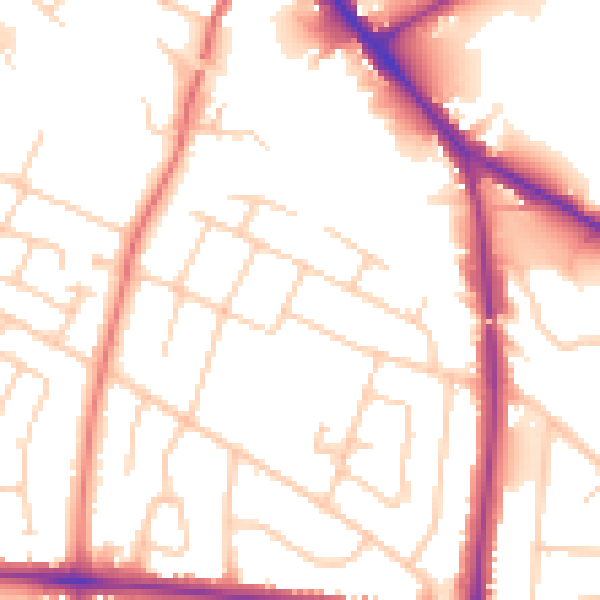
Daytime· 07:00 – 23:00
52.8dB

Night-time· 23:00 – 07:00
43.6dB