33 Brisbane Close, Bramhall, Stockport, SK7 1LF
About 33 Brisbane Close
33 Brisbane Close is a semi-detached house in Bramhall, Stockport, Stockport (SK7 1LF). It has a recorded floor area of 89 m² (around 958 sq ft), construction records dating it to 1950-1966 and council tax band C. The latest certificate (July 2013) shows a D (score 64), on the cusp of jumping into the C band. The recommended improvements would lift it to B (score 82), a 2-band jump. The latest certificate is from July 2013, so improvements made since then won't be reflected.
One planning record on file: an extension approved in 2004. Past consents include an extension, meaningful when judging how the property has evolved. Across 2014–2019, sale prices on this property compounded at 3.3% per year. Today's modelled estimate of £403,000 is 24% above the 2019 sale price. On a £-per-square-foot basis, the last sale (£339/sq ft) was about 38% above the typical sold price in the postcode. At 89 m² it's 22.3% smaller than the typical home in the postcode (115 m² median across 16 EPCs). Sold December 2019 for £325,000.
Everything you need to know about 33 Brisbane Close
The true value, the hidden risks and the full sale history, in one report.
Pick your report · every report is £14.99
One time fee only - money back guarantee

The data behind every report


Energy performance
Recommended upgrades on file would lift this property by multiple EPC bands.
EPC Expired
This certificate is over 10 years old and is no longer valid.Expired 29 Jul 2023
EPC Rating
Get a survey for this property
Level 2 HomeBuyer Report
We've checked 10 risk factors against the available data for this property and believe a Level 2 HomeBuyer Report could be a suitable option for you.
From £695 · Includes VAT
Planning history
Council records include a two-storey side extension at 33 Brisbane Close.
1 application on record at 33 Brisbane Close, Bramhall, Stockport, SK7 1LF
- Jul 2004ExtensionFullOutcome in report
Extension: Two storey · Side of property
Two storey side extension
- Reference
- DC/015278
Unlock 33 Brisbane Close, Bramhall, Stockport, SK7 1LF's full planning history
You're seeing the shape of it. The report has the substance.
- Every decision — granted, refused or withdrawn (1 on record)
- All 1 application on this property in full
- What the pattern means for extending or converting here
One time fee only - money back guarantee
Sales history & valuation
33 Brisbane Close valuation sits well clear of the typical sold price in this postcode.
£403,000
Modelled from EPC, postcode comparables and a sale-price growth of 3.3% per year over 5 years.
£325,000
Growth on file: 3.3% per year over 5 years.
Sales timeline
19 December 2019Most recent
£325,000
+18.2%over 5 years16 October 2014
£275,000
Median price across the last 5 sales in SK7 1LF: £500,000 (2025–2021).
Nearby sales in SK7 1LF
18 Brisbane Close, Bramhall, Stockport, SK7 1LF
Sold Aug 2025
£400,00014 Brisbane Close, Bramhall, Stockport, SK7 1LF
Sold Jun 2025
£87510 Brisbane Close, Bramhall, Stockport, SK7 1LF
Sold Dec 2023
£750,00012 Brisbane Close, Bramhall, Stockport, SK7 1LF
Sold Sept 2021
£600,00015 Brisbane Close, Bramhall, Stockport, SK7 1LF
Sold Jun 2021
£500,000
Versus other Brisbane Close homes
33 Brisbane Close outperforms the street on co₂ emissions by a wide margin.
Price per m²
£3,652
Street avg £3,403
Floor Area
89 m²
Street avg 113 m²
Habitable Rooms
6 rooms
Street avg 6 rooms
CO₂ Emissions
3.5 t/year
Street avg 5.0 t/year
Everything you need to know about 33 Brisbane Close
The true value, the hidden risks and the full sale history, in one report.
Pick your report · every report is £14.99
One time fee only - money back guarantee
The data behind every report
Similar properties nearby
1 Carlton Avenue, Bramhall
SK7 1BW
1 Dalston Drive, Bramhall
SK7 1DW
1 Cromwell Road, Bramhall
SK7 1DA
1 Canberra Road, Bramhall
SK7 1LG
1 Blythe Avenue, Bramhall
SK7 1EU
1 Church Lane, Woodford
SK7 1RQ
1 Adelaide Road, Bramhall
SK7 1NR
1 Crossway, Bramhall
SK7 1LB
The neighbourhood at a glance
Rail-style transport is unusually close for this postcode.
Crime
1/mo
Steady year-on-year across the wider district.
Nearest stop
0.5 km
Meadway — bus stop.
Closest school
0.5 km
Queensgate Primary School. 21 schools nearby.
Go deeper on the local area
A Local Area report breaks down crime, transport links, schools and air quality in depth.
Road noise across the postcode
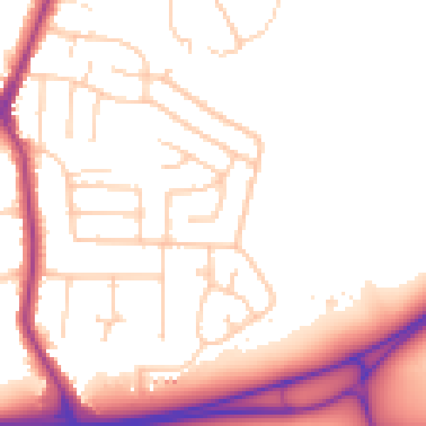
Daytime· 07:00 – 23:00
52.8dB

Night-time· 23:00 – 07:00
45.0dB