Model valuation£417,0008 Busby Close
Local market context
19 Hibbert Lane is an end-of-terrace house in Marple, Stockport, Stockport (SK6 7NN). It has a recorded floor area of 90 m² (around 969 sq ft), construction records dating it to before 1900 and council tax band C. The latest certificate (September 2014) shows a D (score 56), a step below the typical UK home. Earlier certificates rated it C (February 2009); the latest reading is one band lower. Between certificates, wall efficiency dropped from Good to Very Poor and roof efficiency dropped from Good to Very Poor. The recommended improvements would lift it to B (score 86), a 2-band jump. The latest certificate is from September 2014, so improvements made since then won't be reflected.
It hasn't traded since December 2003, a hold of 23 years that's notably long for the area. Across 1996–2003, sale prices on this property compounded at 11.5% per year. Today's modelled estimate of £294,000 sits 133.3% above the 2003 sale of £126,000. On a £-per-square-foot basis, the last sale (£130/sq ft) was about 37.8% below the postcode norm. 3 planning records sit against the property, 3 approved, 0 refused. Past consents include an extension, meaningful when judging how the property has evolved. At 90 m² it's 15.1% smaller than the typical home in the postcode (106 m² median across 13 EPCs).
The true value, the hidden risks and the full sale history, in one report.
Pick your report · from £14.99
One time fee only - money back guarantee

The data behind every report


Recommended upgrades on file would lift this property by multiple EPC bands.
This certificate is over 10 years old and is no longer valid.Expired 04 Sept 2024
Certificate validity
Expired on 4 September 2024

Get a survey for this property
Because the property was built before 1919 and has solid (non-cavity) walls, we believe a Level 3 building survey should be considered.
From £885 · Includes VAT
19 Hibbert Lane has an approved single-storey rear extension on the planning record.
3 applications on record at 19 Hibbert Lane, Marple, Stockport, SK6 7NN
Change of use from school office/tuition rooms ancillary to 19A & 19B Hibbert Lane to self contained office (B1 use)
You're seeing the shape of it. The report has the substance.
One time fee only - money back guarantee
Sale price has at least doubled since 1996.
£294,000
Modelled from EPC, postcode comparables and a sale-price growth of 11.5% per year over 7 years.
£126,000
Growth on file: 11.5% per year over 7 years.
2 December 2003Most recent
£126,000
+110.0%over 4 years5 October 1999
£60,000
+3.4%over 2 years17 October 1996
£58,000
Median price across the last 5 sales in SK6 7NN: £330,750 (2026–2020).
17 Hibbert Lane, Marple, Stockport, SK6 7NN
Sold May 2026
15 Hibbert Lane, Marple, Stockport, SK6 7NN
Sold Jan 2024
5 Hibbert Lane, Marple, Stockport, SK6 7NN
Sold Nov 2021
7 Hibbert Lane, Marple, Stockport, SK6 7NN
Sold Dec 2020
11 Hibbert Lane, Marple, Stockport, SK6 7NN
Sold Oct 2019
Price per m² for 19 Hibbert Lane lags the street by a wide margin.
Price per m²
£1,400
Street avg £2,730
Floor Area
90 m²
Street avg 131 m²
Habitable Rooms
6 rooms
Street avg 7 rooms
CO₂ Emissions
4.8 t/year
Street avg 7.7 t/year
Property research, connected
Explore sale histories, valuations, energy ratings and local areas. Ask the assistant to connect the details and take your research further.
Start your researchSK6 7QJ
SK6 7RP
SK6 7NH
SK6 7BQ
SK6 7PS
SK6 7AU
SK6 7RG
SK6 7PE
Crime
2/mo
Steady year-on-year across the wider district.
Nearest stop
0.1 km
Brindley Avenue — bus stop.
Closest school
0.4 km
All Saints Church of England Primary School Marple. 10 schools nearby.
Go deeper on the local area
A Local Area report breaks down crime, transport links, schools and air quality in depth.
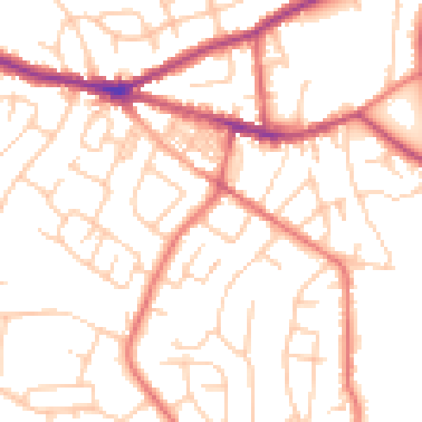
Daytime· 07:00 – 23:00
51.6dB

Night-time· 23:00 – 07:00
40.5dB