Ground Floor Flat, 18 Oak Avenue, Romiley, Stockport, SK6 4DN
About Ground Floor Flat
Ground Floor Flat is a property in Romiley, Stockport, Stockport (SK6 4DN).
Energy performance
No EPC on record
This property doesn't have an Energy Performance Certificate yet. An EPC is required to sell or let — and unlocks our automated valuation.
Get a survey for this property
Level 2 HomeBuyer Report
We've checked 10 risk factors against the available data for this property and believe a Level 2 HomeBuyer Report could be a suitable option for you.
Planning history
No planning applications are recorded against Ground Floor Flat, 18 Oak Avenue, Romiley, Stockport, SK6 4DN. The full report also covers planning activity across the surrounding area.
Sales history & valuation
No sales recorded with HM Land Registry
That can mean the property has never traded since the registry began publishing in 1995, was a new build that hasn't been registered yet, or is held in the same hands long-term.
Median price across the last 5 sales in SK6 4DN: £352,500 (2025–2021).
Nearby sales in SK6 4DN
17 Oak Avenue, Romiley, Stockport, SK6 4DN
Sold Aug 2025
£348,0009 Oak Avenue, Romiley, Stockport, SK6 4DN
Sold Jul 2024
£352,50024 Oak Avenue, Romiley, Stockport, SK6 4DN
Sold Jun 2022
£500,00015 Oak Avenue, Romiley, Stockport, SK6 4DN
Sold Mar 2022
£450,00031a, Oak Avenue, Romiley, Stockport, SK6 4DN
Sold Mar 2021
£125,000
Similar properties nearby
Bank Chambers 2a, Flat 1, Guywood Lane, Romiley
SK6 4AN
Bank Chambers 2a, Flat 2, Guywood Lane, Romiley
SK6 4AN
Bank Chambers 2a, Flat 3, Guywood Lane, Romiley
SK6 4AN
Bank Chambers 2a, Flat 4, Guywood Lane, Romiley
SK6 4AN
Chadkirk Mews, Flat 1, Church Lane, Romiley
SK6 4AA
Chadkirk Mews, Flat 2, Church Lane, Romiley
SK6 4AA
Chadkirk Mews, Flat 3, Church Lane, Romiley
SK6 4AA
Chadkirk Mews, Flat 4, Church Lane, Romiley
SK6 4AA
The neighbourhood at a glance
Rail-style transport is unusually close for this postcode.
Crime
1/mo
Steady year-on-year across the wider district.
Nearest stop
0.1 km
Sandy Lane — bus stop.
Closest school
0.2 km
Romiley Primary School. 18 schools nearby.
Road noise across the postcode
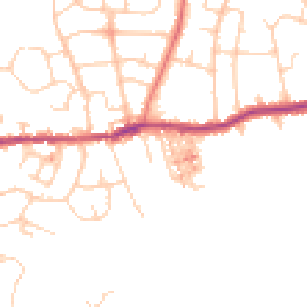
Daytime· 07:00 – 23:00
47.3dB

Night-time· 23:00 – 07:00
38.1dB