Flat 1, 34 The Drive, Bredbury, Stockport, SK6 2DU
About Flat 1
Flat 1 is a semi-detached house in Bredbury, Stockport, Stockport (SK6 2DU). It has a recorded floor area of 47 m² (around 503 sq ft), construction records dating it to 1950-1966 and council tax band A. The latest certificate (August 2009) shows a C (score 69), just inside the C band. The latest certificate is from August 2009, so improvements made since then won't be reflected.
At 47 m² it sits well below the postcode median (88 m² across 11 EPCs), making it one of the more compact homes locally. Its energy rating outperforms most of the postcode (better than 82% of similar EPCs).
Everything you need to know about Flat 1
The true value, the hidden risks and the full sale history, in one report.
Pick your report · every report is £14.99
One time fee only - money back guarantee

The data behind every report


Energy performance
Flat 1's EPC is over a decade old — improvements since won't be reflected.
EPC Expired
This certificate is over 10 years old and is no longer valid.Expired 06 Aug 2019
EPC Rating
Get a survey for this property
Level 2 HomeBuyer Report
We've checked 10 risk factors against the available data for this property and believe a Level 2 HomeBuyer Report could be a suitable option for you.
From £495 · Includes VAT
Planning history
Flat 1 has no planning applications on record.
But the area is active
1 notable application nearby — larger schemes and conversions that could reshape the street. The report maps them all.
Sales history & valuation
Flat 1 has no Land Registry sales on file, suggesting it has stayed in the same hands since registration began.
£130,000
Modelled from EPC, postcode comparables.
No sales recorded with HM Land Registry
That can mean the property has never traded since the registry began publishing in 1995, was a new build that hasn't been registered yet, or is held in the same hands long-term.
Median price across the last 5 sales in SK6 2DU: £240,000 (2025–2021).
Nearby sales in SK6 2DU
2 The Drive, Bredbury, Stockport, SK6 2DU
Sold Aug 2025
£455,00020 The Drive, Bredbury, Stockport, SK6 2DU
Sold Apr 2025
£180,00040 The Drive, Bredbury, Stockport, SK6 2DU
Sold Mar 2025
£173,00010 The Drive, Bredbury, Stockport, SK6 2DU
Sold May 2024
£240,00032 The Drive, Bredbury, Stockport, SK6 2DU
Sold Jun 2021
£245,000
Everything you need to know about Flat 1
The true value, the hidden risks and the full sale history, in one report.
Pick your report · every report is £14.99
One time fee only - money back guarantee
The data behind every report
Similar properties nearby
Flat 1, 75 Lower Bents Lane, Bredbury
SK6 2NL
Flat 2, 75 Lower Bents Lane, Bredbury
SK6 2NL
Flat 4, 75 Lower Bents Lane, Bredbury
SK6 2NL
Flat 2, 34 The Drive, Bredbury
SK6 2DU
Flat 1, 73 Lower Bents Lane, Bredbury
SK6 2NL
Flat 5, 75 Lower Bents Lane, Bredbury
SK6 2NL
Flat 2, 29 Marina Road, Bredbury
SK6 2PR
Flat 1, 29 Marina Road, Bredbury
SK6 2PR
The neighbourhood at a glance
Crime
1/mo
Steady year-on-year across the wider district.
Nearest stop
0.2 km
Travellers Call — bus stop.
Closest school
0.3 km
Arden Primary School. 30 schools nearby.
Go deeper on the local area
A Local Area report breaks down crime, transport links, schools and air quality in depth.
Road noise across the postcode
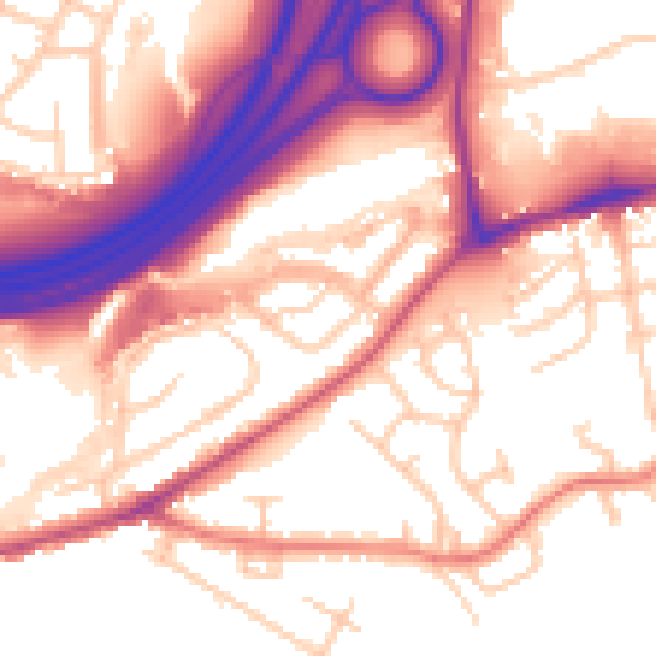
Daytime· 07:00 – 23:00
56.6dB

Night-time· 23:00 – 07:00
47.7dB