Dunston Grange Farm, Dunston Lane, Chesterfield, S41 9RJ
About Dunston Grange Farm
Dunston Grange Farm is a detached house in Chesterfield (S41 9RJ). It has a recorded floor area of 236 m² (around 2540 sq ft), construction records dating it to before 1900 and council tax band D. The latest certificate (February 2026) shows a C (score 77), near the top of the C band. When first surveyed in December 2012 the rating was G, the property has climbed 4 bands since. Between certificates, wall efficiency went from Very Poor to Good, roof efficiency went from Very Poor to Very Good and window efficiency went from Very Poor to Good. The recommended improvements would push it to B (score 82). This certificate was lodged in the last six months, so the rating reflects current condition.
At 236 m² the property is well over the postcode median (162 m² across 7 EPCs), placing it in the larger end of the local stock. Today's modelled estimate of £747,000 sits 239.5% above the 2019 sale of £220,000. On a £-per-square-foot basis, the last sale (£87/sq ft) was about 71.9% below the postcode norm. 31 planning records sit against the property, 0 approved, 15 refused. The record references listed-building consent, which constrain future alterations. Most recent transfer: May 2019 at £220,000.
Everything you need to know about Dunston Grange Farm
The true value, the hidden risks and the full sale history, in one report.
Pick your report · from £14.99
One time fee only - money back guarantee

The data behind every report


Energy performance
The EPC has just been inspected, so the rating reflects current condition.
EPC Rating
Certificate validity
Valid until 19 February 2036
Property Improvements
Changes detected from historical EPC data
Upgraded to gas central heating
Switched from solid fuel to cleaner energy source
Heating controls upgraded for better temperature management
Hot water efficiency improved
Single glazing replaced with double or better glazing
Wall insulation improved
More low energy lighting installed
High performance glazing installed
Wall insulation improved
Loft insulation installed or upgraded to 250mm+
More low energy lighting installed

Get a survey for this property
Level 3 Building Survey
Because the property was built before 1919 and has been extended more than once, we believe a Level 3 building survey should be considered.
From £1,220 · Includes VAT
Planning history
A recent planning application at Dunston Grange Farm was refused — worth checking the council file.
31 applications on record at Dunston Grange Farm, Dunston Lane, Chesterfield, S41 9RJ
1 live now- Sept 2004HeritageOutcome in report
To dismantle dangerous building and use materials to repair other farm buildings
- Documents
- 2 docs on file
- Reference
- CHE/04/00182/LBD
- More recent applications — locked
- ConditionsApr 2026Decision
- ConditionsFeb 2026Decision
+ 28 more applications in the report
Unlock Dunston Grange Farm, Dunston Lane, Chesterfield, S41 9RJ's full planning history
You're seeing the shape of it. The report has the substance.
- Every decision — granted, refused or withdrawn (30 on record)
- All 31 applications on this property in full, plus 3 notable nearby
- The 737 documents, officer reports & conditions
- What the pattern means for extending or converting here
One time fee only - money back guarantee
Sales history & valuation
Latest sale on Dunston Grange Farm was the lowest on Land Registry record across the postcode.
£747,000
Modelled from EPC, postcode comparables.
£220,000
Recorded with HM Land Registry.
Sales timeline
14 May 2019Most recent
£220,000
Median price across the last 5 sales in S41 9RJ: £520,000 (2026–2019).
Nearby sales in S41 9RJ
5 Dunston Grange, Dunston Lane, Chesterfield, S41 9RJ
Sold Apr 2026
£585,0001 Dunston Grange, Dunston Lane, Chesterfield, S41 9RJ
Sold Jun 2021
£520,0004 Dunston Grange, Dunston Lane, Chesterfield, S41 9RJ
Sold Mar 2021
£545,0002 Dunston Grange, Dunston Lane, Chesterfield, S41 9RJ
Sold Aug 2020
£495,0003 Dunston Grange, Dunston Lane, Chesterfield, S41 9RJ
Sold Oct 2019
£520,000
Versus other Dunston Lane homes
On price per m², Dunston Grange Farm runs well behind the street norm.
Price per m²
£932
Street avg £3,418
Floor Area
236 m²
Street avg 178 m²
CO₂ Emissions
5.4 t/year
Street avg 3.7 t/year
Years Held
7 years
Street avg 6 years
Everything you need to know about Dunston Grange Farm
The true value, the hidden risks and the full sale history, in one report.
Pick your report · from £14.99
One time fee only - money back guarantee
The data behind every report
Similar properties nearby
1 Dunston Grange, Dunston Lane
S41 9RJ
1 Barlow Road
S41 9RS
1 Dunston Road
S41 9RW
1 Brearley Hall, Woodmere Drive, Old Whittington
S41 9TA
1 Cutthorpe Grange
S41 9SD
1 Ashleigh Close, Old Whittington
S41 9NA
1 Abbey Croft
S41 9SB
1 Coupland Close, Old Whittington
S41 9TB
The neighbourhood at a glance
Daytime road noise here sits well below conversation level — a quiet pocket of the postcode.
Crime
270/mo
Steady year-on-year across the wider district.
Nearest stop
0.3 km
Kingswood Close — bus stop.
Closest school
0.8 km
Dunston Primary and Nursery Academy. 17 schools nearby.
Go deeper on the local area
A Local Area report breaks down crime, transport links, schools and air quality in depth.
Road noise across the postcode
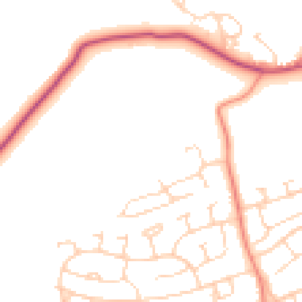
Daytime· 07:00 – 23:00
49.5dB

Night-time· 23:00 – 07:00
40.2dB