74 Coward Drive, Oughtibridge, Sheffield, S35 0JP
About 74 Coward Drive
74 Coward Drive is a three-bedroom end-of-terrace house in Oughtibridge, Sheffield, Sheffield (S35 0JP). It has a recorded floor area of 70 m² (around 753 sq ft), construction records dating it to 1983-1990 and council tax band B. The latest certificate (December 2024) shows a D (score 68), on the cusp of jumping into the C band. The recommended improvements would lift it to B (score 83), a 2-band jump.
A recent sale: £265,000 in March 2025. Across 1996–2025, sale prices on this property compounded at 6.2% per year. On a £-per-square-foot basis, the last sale (£352/sq ft) was about 108.2% above the typical sold price in the postcode. One historical planning record sits against the property in 2011.
What this property has
Inside
- Bedrooms3
Everything you need to know about 74 Coward Drive
The true value, the hidden risks and the full sale history, in one report.
Pick your report · from £14.99
One time fee only - money back guarantee

The data behind every report







Energy performance
Recommended upgrades on file would lift this property by multiple EPC bands.
EPC Rating
Certificate validity
Valid until 10 December 2034

Get a survey for this property
Level 2 HomeBuyer Report
We've checked 10 risk factors against the available data for this property and believe a Level 2 HomeBuyer Report could be a suitable option for you.
From £545 · Includes VAT
Planning history
1 application on record at 74 Coward Drive, Oughtibridge, Sheffield, S35 0JP
- Oct 2011ConditionsOutcome in report
Application to approve details in relation to condition 1. expiry; 2. PD restrictions; 3. sustainability; 4. approved documents 5. car parking; 6. vehicular access; 7. redundant access; 8. intervisibilty splays; 9. wheel cleaning; 10. width of driveways; 11. reconstruction of footways; 12. reprofiling works; 13. details materials; 14. samples materials; 15. site enclosure; 16. retention of trees; 17. protection of trees; 18. landscaping scheme; 19. renewable energy; 20. land contamination; 21. intrusive site investigation report; 22.remediation strategy report; remediation strategy; 24. validation report; 25. no obstruction to sewers; 26. drainage; 27. disposal of foul and surface water and 28. no piped discharge relating to planning permission 10/03955/FUL
- Documents
- 19 docs on file
- Reference
- 11/02345/COND
Unlock 74 Coward Drive, Oughtibridge, Sheffield, S35 0JP's full planning history
You're seeing the shape of it. The report has the substance.
- Every decision — granted, refused or withdrawn (1 on record)
- All 1 application on this property in full, plus 3 notable nearby
- The 19 documents, officer reports & conditions
- What the pattern means for extending or converting here
One time fee only - money back guarantee
Sales history & valuation
Price for 74 Coward Drive has grown more than fourfold since the 1996 starting point.
£275,000
Modelled from EPC, postcode comparables and a sale-price growth of 6.2% per year over 28 years.
£265,000
Growth on file: 6.2% per year over 28 years.
Sales timeline
28 March 2025Most recent
£265,000
+100.8%over 18 years2 April 2006
£132,000
+175.0%over 9 years12 November 1996
£48,000
Median price across the last 5 sales in S35 0JP: £272,000 (2025–2023).
Nearby sales in S35 0JP
82 Coward Drive, Oughtibridge, Sheffield, S35 0JP
Sold Nov 2025
£248,00071 Coward Drive, Oughtibridge, Sheffield, S35 0JP
Sold Jul 2025
£330,00077 Coward Drive, Oughtibridge, Sheffield, S35 0JP
Sold Mar 2025
£272,00093 Coward Drive, Oughtibridge, Sheffield, S35 0JP
Sold Aug 2024
£181,23437 Coward Drive, Oughtibridge, Sheffield, S35 0JP
Sold Dec 2023
£295,000
Versus other Coward Drive homes
On price per m², 74 Coward Drive stands well clear of the street.
Price per m²
£3,786
Street avg £2,570
Floor Area
70 m²
Street avg 87 m²
Habitable Rooms
4 rooms
Street avg 5 rooms
CO₂ Emissions
3.2 t/year
Street avg 3.4 t/year
Everything you need to know about 74 Coward Drive
The true value, the hidden risks and the full sale history, in one report.
Pick your report · from £14.99
One time fee only - money back guarantee
The data behind every report
Similar properties nearby
1 Church Close, Oughtibridge
S35 0JN
1 Birch House Avenue, Oughtibridge
S35 0FH
1 Bertram Road, Oughtibridge
S35 0FF
1 Acorn Court, Oughtibridge
S35 0BG
1 Birch Grove, Oughtibridge
S35 0FG
1 Don Avenue, Wharncliffe Side
S35 0DH
1 Cowley Road, Oughtibridge
S35 0FZ
1 Dixon Drive, Wharncliffe Side
S35 0DG
The neighbourhood at a glance
Daytime road noise here sits well below conversation level — a quiet pocket of the postcode.
Crime
217/mo
Falling year-on-year across the wider district.
Nearest stop
0.2 km
Low Road/Station Lane — bus stop.
Closest school
0.2 km
Oughtibridge Primary School. 6 schools nearby.
Go deeper on the local area
A Local Area report breaks down crime, transport links, schools and air quality in depth.
Road noise across the postcode
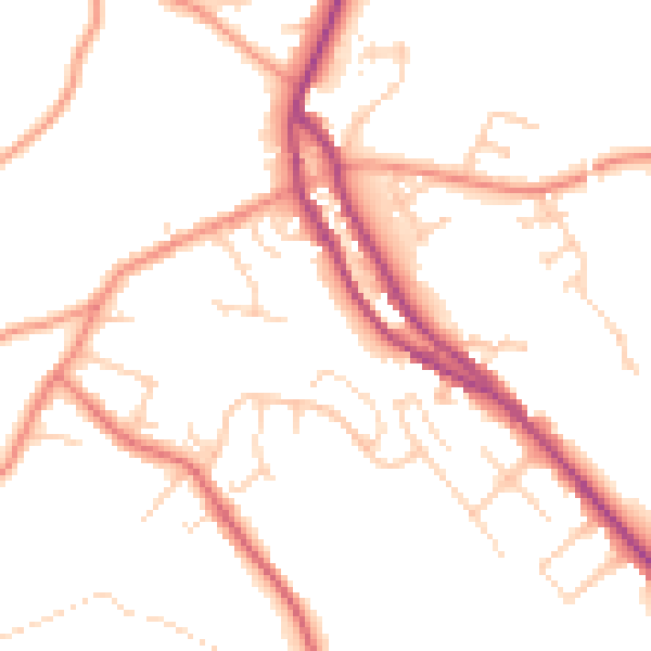
Daytime· 07:00 – 23:00
49.3dB

Night-time· 23:00 – 07:00
40.1dB