18 Lambrell Avenue, Kiveton Park, Sheffield, S26 5NS
About 18 Lambrell Avenue
18 Lambrell Avenue is a mid-terrace house in Kiveton Park, Sheffield, Sheffield (S26 5NS). It has a recorded floor area of 130 m² (around 1399 sq ft), construction records dating it to 2003-2006 and council tax band C. The latest certificate (December 2015) shows a C (score 76), near the top of the C band. The recommended improvements would push it to B (score 86). The latest certificate is from December 2015, so improvements made since then won't be reflected.
Untraded for 18 years, with the last transfer in December 2007. That sale landed at the peak of the pre-credit-crunch market, which is a useful reference point when interpreting the price. At 130 m² it's 28.7% larger than the typical home in the postcode (101 m² median across 65 EPCs). Today's modelled estimate of £249,000 is 46.5% above the 2007 sale price. On a £-per-square-foot basis, the last sale (£121/sq ft) was about 17.8% below the postcode norm.
Everything you need to know about 18 Lambrell Avenue
The true value, the hidden risks and the full sale history, in one report.
30-day money-back guarantee

The data behind every report


Energy performance
EPC Expired
This certificate is over 10 years old and is no longer valid.Expired 17 Dec 2025
EPC Rating
Planning history
18 Lambrell Avenue has no planning applications on record.
The full report still covers planning activity across the surrounding area.
Sales history & valuation
The latest sale landed at the peak of the pre-credit-crunch market — a high-water reference point.
£249,000
Modelled from EPC, postcode comparables.
£169,950
Recorded with HM Land Registry.
Sales timeline
19 December 2007Most recent
£169,950
Median price across the last 5 sales in S26 5NS: £213,000 (2025–2025).
Nearby sales in S26 5NS
60 Lambrell Avenue, Kiveton Park, Sheffield, S26 5NS
Sold Jul 2025
£270,00036 Lambrell Avenue, Kiveton Park, Sheffield, S26 5NS
Sold Jul 2025
£115,00010 Lambrell Avenue, Kiveton Park, Sheffield, S26 5NS
Sold Jul 2025
£220,00015 Lambrell Avenue, Kiveton Park, Sheffield, S26 5NS
Sold May 2025
£213,00066 Lambrell Avenue, Kiveton Park, Sheffield, S26 5NS
Sold Mar 2025
£122,000
Versus other Lambrell Avenue homes
18 Lambrell Avenue is notably below the street on co₂ emissions.
Price per m²
£1,307
Street avg £1,708
Floor Area
130 m²
Street avg 113 m²
Habitable Rooms
6 rooms
Street avg 5 rooms
CO₂ Emissions
3.5 t/year
Street avg 2.3 t/year
Everything you need to know about 18 Lambrell Avenue
The true value, the hidden risks and the full sale history, in one report.
30-day money-back guarantee
The data behind every report
Similar properties nearby
1 Horseshoe Close, Wales
S26 5PZ
1 Ashby Drive, Kiveton Park
S26 5PU
1 Cypress Grove, Wales
S26 5QA
1 Fir Tree Drive, Wales
S26 5LZ
1 Cherry Tree Road, Wales
S26 5LL
1 Lambrell Green, Kiveton Park
S26 5NT
1 Beeches Road, Wales
S26 5RR
1 Hazel Way, Kiveton Park
S26 5AD
The neighbourhood at a glance
Rail-style transport is unusually close for this postcode.
Crime
4/mo
Steady year-on-year across the wider district.
Nearest stop
0.4 km
Wales Road/Chestnut Avenue — bus stop.
Closest school
0.7 km
Wales High School. 9 schools nearby.
Go deeper on the local area
The full report breaks down crime, transport links, schools and air quality in depth.
Road noise across the postcode
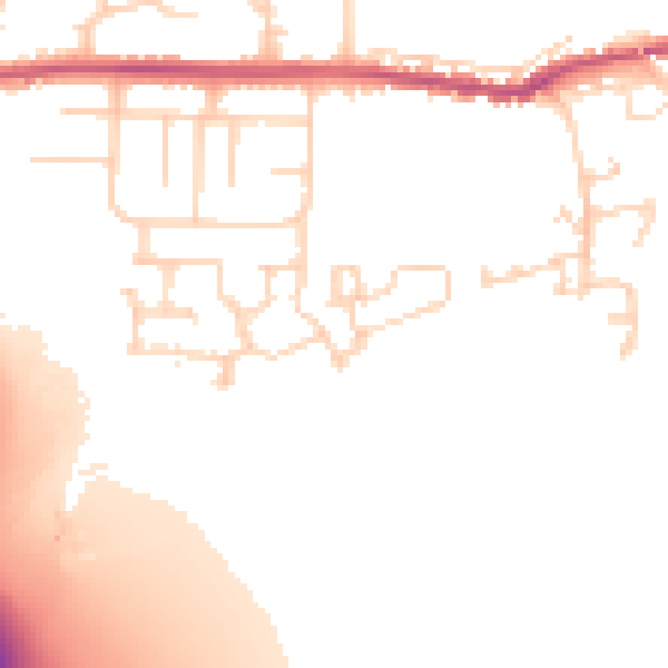
Daytime· 07:00 – 23:00
51.5dB

Night-time· 23:00 – 07:00
43.3dB