10 Coppice End, Ryde, PO33 1QN
About 10 Coppice End
10 Coppice End is a three-bedroom detached house in Ryde (PO33 1QN). It has a recorded floor area of 108 m² (around 1163 sq ft), construction records dating it to 1996-2002 and council tax band E. The latest certificate (November 2019) shows a C (score 69), just inside the C band. The recommended improvements would push it to B (score 81). The home occupies a cul-de-sac position.
Across 2002–2023, sale prices on this property compounded at 4% per year. On a £-per-square-foot basis, the last sale (£335/sq ft) was about 116.9% above the typical sold price in the postcode. At 108 m² it's 18.8% smaller than the typical home in the postcode (133 m² median across 10 EPCs). Last sale on file: £390,000 in September 2023.
What this property has
Inside
- Bedrooms3
- Bathrooms2
Outside
- GarageIntegral
- Cul-de-sacYes
Building
- RefurbishedYes
Everything you need to know about 10 Coppice End
The true value, the hidden risks and the full sale history, in one report.
30-day money-back guarantee

The data behind every report


Energy performance
EPC Rating
Planning history
10 Coppice End has no planning applications on record.
Notable planning nearby
2applications of note in the surrounding area
We flagged 1 thing worth checking at 10 Coppice End
Independent checks surfaced things a buyer would want to understand before offering. The report explains each one in full, with the underlying data and what to ask.
- Larger development activity nearby
30-day money-back guarantee
Sales history & valuation
Latest sale on 10 Coppice End was the highest on Land Registry record across the postcode.
£419,000
Modelled from EPC, postcode comparables and a sale-price growth of 4.0% per year over 21 years.
£390,000
Growth on file: 4.0% per year over 21 years.
Sales timeline
21 September 2023Most recent
£390,000
+27.9%over 3 years11 June 2020
£305,000
+81.5%over 18 years2 April 2002
£168,000
Median price across the last 5 sales in PO33 1QN: £295,000 (2020–2015).
Versus other Coppice End homes
10 Coppice End outperforms the street on price per m² by a wide margin.
Price per m²
£3,611
Street avg £2,058
Floor Area
108 m²
Street avg 150 m²
Habitable Rooms
5 rooms
Street avg 7 rooms
CO₂ Emissions
3.5 t/year
Street avg 4.5 t/year
Everything you need to know about 10 Coppice End
The true value, the hidden risks and the full sale history, in one report.
30-day money-back guarantee
The data behind every report
Similar properties nearby
1 Downs View Road, St Helens
PO33 1YE
1 Amherst Mews
PO33 1FG
1 Arundel Close
PO33 1BS
1 Banbury Close, Somerset Road
PO33 1DP
1 Broomlands Close, St Helens
PO33 1XH
1 Down Cottage, Upper Green Road, St Helens
PO33 1XF
1 Amherst Place
PO33 1FE
1 Aspen Gardens
PO33 1RE
The neighbourhood at a glance
Rail-style transport is unusually close for this postcode.
Crime
7/mo
Steady year-on-year across the wider district.
Nearest stop
0.2 km
Hayward Avenue — bus stop.
Closest school
1.0 km
Oakfield Church of England Aided Primary School, Ryde. 8 schools nearby.
Go deeper on the local area
The full report breaks down crime, transport links, schools and air quality in depth.
Road noise across the postcode
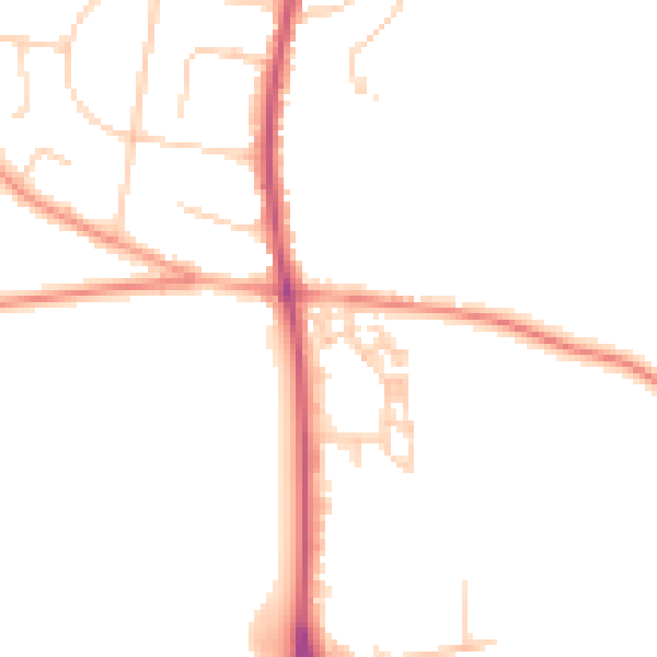
Daytime· 07:00 – 23:00
46.0dB

Night-time· 23:00 – 07:00
38.2dB