Model valuation£417,0008 Busby Close
Local market context
Catisfield House is a semi-detached house in Fareham (PO15 5NS). It has a recorded floor area of 95 m² (around 1023 sq ft) and construction records dating it to before 1900. The latest certificate (August 2025) shows a G (score 1), near the bottom of the EPC scale. Earlier certificates rated it D (November 2014); the latest reading is 3 bands lower. Between certificates, roof efficiency dropped from Good to Average and lighting dropped from Average to Poor. At 95 m² this is the 3rd smallest of 4 units on EPC record in Catisfield House, where floor areas span 70–103 m². The building's EPC ratings span G to D, with this unit at the bottom. On EPC score it ranks last in the building (1 versus a best of 67).
At 95 m² it's 17% smaller than the typical home in the postcode (115 m² median across 8 EPCs). On energy efficiency it sits in the bottom 10% of properties in this postcode — significant headroom for improvement. 5 planning records sit against the property, 0 approved, 0 refused. The record references listed-building consent and conservation-area consent, which constrain future alterations. Last sold in September 2016, so it's been off the market for around 10 years. Across the public record there are 4 sales, relatively high churn for a single property. Across 2002–2016, sale prices on this property compounded at 4% per year. Today's modelled estimate of £274,000 is 26.3% above the 2016 sale price.
The true value, the hidden risks and the full sale history, in one report.
Pick your report · from £14.99
One time fee only - money back guarantee

The data behind every report


Catisfield House sits at the bottom of the postcode for energy efficiency — meaningful headroom to improve.
Certificate validity
Valid until 5 August 2035
Changes detected from historical EPC data
More low energy lighting installed

Get a survey for this property
Because the property was built before 1919, we believe a Level 3 building survey should be considered.
From £885 · Includes VAT
Catisfield House has a listed-building consent on record — alterations to a listed property are tightly controlled.
5 applications on record at Catisfield House, Flat 6, 52 Catisfield Lane, Fareham, PO15 5NS
Reduce Eucalyptus By 7Ft Which Lies Within Conservation Area
+ 2 more applications in the report
You're seeing the shape of it. The report has the substance.
One time fee only - money back guarantee
Catisfield House changed hands twice within eighteen months — unusual for the area.
£274,000
Modelled from EPC, postcode comparables and a sale-price growth of 4.0% per year over 14 years.
£217,000
Growth on file: 4.0% per year over 14 years.
1 September 2016Most recent
£217,000
+11.3%over 1 year30 April 2015
£195,000
-7.1%18 December 2014
£210,000
+69.4%over 12 years11 June 2002
£124,000
Median price across the last 5 sales in PO15 5NS: £595,000 (2026–2021).
56 Catisfield Lane, Fareham, PO15 5NS
Sold Mar 2026
58 Catisfield Lane, Fareham, PO15 5NS
Sold Mar 2025
60 Catisfield Lane, Fareham, PO15 5NS
Sold Feb 2024
Catisfield House, Flat 3, 52 Catisfield Lane, Fareham, PO15 5NS
Sold Apr 2022
54 Catisfield Lane, Fareham, PO15 5NS
Sold Mar 2021
EPC Rating for Catisfield House lags the street by a wide margin.
Price per m²
£2,284
Street avg £2,807
Floor Area
95 m²
Street avg 85 m²
Habitable Rooms
4 rooms
Street avg 3 rooms
CO₂ Emissions
19.0 t/year
Street avg 3.6 t/year
Property research, connected
Explore sale histories, valuations, energy ratings and local areas. Ask the assistant to connect the details and take your research further.
Start your researchPO15 5NS
PO15 5NS
PO15 5NS
PO15 5NS
PO15 5NS
PO15 5DS
PO15 5DS
PO15 5DS
Crime
104/mo
Steady year-on-year across the wider district.
Nearest stop
0.2 km
Hampton Grove — bus stop.
Closest school
0.8 km
Ranvilles Junior School. 17 schools nearby.
Go deeper on the local area
A Local Area report breaks down crime, transport links, schools and air quality in depth.
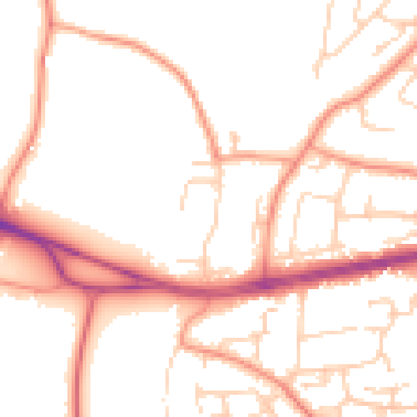
Daytime· 07:00 – 23:00
51.6dB

Night-time· 23:00 – 07:00
41.8dB