8 Wentworth Road, Oxford, OX2 7TG
About 8 Wentworth Road
8 Wentworth Road is a three-bedroom semi-detached house in Oxford (OX2 7TG). It has a recorded floor area of 106 m² (around 1141 sq ft), construction records dating it to 1900-1929 and council tax band E. The latest certificate (July 2025) shows a C (score 72). The rating has held steady at C across 2 certificates since December 2011. Between certificates, wall efficiency went from Very Poor to Good and roof efficiency went from Good to Very Good. The recommended improvements would push it to B (score 81).
Across 2004–2021, sale prices on this property compounded at 5.2% per year. Today's modelled estimate of £810,000 is 24.6% above the 2021 sale price. On a £-per-square-foot basis, the last sale (£570/sq ft) was about 51.4% above the typical sold price in the postcode. 4 planning records sit against the property, 0 approved, 3 refused. Sold December 2021 for £650,000. That sale was during the post-pandemic price surge, when transactions cleared materially above pre-2020 trend.
What this property has
Inside
- Bedrooms3
- EnsuiteYes
- FireplaceYes
Outside
- Private gardenSouth-facing
- ParkingOff street
Everything you need to know about 8 Wentworth Road
The true value, the hidden risks and the full sale history, in one report.
Pick your report · from £14.99
One time fee only - money back guarantee

The data behind every report





Energy performance
EPC Rating
Certificate validity
Valid until 10 July 2035
Property Improvements
Changes detected from historical EPC data
Wall insulation improved
Loft insulation upgraded to recommended levels
More low energy lighting installed

Get a survey for this property
Level 3 Building Survey
Because the property was built before 1919 and has solid (non-cavity) walls, we believe a Level 3 building survey should be considered.
From £1,360 · Includes VAT
Planning history
4 applications on record at 8 Wentworth Road, Oxford, OX2 7TG
- Sept 2004New BuildFullOutcome in report
Demolition of garage. Subdivision of side garage and erection of detached 2/3 storey block of 3x1 bedroom flats, with one in roof space. Provision of 3 on-plot car parking spaces, accessed from Salisbury Crescent. (Amended plans)
- Documents
- 13 docs on file
- Reference
- 04/01223/FUL
- More recent applications — locked
- Loft ConversionOct 2005Decision
- Loft ConversionJun 2005Decision
+ 1 more application in the report
Unlock 8 Wentworth Road, Oxford, OX2 7TG's full planning history
You're seeing the shape of it. The report has the substance.
- Every decision — granted, refused or withdrawn (4 on record)
- All 4 applications on this property in full, plus 5 notable nearby
- The 26 documents, officer reports & conditions
- What the pattern means for extending or converting here
One time fee only - money back guarantee
Sales history & valuation
8 Wentworth Road has more than doubled in price since the earliest registered sale in 2004.
£810,000
Modelled from EPC, postcode comparables and a sale-price growth of 5.2% per year over 17 years.
£650,000
Growth on file: 5.2% per year over 17 years.
Sales timeline
1 December 2021Most recent
£650,000
+35.4%over 9 years19 August 2012
£479,950
+76.1%over 7 years22 November 2004
£272,500
Median price across the last 5 sales in OX2 7TG: £667,500 (2022–2012).
Versus other Wentworth Road homes
CO₂ Emissions for 8 Wentworth Road runs comfortably ahead of the street norm.
Price per m²
£6,132
Street avg £5,879
Floor Area
106 m²
Street avg 131 m²
Habitable Rooms
5 rooms
Street avg 6 rooms
CO₂ Emissions
3.1 t/year
Street avg 4.8 t/year
Everything you need to know about 8 Wentworth Road
The true value, the hidden risks and the full sale history, in one report.
Pick your report · from £14.99
One time fee only - money back guarantee
The data behind every report
Similar properties nearby
1 Grimbly Place
OX2 7LT
1 Heron Place
OX2 7QR
1 Diamond Cottages, Banbury Road
OX2 7EQ
1 Harpes Road
OX2 7QJ
1 Century Row, Middle Way
OX2 7LP
1 Field House Drive
OX2 7NT
1 Ferry Pool Road
OX2 7DT
1 Bishop Kirk Place
OX2 7HJ
The neighbourhood at a glance
Crime
155/mo
Steady year-on-year across the wider district.
Nearest stop
0.2 km
Jackson Road — bus stop.
Closest school
0.5 km
Cutteslowe Primary School. 8 schools nearby.
Go deeper on the local area
A Local Area report breaks down crime, transport links, schools and air quality in depth.
Road noise across the postcode
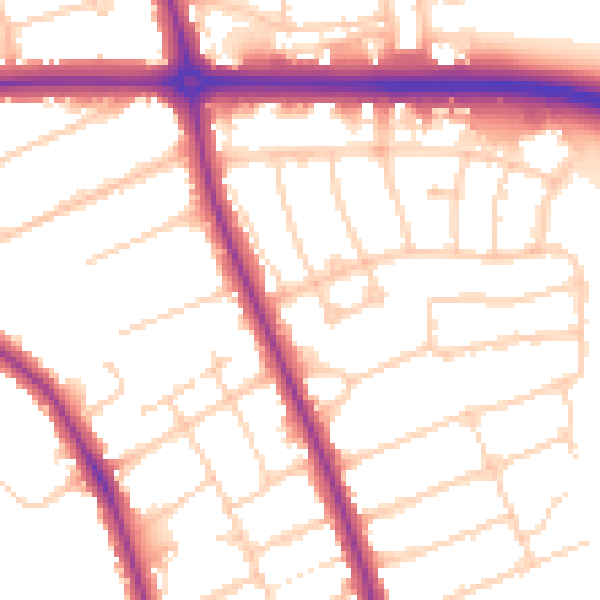
Daytime· 07:00 – 23:00
52.9dB

Night-time· 23:00 – 07:00
44.6dB