Are you a property professional?Get qualified leads from motivated homeowners.
Get started8 Cemetery Road, Abingdon, OX14 1AS
4 sales on record
About 8 Cemetery Road
A plain-English summary derived from public records, EPC certificates, sold prices and local data.
8 Cemetery Road is a two-bedroom semi-detached house in Abingdon (OX14 1AS). It has a recorded floor area of 57 m² (around 614 sq ft), construction records dating it to before 1900 and council tax band D. The latest certificate (June 2014) shows a D (score 55), a step below the typical UK home. When first surveyed in October 2008 the rating was E, the property has climbed 1 band since. The recommended improvements would lift it to B (score 91), a 2-band jump. The latest certificate is from June 2014, so improvements made since then won't be reflected.
Sale prices here have outpaced England HPI: 2.8% per year against 0% for the wider region. Today's modelled estimate of £338,000 is 12.7% above the 2019 sale price. On a £-per-square-foot basis, the last sale (£489/sq ft) was about 21.3% above the typical sold price in the postcode. At 57 m² it sits well below the postcode median (102 m² across 7 EPCs), making it one of the more compact homes locally. Sold November 2019 for £300,000. Across the public record there are 4 sales, relatively high churn for a single property. 3 planning records sit against the property, 0 approved, 0 refused.
What this property has
Pulled from EPC certificates, claim submissions and our property model. Empty categories are hidden — we only show what's known.
Inside
- Bedrooms2
- Bathrooms1
- Dining roomYes
Outside
- Private garden
Energy performance
Every EPC certificate filed against this property — current rating, recorded improvements, and where there's headroom to reach a higher band.
Recommended upgrades on file would lift this property by multiple EPC bands.
EPC Expired
This certificate is over 10 years old and is no longer valid.Expired 10 Jun 2024
Planning history
Applications and permits filed against 8 Cemetery Road, Abingdon, OX14 1AS, sourced from the PlanIt planning register.
- Mar 2025ExtensionAmendmentPlanning Permission
Extension: Single storey
Variation of condition 3 (materials) on application P23/V0905/HH - change of materials to proposed facade from stone slips to Millboard 'board and batten' cladding in Limited Oak or similar. (Certificate B received 13th February 2025) (Single storey front extension and 2 No. rooflights. Double glazed doors and windows. Flat roof shed construction.)
Sales history & valuation
Recorded transactions, our model's current estimate, and a quick read on what neighbouring properties have sold for.
Current estimate
See how we calculated this£338,000
Modelled from EPC, postcode comparables and a sale-price growth of 2.8% per year over 15 years.
Last sold (2019)
£300,000
Growth on file: 2.8% per year over 15 years.
Sales timeline
Versus other Cemetery Road homes
Four headline reads against 7 similar houses on this street, drawn from the latest EPC and Land Registry data.
8 Cemetery Road outperforms the street on co₂ emissions by a wide margin.
Price per m²
£5,263
Street avg £4,551
Floor Area
57 m²
Street avg 107 m²
Habitable Rooms
5 rooms
Similar properties nearby
A handful of close matches in the same postcode area, ranked by likeness on bedrooms, type and floor area.
The neighbourhood at a glance
A condensed read of the local area. Each tile links through to the full breakdown on the Abingdon district page.
Crime
6/mo
Steady year-on-year across the wider district.
Nearest stop
0.3 km
Colwell Drive — bus stop.
Road noise across the postcode
Modelled day and night-time noise levels around OX14 1AS from Defra's strategic mapping. The pin marks this postcode's centroid.
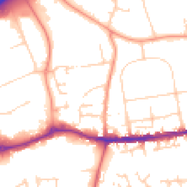
Daytime· 07:00 – 23:00
52.4dB

Everything within walking distance
Schools, transport stops and scenic spots near this property — 45 points of interest in total.
Beautiful places to visit nearby
Curated scenic spots within reach of this postcode, served by Beautifulplaces.ai. Photography and tagging come from their open dataset.
Common questions
The questions buyers, sellers and homeowners most often ask about 8 Cemetery Road, Abingdon, OX14 1AS. Each answer is also embedded as structured data for search engines.