62 Rewley Road, Oxford, OX1 2RQ
About 62 Rewley Road
62 Rewley Road is a mid-terrace house in Oxford (OX1 2RQ). It has a recorded floor area of 107 m² (around 1152 sq ft), construction records dating it to 1996-2002 and council tax band E. The latest certificate (June 2022) shows a C (score 74). The recommended improvements would push it to B (score 84).
At 107 m² the property is well over the postcode median (77 m² across 42 EPCs), placing it in the larger end of the local stock. Across 1999–2023, sale prices on this property compounded at 5.2% per year. On a £-per-square-foot basis, the last sale (£664/sq ft) was about 141.3% above the typical sold price in the postcode. Last sale on file: £765,000 in May 2023.
Everything you need to know about 62 Rewley Road
The true value, the hidden risks and the full sale history, in one report.
30-day money-back guarantee

The data behind every report


Energy performance
EPC Rating
Planning history
62 Rewley Road has no planning applications on record.
Notable planning nearby
2applications of note in the surrounding area
We flagged 1 thing worth checking at 62 Rewley Road
Independent checks surfaced things a buyer would want to understand before offering. The report explains each one in full, with the underlying data and what to ask.
- Larger development activity nearby
30-day money-back guarantee
Sales history & valuation
62 Rewley Road has more than tripled in price since its earliest registered sale in 1999.
£771,000
Modelled from EPC, postcode comparables and a sale-price growth of 5.2% per year over 24 years.
£765,000
Growth on file: 5.2% per year over 24 years.
Sales timeline
14 May 2023Most recent
£765,000
+93.7%over 14 years29 July 2008
£395,000
+71.8%over 9 years27 June 1999
£229,950
Median price across the last 5 sales in OX1 2RQ: £545,000 (2025–2024).
Versus other Rewley Road homes
On price per m², 62 Rewley Road stands well clear of the street.
Price per m²
£7,150
Street avg £4,425
Floor Area
107 m²
Street avg 110 m²
Habitable Rooms
5 rooms
Street avg 5 rooms
CO₂ Emissions
3.0 t/year
Street avg 3.2 t/year
Everything you need to know about 62 Rewley Road
The true value, the hidden risks and the full sale history, in one report.
30-day money-back guarantee
The data behind every report
Similar properties nearby
The neighbourhood at a glance
Rail-style transport is unusually close for this postcode.
Crime
6/mo
Rising year-on-year across the wider district.
Nearest stop
0.3 km
Canal Street — bus stop.
Closest school
0.4 km
St Barnabas' Church of England Aided Primary School. 16 schools nearby.
Go deeper on the local area
The full report breaks down crime, transport links, schools and air quality in depth.
Road noise across the postcode
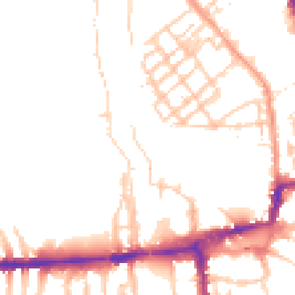
Daytime· 07:00 – 23:00
49.7dB
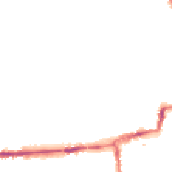
Night-time· 23:00 – 07:00
41.0dB