8 Fountains Walk, Chadderton, Oldham, OL9 8PX
About 8 Fountains Walk
8 Fountains Walk is a property in Chadderton, Oldham, Oldham (OL9 8PX). It has council tax band B.
Untraded for 31 years, with the last transfer in May 1995. Only one transfer is on record with HM Land Registry, suggesting it has stayed in the same hands for a long time.
Everything you need to know about 8 Fountains Walk
The true value, the hidden risks and the full sale history, in one report.
Pick your report · every report is £14.99
One time fee only - money back guarantee

The data behind every report


Energy performance
No EPC on record
This property doesn't have an Energy Performance Certificate yet. An EPC is required to sell or let — and unlocks our automated valuation.
Get a survey for this property
Level 2 HomeBuyer Report
We've checked 10 risk factors against the available data for this property and believe a Level 2 HomeBuyer Report could be a suitable option for you.
Planning history
8 Fountains Walk has no planning applications on record.
But the area is active
2 notable applications nearby — larger schemes and conversions that could reshape the street. The report maps them all.
Sales history & valuation
8 Fountains Walk has been held in the same hands since before 2000.
£47,000
Recorded with HM Land Registry.
Sales timeline
18 May 1995Most recent
£47,000
Median price across the last 5 sales in OL9 8PX: £132,000 (2023–2021).
Nearby sales in OL9 8PX
2 Fountains Walk, Chadderton, Oldham, OL9 8PX
Sold Nov 2023
£132,0004 Fountains Walk, Chadderton, Oldham, OL9 8PX
Sold Feb 2022
£125,0006 Fountains Walk, Chadderton, Oldham, OL9 8PX
Sold Jan 2022
£139,0007 Fountains Walk, Chadderton, Oldham, OL9 8PX
Sold Dec 2021
£140,0003 Fountains Walk, Chadderton, Oldham, OL9 8PX
Sold Nov 2011
£53,000
Everything you need to know about 8 Fountains Walk
The true value, the hidden risks and the full sale history, in one report.
Pick your report · every report is £14.99
One time fee only - money back guarantee
The data behind every report
Similar properties nearby
1 Abbey Grove, Chadderton
OL9 8RJ
1 Alcester Street, Chadderton
OL9 8LD
1 Argyll Road, Chadderton
OL9 8AJ
1 Ashton Crescent, Chadderton
OL9 8HE
1 Bardsley Street, Chadderton
OL9 8HG
1 Berkeley Avenue, Chadderton
OL9 8BL
1 Bernice Avenue, Chadderton
OL9 8QJ
1 Birchenlea Street, Chadderton
OL9 8HA
The neighbourhood at a glance
Rail-style transport is unusually close for this postcode.
Crime
1/mo
Steady year-on-year across the wider district.
Nearest stop
0.1 km
The Sportsman — bus stop.
Closest school
0.4 km
Saint John Henry Newman Roman Catholic College, A Voluntary Academy. 50 schools nearby.
Go deeper on the local area
A Local Area report breaks down crime, transport links, schools and air quality in depth.
Road noise across the postcode
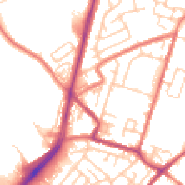
Daytime· 07:00 – 23:00
52.4dB
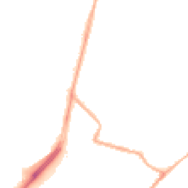
Night-time· 23:00 – 07:00
42.3dB