Brooklands House, Brooklands Avenue, Chadderton, Oldham, OL9 8PF
About Brooklands House
Brooklands House is a three-bedroom property in Chadderton, Oldham, Oldham (OL9 8PF). It has council tax band B.
Untraded for 22 years, with the last transfer in December 2004.
What this property has
Inside
- Bedrooms3
- Bathrooms1
Everything you need to know about Brooklands House
The true value, the hidden risks and the full sale history, in one report.
Pick your report · every report is £14.99
One time fee only - money back guarantee

The data behind every report


Energy performance
No EPC on record
This property doesn't have an Energy Performance Certificate yet. An EPC is required to sell or let — and unlocks our automated valuation.
Get a survey for this property
Level 2 HomeBuyer Report
We've checked 10 risk factors against the available data for this property and believe a Level 2 HomeBuyer Report could be a suitable option for you.
Planning history
Brooklands House has no planning applications on record.
But the area is active
2 notable applications nearby — larger schemes and conversions that could reshape the street. The report maps them all.
Sales history & valuation
£130,000
Recorded with HM Land Registry.
Sales timeline
3 December 2004Most recent
£130,000
Median price across the last 5 sales in OL9 8PF: £110,000 (2024–2015).
Nearby sales in OL9 8PF
14 Brooklands Avenue, Chadderton, Oldham, OL9 8PF
Sold Oct 2024
£157,5001 Brooklands Avenue, Chadderton, Oldham, OL9 8PF
Sold Apr 2022
£137,0003 Brooklands Avenue, Chadderton, Oldham, OL9 8PF
Sold Jan 2022
£110,00012 Brooklands Avenue, Chadderton, Oldham, OL9 8PF
Sold Nov 2016
£68,0005 Brooklands Avenue, Chadderton, Oldham, OL9 8PF
Sold Oct 2015
£109,000
Everything you need to know about Brooklands House
The true value, the hidden risks and the full sale history, in one report.
Pick your report · every report is £14.99
One time fee only - money back guarantee
The data behind every report
Similar properties nearby
1 Elizabeth Avenue, Chadderton
OL9 8LY
1 Bowling Green Close, Chadderton
OL9 8LU
1 Cheviot Close, Chadderton
OL9 8PR
1 Bardsley Street, Chadderton
OL9 8HG
1 Fife Avenue, Chadderton
OL9 8AG
1 Fourth Avenue, Chadderton
OL9 8PG
1 Bredbury Street, Chadderton
OL9 8QW
1 Dunster House, Dunster Close, Chadderton
OL9 8DJ
The neighbourhood at a glance
Rail-style transport is unusually close for this postcode.
Crime
1/mo
Steady year-on-year across the wider district.
Nearest stop
0.1 km
Robinson Street — bus stop.
Closest school
0.1 km
Christ Church CofE Primary School. 47 schools nearby.
Go deeper on the local area
A Local Area report breaks down crime, transport links, schools and air quality in depth.
Road noise across the postcode
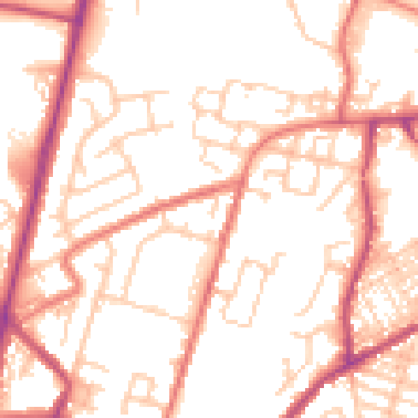
Daytime· 07:00 – 23:00
53.1dB
Night-time· 23:00 – 07:00
42.5dB