16 Ashton Crescent, Chadderton, Oldham, OL9 8HE
About 16 Ashton Crescent
16 Ashton Crescent is a three-bedroom semi-detached house in Chadderton, Oldham, Oldham (OL9 8HE). It has a recorded floor area of 72 m² (around 775 sq ft), construction records dating it to 1930-1949 and council tax band B. The latest certificate (June 2020) shows a D (score 64), on the cusp of jumping into the C band. The recommended improvements would lift it to B (score 82), a 2-band jump. Other recorded features include a conservatory.
Today's modelled estimate of £235,000 is 46.9% above the 2020 sale price. On a £-per-square-foot basis, the last sale (£206/sq ft) was about 32.4% above the typical sold price in the postcode. Last sale on file: £159,950 in October 2020.
What this property has
Inside
- Bedrooms3
- Bathrooms1
- ConservatoryYes
Outside
- Communal gardenYes
- GarageYes
Everything you need to know about 16 Ashton Crescent
The true value, the hidden risks and the full sale history, in one report.
Pick your report · every report is £14.99
One time fee only - money back guarantee

The data behind every report


Energy performance
Recommended upgrades on file would lift this property by multiple EPC bands.
EPC Rating
Get a survey for this property
Level 2 HomeBuyer Report
We've checked 10 risk factors against the available data for this property and believe a Level 2 HomeBuyer Report could be a suitable option for you.
From £545 · Includes VAT
Planning history
16 Ashton Crescent has no planning applications on record.
But the area is active
2 notable applications nearby — larger schemes and conversions that could reshape the street. The report maps them all.
Sales history & valuation
The latest sale landed in the post-pandemic price surge — useful context when reading the figure.
£235,000
Modelled from EPC, postcode comparables.
£159,950
Recorded with HM Land Registry.
Sales timeline
22 October 2020Most recent
£159,950
Median price across the last 5 sales in OL9 8HE: £218,000 (2025–2023).
Nearby sales in OL9 8HE
41 Ashton Crescent, Chadderton, Oldham, OL9 8HE
Sold May 2025
£260,00061 Ashton Crescent, Chadderton, Oldham, OL9 8HE
Sold Feb 2025
£255,00037 Ashton Crescent, Chadderton, Oldham, OL9 8HE
Sold Apr 2024
£218,00029 Ashton Crescent, Chadderton, Oldham, OL9 8HE
Sold Nov 2023
£85023 Ashton Crescent, Chadderton, Oldham, OL9 8HE
Sold Aug 2023
£200,000
Versus other Ashton Crescent homes
Price per m²
£2,222
Street avg £2,087
Floor Area
72 m²
Street avg 88 m²
Habitable Rooms
5 rooms
Street avg 5 rooms
CO₂ Emissions
3.6 t/year
Street avg 4.5 t/year
Everything you need to know about 16 Ashton Crescent
The true value, the hidden risks and the full sale history, in one report.
Pick your report · every report is £14.99
One time fee only - money back guarantee
The data behind every report
Similar properties nearby
1 Cheviot Close, Chadderton
OL9 8PR
1 Bowling Green Close, Chadderton
OL9 8LU
1 Bardsley Street, Chadderton
OL9 8HG
1 Elizabeth Avenue, Chadderton
OL9 8LY
1 Fife Avenue, Chadderton
OL9 8AG
1 Fourth Avenue, Chadderton
OL9 8PG
1 Bredbury Street, Chadderton
OL9 8QW
1 Granby Place, Granby Street, Chadderton
OL9 8EX
The neighbourhood at a glance
Rail-style transport is unusually close for this postcode.
Crime
1/mo
Steady year-on-year across the wider district.
Nearest stop
0.1 km
Houseley Avenue — bus stop.
Closest school
0.6 km
Yew Tree Community School. 48 schools nearby.
Go deeper on the local area
A Local Area report breaks down crime, transport links, schools and air quality in depth.
Road noise across the postcode
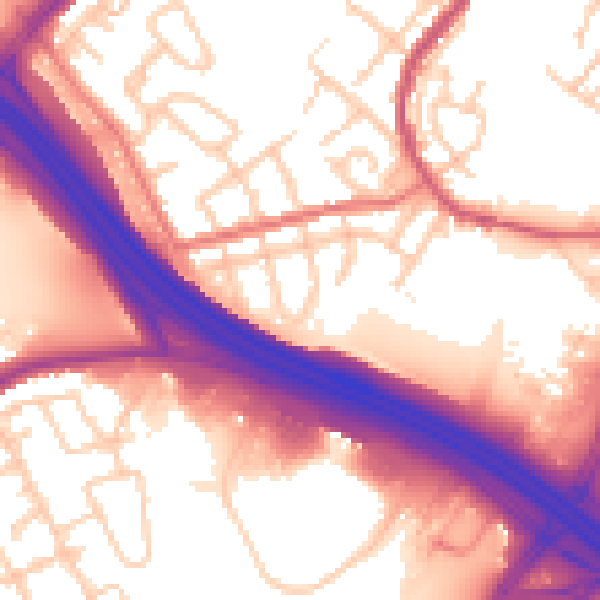
Daytime· 07:00 – 23:00
58.1dB

Night-time· 23:00 – 07:00
49.4dB