35 Abingdon Close, Rochdale, OL11 3PU
About 35 Abingdon Close
35 Abingdon Close is a two-bedroom mid-terrace house in Rochdale (OL11 3PU). It has a recorded floor area of 56 m² (around 603 sq ft), construction records dating it to 1967-1975 and council tax band B. Other recorded features include a conservatory. Our model identifies extension potential, subject to local planning policy. The home occupies a cul-de-sac position. The latest certificate (March 2021) shows a C (score 71). The recommended improvements would push it to B (score 89).
Untraded for 19 years, with the last transfer in June 2007. That sale landed at the peak of the pre-credit-crunch market, which is a useful reference point when interpreting the price. Today's modelled estimate of £149,000 sits 56.8% above the 2007 sale of £95,000. On a £-per-square-foot basis, the last sale (£158/sq ft) was about 121% above the typical sold price in the postcode.
What this property has
Inside
- Bedrooms2
- Bathrooms1
- Dining roomYes
- ConservatoryYes
Outside
- Private gardenRear
- GarageYes
- Cul-de-sacYes
Building
- Central heatingYes
- RefurbishedYes
- Extension potentialPossible
Everything you need to know about 35 Abingdon Close
The true value, the hidden risks and the full sale history, in one report.
30-day money-back guarantee

The data behind every report


Energy performance
EPC Rating
Planning history
35 Abingdon Close has no planning applications on record.
Notable planning nearby
4applications of note in the surrounding area
We flagged 1 thing worth checking at 35 Abingdon Close
Independent checks surfaced things a buyer would want to understand before offering. The report explains each one in full, with the underlying data and what to ask.
- Signs of HMO activity in the area
30-day money-back guarantee
Sales history & valuation
The latest sale landed at the peak of the pre-credit-crunch market — a high-water reference point.
£149,000
Modelled from EPC, postcode comparables.
£95,000
Recorded with HM Land Registry.
Sales timeline
10 June 2007Most recent
£95,000
Median price across the last 5 sales in OL11 3PU: £60,000 (2024–2015).
Nearby sales in OL11 3PU
Versus other Abingdon Close homes
On price per m², 35 Abingdon Close stands well clear of the street.
Price per m²
£1,696
Street avg £997
Floor Area
56 m²
Street avg 61 m²
Habitable Rooms
3 rooms
Street avg 4 rooms
CO₂ Emissions
2.3 t/year
Street avg 2.9 t/year
Everything you need to know about 35 Abingdon Close
The true value, the hidden risks and the full sale history, in one report.
30-day money-back guarantee
The data behind every report
Similar properties nearby
The neighbourhood at a glance
Rail-style transport is unusually close for this postcode.
Crime
1/mo
Steady year-on-year across the wider district.
Nearest stop
0.1 km
Merefield Street — bus stop.
Closest school
0.2 km
Ashfield Valley Primary School. 32 schools nearby.
Go deeper on the local area
The full report breaks down crime, transport links, schools and air quality in depth.
Road noise across the postcode
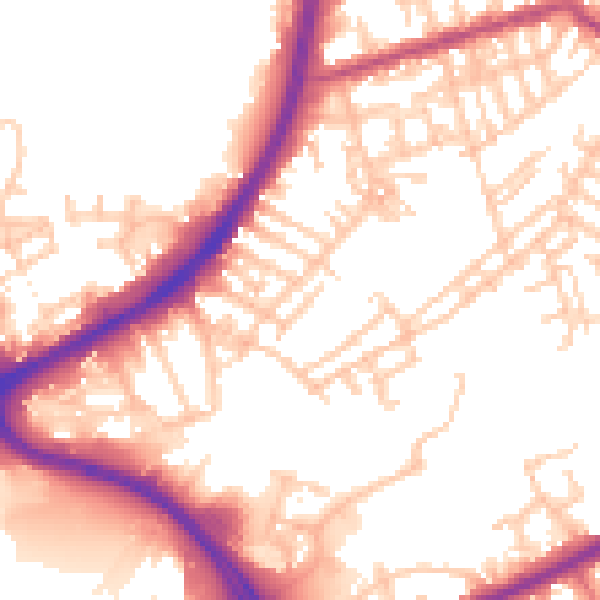
Daytime· 07:00 – 23:00
54.3dB

Night-time· 23:00 – 07:00
46.0dB