Are you a property professional?Get qualified leads from motivated homeowners.
Get started32 Crewys Road, Barnet, London, NW2 2AA
2 planning records
About 32 Crewys Road
A plain-English summary derived from public records, EPC certificates, sold prices and local data.
32 Crewys Road is a three-bedroom mid-terrace house in Barnet, London, London (NW2 2AA). It has a recorded floor area of 38 m² (around 409 sq ft), construction records dating it to 1900-1929 and council tax band D. The latest certificate (May 2020) shows a C (score 79), near the top of the C band. The rating has held steady at C across 4 certificates since October 2013. Between certificates, wall efficiency went from Very Poor to Very Good, window efficiency went from Average to Very Good and lighting went from Very Poor to Very Good; while hot-water efficiency dropped from Good to Poor and main heating dropped from Good to Very Poor. Main heating runs on electricity: electricity, unspecified tariff. At 38 m² this is the 4th smallest of 35 units on EPC record in the building, where floor areas span 14–151 m². The building's EPC ratings span E to B across 35 units on file.
At 38 m² it sits well below the postcode median (58 m² across 41 EPCs), making it one of the more compact homes locally. 2 planning records sit against the property, 1 approved, 0 refused. Past consents include an extension, meaningful when judging how the property has evolved. Today's modelled estimate of £934,000 is 13.9% above the 2021 sale price. On a £-per-square-foot basis, the last sale (£2,005/sq ft) was about 649.9% above the typical sold price in the postcode. Sold February 2021 for £820,000. That sale was during the post-pandemic price surge, when transactions cleared materially above pre-2020 trend.
What this property has
Pulled from EPC certificates, claim submissions and our property model. Empty categories are hidden — we only show what's known.
Inside
- Bedrooms3
- Bathrooms2
- Dining roomYes
- CloakroomYes
Energy performance
Every EPC certificate filed against this property — current rating, recorded improvements, and where there's headroom to reach a higher band.
32 Crewys Road's carbon output is low for the local stock.
Current Certificate(1 of 4)
May 2020
EPC Rating
A
B
C
C79
D
E
F
G
Main Heating
Electric
Main Fuel
Electric
Hot Water
Poor
Windows
Very Good
CO2 Emissions
1.1 t/year
Occupancy
—
Planning history
Applications and permits filed against 32 Crewys Road, Barnet, London, NW2 2AA, sourced from the PlanIt planning register.
Planning history includes both a loft conversion and an extension — the classic family-home expansion.
- Dec 2021Loft ConversionOutlineLawful
Roof extension involving side and rear dormer window with juliette balcony and 3no front facing rooflights
Sales history & valuation
Recorded transactions, our model's current estimate, and a quick read on what neighbouring properties have sold for.
The latest sale landed in the post-pandemic price surge — useful context when reading the figure.
Current estimate
See how we calculated this£934,000
Modelled from EPC, postcode comparables.
Last sold (2021)
£820,000
Recorded with HM Land Registry.
Sales timeline
Versus other Crewys Road homes
Four headline reads against 38 similar flats on this street, drawn from the latest EPC and Land Registry data.
32 Crewys Road outperforms the street on price per m² by a wide margin.
Price per m²
£21,579
Street avg £5,120
Floor Area
38 m²
Street avg 53 m²
CO₂ Emissions
1.1 t/year
Similar properties nearby
A handful of close matches in the same postcode area, ranked by likeness on bedrooms, type and floor area.
The neighbourhood at a glance
A condensed read of the local area. Each tile links through to the full breakdown on the London district page.
Reported crime in the wider district is trending notably upward year-on-year.
Crime
14/mo
Rising year-on-year across the wider district.
Nearest stop
0.1 km
Childs Hill / Cricklewood Lane — bus stop.
Road noise across the postcode
Modelled day and night-time noise levels around NW2 2AA from Defra's strategic mapping. The pin marks this postcode's centroid.
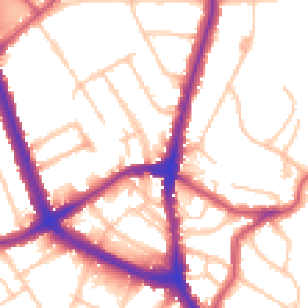
Daytime· 07:00 – 23:00
54.3dB

Everything within walking distance
Schools, transport stops and scenic spots near this property — 78 points of interest in total.
Beautiful places to visit nearby
Curated scenic spots within reach of this postcode, served by Beautifulplaces.ai. Photography and tagging come from their open dataset.
Common questions
The questions buyers, sellers and homeowners most often ask about 32 Crewys Road, Barnet, London, NW2 2AA. Each answer is also embedded as structured data for search engines.