Are you a property professional?Get qualified leads from motivated homeowners.
Get started1 Colville Road, Lowestoft, NR33 9QX
Extendable
About 1 Colville Road
A plain-English summary derived from public records, EPC certificates, sold prices and local data.
1 Colville Road is a two-bedroom end-of-terrace house in Lowestoft (NR33 9QX). It has a recorded floor area of 69 m² (around 743 sq ft), construction records dating it to before 1900 and council tax band B. The latest certificate (August 2018) shows an E (score 52), well below the UK norm with real room to improve. The rating has held steady at E across 3 certificates since July 2014. Between certificates, roof efficiency went from Very Poor to Good, window efficiency went from Average to Good and hot-water efficiency went from Poor to Good; while lighting dropped from Very Good to Average. The recommended improvements would lift it to B (score 84), a 3-band jump. Our model identifies extension potential, subject to local planning policy. The home occupies a corner plot.
Sale prices here have outpaced England HPI: 4.5% per year against 0% for the wider region. On a £-per-square-foot basis, the last sale (£242/sq ft) was about 82.8% above the typical sold price in the postcode. A recent sale: £180,000 in December 2024. At 69 m² it's 25% smaller than the typical home in the postcode (92 m² median across 18 EPCs). It lags the bulk of the postcode on energy efficiency (less efficient than 72% of similar EPCs). 2 planning records sit against the property, 2 approved, 0 refused.
What this property has
Pulled from EPC certificates, claim submissions and our property model. Empty categories are hidden — we only show what's known.
Inside
- Bedrooms2
- Bathrooms1
- Dining roomYes
Outside
- Garage
Energy performance
Every EPC certificate filed against this property — current rating, recorded improvements, and where there's headroom to reach a higher band.
Recommended upgrades on file would lift this property by multiple EPC bands.
Current Certificate(1 of 3)
Aug 2018
EPC Rating
A
B
C
D
E
E52
F
G
Main Heating
Gas
Main Fuel
Gas
Hot Water
Good
Windows
Good
CO2 Emissions
3.7 t/year
Occupancy
Owner Occupied
Planning history
Applications and permits filed against 1 Colville Road, Lowestoft, NR33 9QX, sourced from the PlanIt planning register.
- Apr 2017New BuildFullGranted
Construction of a detached house
Sales history & valuation
Recorded transactions, our model's current estimate, and a quick read on what neighbouring properties have sold for.
Sale price has grown by over 3x since 1995.
Current estimate
See how we calculated this£180,000
Modelled from EPC, postcode comparables and a sale-price growth of 4.5% per year over 30 years.
Last sold (2024)
£180,000
Growth on file: 4.5% per year over 30 years.
Sales timeline
Versus other Colville Road homes
Four headline reads against 18 similar houses on this street, drawn from the latest EPC and Land Registry data.
Years Held for 1 Colville Road lags the street by a wide margin.
Price per m²
£2,609
Street avg £1,865
Floor Area
69 m²
Street avg 91 m²
Habitable Rooms
5 rooms
Similar properties nearby
A handful of close matches in the same postcode area, ranked by likeness on bedrooms, type and floor area.
The neighbourhood at a glance
A condensed read of the local area. Each tile links through to the full breakdown on the Lowestoft district page.
Rail-style transport is unusually close for this postcode.
Crime
4/mo
Steady year-on-year across the wider district.
Nearest stop
0.0 km
Planters Grove — bus stop.
Road noise across the postcode
Modelled day and night-time noise levels around NR33 9QX from Defra's strategic mapping. The pin marks this postcode's centroid.
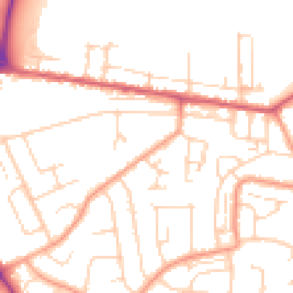
Daytime· 07:00 – 23:00
50.8dB

Everything within walking distance
Schools, transport stops and scenic spots near this property — 48 points of interest in total.
Beautiful places to visit nearby
Curated scenic spots within reach of this postcode, served by Beautifulplaces.ai. Photography and tagging come from their open dataset.
Common questions
The questions buyers, sellers and homeowners most often ask about 1 Colville Road, Lowestoft, NR33 9QX. Each answer is also embedded as structured data for search engines.