The Orchard, West Road, West Caister, Great Yarmouth, NR30 5TB
About The Orchard
The Orchard is a detached house in West Caister, Great Yarmouth, Great Yarmouth (NR30 5TB). It has a recorded floor area of 163 m² (around 1755 sq ft) and construction records dating it to 1991-1995. The latest certificate (April 2014) shows a D (score 61), on the cusp of jumping into the C band. The recommended improvements would push it to C (score 75). The latest certificate is from April 2014, so improvements made since then won't be reflected.
Last sold in February 2015, so it's been off the market for around 12 years. Across 2000–2015, sale prices on this property compounded at 4.1% per year. Today's modelled estimate of £481,000 is 48% above the 2015 sale price.
Everything you need to know about The Orchard
The true value, the hidden risks and the full sale history, in one report.
Pick your report · from £14.99
One time fee only - money back guarantee

The data behind every report


Energy performance
The Orchard's carbon output runs well above what efficient homes in the postcode produce.
EPC Expired
This certificate is over 10 years old and is no longer valid.Expired 10 Apr 2024
EPC Rating
Certificate validity
Expired on 10 April 2024

Get a survey for this property
Level 3 Building Survey
Because the property has been extended more than once, we believe a Level 3 building survey should be considered.
From £1,020 · Includes VAT
Planning history
The Orchard has no planning applications on record.
A planning report still maps activity across the surrounding area and reads this property's extension & conversion potential.
Sales history & valuation
The Orchard valuation sits well clear of the typical sold price in this postcode.
£481,000
Modelled from EPC, postcode comparables and a sale-price growth of 4.1% per year over 14 years.
£325,000
Growth on file: 4.1% per year over 14 years.
Sales timeline
9 February 2015Most recent
£325,000
+10.2%over 9 years25 August 2005
£294,950
+61.2%over 4 years14 September 2000
£183,000
Median price across the last 5 sales in NR30 5TB: £229,950 (2020–2002).
Nearby sales in NR30 5TB
Brambly Hedge, West Road, West Caister, Great Yarmouth, NR30 5TB
Sold Dec 2020
£340,000Jenzelle, West Road, West Caister, Great Yarmouth, NR30 5TB
Sold Nov 2015
£229,950The Grange, West Road, West Caister, Great Yarmouth, NR30 5TB
Sold Nov 2013
£410,000Milestone, West Road, West Caister, Great Yarmouth, NR30 5TB
Sold Feb 2008
£125,000Heathlands, West Road, West Caister, Great Yarmouth, NR30 5TB
Sold Apr 2002
£130,000
Everything you need to know about The Orchard
The true value, the hidden risks and the full sale history, in one report.
Pick your report · from £14.99
One time fee only - money back guarantee
The data behind every report
Similar properties nearby
1 Carter Close, Caister On Sea
NR30 5NT
1 Alexander Close, Caister On Sea
NR30 5QF
1 Allendale Road, Caister On Sea
NR30 5ES
1 Burgess Close, Caister On Sea
NR30 5XD
1 Beeleigh Way, Caister On Sea
NR30 5UP
1 Caister Sands Avenue, Caister On Sea
NR30 5PF
1 Bungalow, Nova Scotia, West Caister
NR30 5SH
1 Brooke Avenue, Caister On Sea
NR30 5RN
The neighbourhood at a glance
Crime
376/mo
Falling year-on-year across the wider district.
Closest school
0.8 km
Caister Junior School. 4 schools nearby.
Go deeper on the local area
A Local Area report breaks down crime, transport links, schools and air quality in depth.
Road noise across the postcode
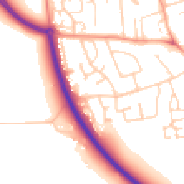
Daytime· 07:00 – 23:00
53.8dB

Night-time· 23:00 – 07:00
44.2dB