Cramdail, West Carr Road, Attleborough, NR17 1AA
About Cramdail
Cramdail is a detached house in Attleborough (NR17 1AA). It has a recorded floor area of 100 m² (around 1076 sq ft), construction records dating it to 1950-1966 and council tax band D. The latest certificate (March 2013) shows a D (score 59), a step below the typical UK home. The recommended improvements would lift it to B (score 81), a 2-band jump. The latest certificate is from March 2013, so improvements made since then won't be reflected.
Last changed hands 13 years ago, in July 2013. 3 planning records sit against the property, 0 approved, 0 refused. Across 1999–2013, sale prices on this property compounded at 9% per year. Today's modelled estimate of £344,000 is 46.4% above the 2013 sale price.
Everything you need to know about Cramdail
The true value, the hidden risks and the full sale history, in one report.
30-day money-back guarantee

The data behind every report


Energy performance
Recommended upgrades on file would lift this property by multiple EPC bands.
EPC Expired
This certificate is over 10 years old and is no longer valid.Expired 27 Mar 2023
EPC Rating
Planning history
- Sept 2014ApplicationIn report
Amendment to 3PL/2013/0681 Change garage to render on 3 sides & brick at front & off set garage door
- Documents
- 4 docs on file
- Reference
- 3NM/2014/0076/NMA
- May 2014ExtensionFullIn report
Extension: Rear of property
Proposed rear extension
- Documents
- 5 docs on file
- Reference
- 3PL/2014/0360/F
We flagged 1 thing worth checking at Cramdail
Independent checks surfaced things a buyer would want to understand before offering. The report explains each one in full, with the underlying data and what to ask.
- Larger development activity nearby
30-day money-back guarantee
Sales history & valuation
Sale price has grown by over 3x since 1999.
£344,000
Modelled from EPC, postcode comparables and a sale-price growth of 9.0% per year over 14 years.
£235,000
Growth on file: 9.0% per year over 14 years.
Sales timeline
28 July 2013Most recent
£235,000
+243.1%over 14 years29 April 1999
£68,500
Median price across the last 5 sales in NR17 1AA: £345,000 (2025–2022).
Nearby sales in NR17 1AA
Glenross, West Carr Road, Attleborough, NR17 1AA
Sold Jul 2025
£345,000The Cherries, West Carr Road, Attleborough, NR17 1AA
Sold Dec 2024
£400,0003 West Carr Road, Attleborough, NR17 1AA
Sold Oct 2024
£265,000Willowdale, West Carr Road, Attleborough, NR17 1AA
Sold Jun 2024
£680,0006 West Carr Road, Attleborough, NR17 1AA
Sold Nov 2021
£170,000
Versus other West Carr Road homes
On years held, Cramdail stands well clear of the street.
Price per m²
£2,350
Street avg £2,770
Floor Area
100 m²
Street avg 119 m²
Habitable Rooms
5 rooms
Street avg 5 rooms
CO₂ Emissions
5.2 t/year
Street avg 4.4 t/year
Everything you need to know about Cramdail
The true value, the hidden risks and the full sale history, in one report.
30-day money-back guarantee
The data behind every report
Similar properties nearby
1 Bracken Drive
NR17 1TA
1 Blenheim Drive
NR17 1QZ
1 Buckenham Road
NR17 1NQ
1 Barrack Row, Little Ellingham
NR17 1JJ
1 Chequers Lane, Great Ellingham
NR17 1HR
1 Bryony Way
NR17 1QL
1 Barley Way
NR17 1YD
1 Chequers Green, Great Ellingham
NR17 1HU
The neighbourhood at a glance
Crime
2/mo
Steady year-on-year across the wider district.
Nearest stop
1.5 km
Attleborough Rail Station — railway station.
Closest school
0.4 km
Rosecroft Primary School. 3 schools nearby.
Go deeper on the local area
The full report breaks down crime, transport links, schools and air quality in depth.
Road noise across the postcode
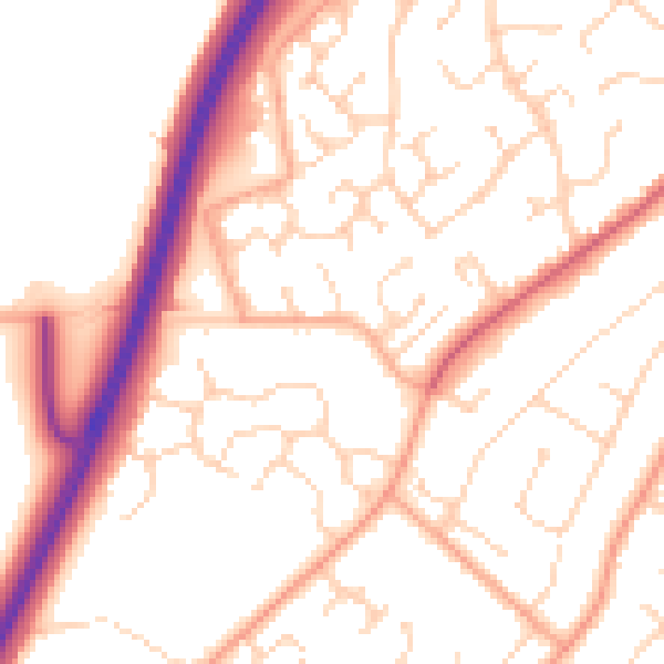
Daytime· 07:00 – 23:00
52.5dB

Night-time· 23:00 – 07:00
42.0dB