7 Carlin Close, Wellingborough, NN8 6BG
About 7 Carlin Close
7 Carlin Close is a mid-terrace house in Wellingborough (NN8 6BG). It has a recorded floor area of 71 m² (around 764 sq ft) and construction records dating it to 2019. The latest certificate (February 2023) returns a high B (score 85), putting the home a stone's throw from an A rating. The recommended improvements would push it to A (score 97).
It changed hands recently, sold October 2025 for £219,500. Across 2023–2025, sale prices on this property compounded at -2.7% per year.
Everything you need to know about 7 Carlin Close
The true value, the hidden risks and the full sale history, in one report.
Pick your report · from £14.99
One time fee only - money back guarantee

The data behind every report







Energy performance
7 Carlin Close's carbon output is low for the local stock.
EPC Rating
Certificate validity
Valid until 13 February 2033

Get a survey for this property
Level 2 HomeBuyer Report
We've checked 10 risk factors against the available data for this property and believe a Level 2 HomeBuyer Report could be a suitable option for you.
From £545 · Includes VAT
Planning history
7 Carlin Close has no planning applications on record.
A planning report still maps activity across the surrounding area and reads this property's extension & conversion potential.
Sales history & valuation
£223,000
Modelled from EPC, postcode comparables and a sale-price growth of -2.7% per year over 3 years.
£219,500
Growth on file: -2.7% per year over 3 years.
Sales timeline
19 October 2025Most recent
£219,500
-6.8%over 2 years30 March 2023
£235,595
Median price across the last 5 sales in NN8 6BG: £215,000 (2026–2024).
Nearby sales in NN8 6BG
Flat 1, 16 Carlin Close, Wellingborough, NN8 6BG
Sold Apr 2026
£185,0008 Carlin Close, Wellingborough, NN8 6BG
Sold Jan 2026
£320,00015 Carlin Close, Wellingborough, NN8 6BG
Sold Jul 2025
£215,000Flat 4, 16 Carlin Close, Wellingborough, NN8 6BG
Sold Aug 2024
£171,00017 Carlin Close, Wellingborough, NN8 6BG
Sold Jan 2024
£270,750
Versus other Carlin Close homes
Years Held for 7 Carlin Close lags the street by a wide margin.
Price per m²
£3,092
Street avg £3,270
Floor Area
71 m²
Street avg 83 m²
CO₂ Emissions
1.0 t/year
Street avg 1.3 t/year
Years Held
1 years
Street avg 3 years
Everything you need to know about 7 Carlin Close
The true value, the hidden risks and the full sale history, in one report.
Pick your report · from £14.99
One time fee only - money back guarantee
The data behind every report
Similar properties nearby
The neighbourhood at a glance
Crime
456/mo
Falling year-on-year across the wider district.
Nearest stop
0.1 km
Balharvie Road — bus stop.
Closest school
0.4 km
The Glenvale Church of England Primary School. 17 schools nearby.
Go deeper on the local area
A Local Area report breaks down crime, transport links, schools and air quality in depth.
Road noise across the postcode
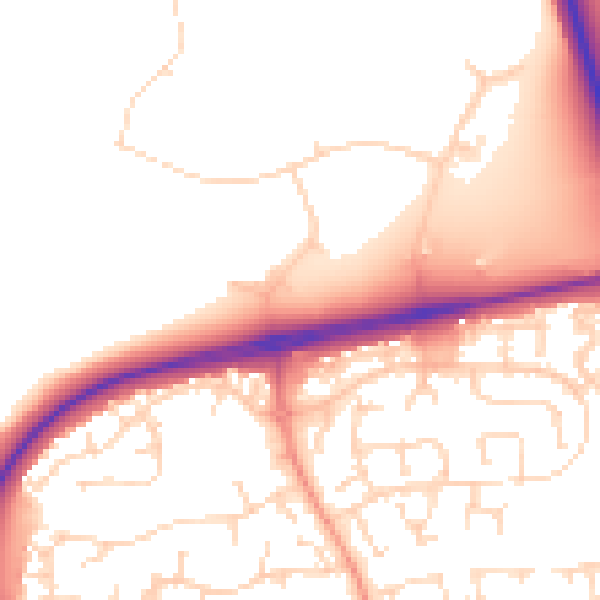
Daytime· 07:00 – 23:00
52.8dB

Night-time· 23:00 – 07:00
44.2dB