53 High Street, Weston Favell, Northampton, NN3 3JS
About 53 High Street
53 High Street is a three-bedroom end-of-terrace house in Weston Favell, Northampton, Northampton (NN3 3JS). It has a recorded floor area of 84 m² (around 904 sq ft), construction records dating it to 1930-1949 and council tax band B. The latest certificate (October 2016) shows an E (score 51), well below the UK norm with real room to improve. The recommended improvements would lift it to C (score 79), a 2-band jump.
On energy efficiency it sits in the bottom 10% of properties in this postcode — significant headroom for improvement. Last changed hands 9 years ago, in April 2017. Across the public record there are 4 sales, relatively high churn for a single property. 2 planning records sit against the property, 2 approved, 0 refused. Past consents include tree works, meaningful when judging how the property has evolved. Across 2002–2017, sale prices on this property compounded at 6.1% per year. Today's modelled estimate of £303,000 is 42.3% above the 2017 sale price.
What this property has
Inside
- Bedrooms3
- Dining roomYes
Building
- RefurbishedYes
Everything you need to know about 53 High Street
The true value, the hidden risks and the full sale history, in one report.
Pick your report · from £14.99
One time fee only - money back guarantee

The data behind every report





Energy performance
53 High Street sits at the bottom of the postcode for energy efficiency — meaningful headroom to improve.
EPC Rating
Certificate validity
Valid until 18 October 2026

Get a survey for this property
Level 3 Building Survey
Because the property has solid (non-cavity) walls, we believe a Level 3 building survey should be considered.
From £955 · Includes VAT
Planning history
Planning history at 53 High Street is exclusively tree-management applications — typical for a property with mature trees on or near the plot.
2 applications on record at 53 High Street, Weston Favell, Northampton, NN3 3JS
- Jul 2018Tree WorksTreesOutcome in report
T1 - To remove Conifers and Juniper tree as they are over hanging the pavement H1 - To reduce a Laurel hedge by 6ft T2 - To remove Conifers as they are touching both surrounding buildings T3 - To remove a line of Conifers as it is overhanging 2 gardens. T4 - To remove a Conifer as it is overhanging 4 gardens and a greenhouse, it is also causing damage to the boundary fence.
- Documents
- 5 docs on file
- Reference
- N/2018/1064
- More recent applications — locked
- Tree WorksDec 2020Decision
Unlock 53 High Street, Weston Favell, Northampton, NN3 3JS's full planning history
You're seeing the shape of it. The report has the substance.
- Every decision — granted, refused or withdrawn (2 on record)
- All 2 applications on this property in full, plus 7 notable nearby
- The 10 documents, officer reports & conditions
- What the pattern means for extending or converting here
One time fee only - money back guarantee
Sales history & valuation
Sale price has at least doubled since 2002.
£303,000
Modelled from EPC, postcode comparables and a sale-price growth of 6.1% per year over 15 years.
£213,000
Growth on file: 6.1% per year over 15 years.
Sales timeline
27 April 2017Most recent
£213,000
+52.7%over 11 years13 October 2005
£139,500
+25.7%over 2 years17 December 2002
£111,000
+27.7%over 10 months22 February 2002
£86,950
Median price across the last 5 sales in NN3 3JS: £290,000 (2025–2017).
Nearby sales in NN3 3JS
71 High Street, Weston Favell, Northampton, NN3 3JS
Sold Sept 2025
£350,00023 High Street, Weston Favell, Northampton, NN3 3JS
Sold Mar 2019
£290,0001 High Street, Weston Favell, Northampton, NN3 3JS
Sold Aug 2017
£225,00051 High Street, Weston Favell, Northampton, NN3 3JS
Sold Jun 2016
£192,50021 High Street, Weston Favell, Northampton, NN3 3JS
Sold Aug 2014
£476,950
Versus other High Street homes
53 High Street is notably below the street on price per m².
Price per m²
£2,536
Street avg £3,657
Floor Area
84 m²
Street avg 74 m²
Habitable Rooms
6 rooms
Street avg 5 rooms
CO₂ Emissions
5.7 t/year
Street avg 3.3 t/year
Everything you need to know about 53 High Street
The true value, the hidden risks and the full sale history, in one report.
Pick your report · from £14.99
One time fee only - money back guarantee
The data behind every report
Similar properties nearby
The neighbourhood at a glance
Crime
461/mo
Falling year-on-year across the wider district.
Nearest stop
0.2 km
Booth Lane South — bus stop.
Closest school
0.5 km
Weston Favell CofE Primary School. 28 schools nearby.
Go deeper on the local area
A Local Area report breaks down crime, transport links, schools and air quality in depth.
Road noise across the postcode
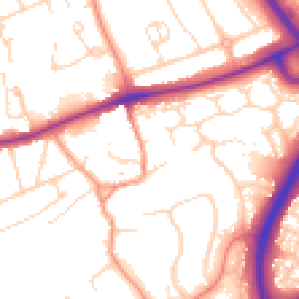
Daytime· 07:00 – 23:00
54.0dB

Night-time· 23:00 – 07:00
45.1dB