25 Birkland Avenue, Mapperley, Nottingham, NG3 5LA
About 25 Birkland Avenue
25 Birkland Avenue is a detached house in Mapperley, Nottingham, Nottingham (NG3 5LA). It has a recorded floor area of 139 m² (around 1496 sq ft) and council tax band D. The latest certificate (May 2019) returns a B (score 83), comfortably above the UK average.
Its energy rating outperforms most of the postcode (better than 74% of similar EPCs). One historical planning record sits against the property in 2018.
Everything you need to know about 25 Birkland Avenue
The true value, the hidden risks and the full sale history, in one report.
Pick your report · every report is £14.99
One time fee only - money back guarantee

The data behind every report


Energy performance
EPC Rating
Get a survey for this property
Level 2 HomeBuyer Report
We've checked 10 risk factors against the available data for this property and believe a Level 2 HomeBuyer Report could be a suitable option for you.
From £595 · Includes VAT
Planning history
1 application on record at 25 Birkland Avenue, Mapperley, Nottingham, NG3 5LA
- Aug 2018New BuildFullOutcome in report
Demolish existing dwelling and construct 2No 3 bedroom detached two storey dwellings
- Documents
- 12 docs on file
- Reference
- 2018/0584
Unlock 25 Birkland Avenue, Mapperley, Nottingham, NG3 5LA's full planning history
You're seeing the shape of it. The report has the substance.
- Every decision — granted, refused or withdrawn (1 on record)
- All 1 application on this property in full, plus 4 notable nearby
- The 12 documents, officer reports & conditions
- What the pattern means for extending or converting here
One time fee only - money back guarantee
Sales history & valuation
25 Birkland Avenue has no Land Registry sales on file, suggesting it has stayed in the same hands since registration began.
£400,000
Modelled from EPC, postcode comparables.
No sales recorded with HM Land Registry
That can mean the property has never traded since the registry began publishing in 1995, was a new build that hasn't been registered yet, or is held in the same hands long-term.
Median price across the last 5 sales in NG3 5LA: £335,000 (2025–2020).
Nearby sales in NG3 5LA
16 Birkland Avenue, Mapperley, Nottingham, NG3 5LA
Sold Mar 2025
£238,00031 Birkland Avenue, Mapperley, Nottingham, NG3 5LA
Sold Dec 2024
£435,00042a, Birkland Avenue, Mapperley, Nottingham, NG3 5LA
Sold Sept 2024
£335,00027 Birkland Avenue, Mapperley, Nottingham, NG3 5LA
Sold Nov 2023
£425,00021 Birkland Avenue, Mapperley, Nottingham, NG3 5LA
Sold Aug 2020
£270,000
Versus other Birkland Avenue homes
25 Birkland Avenue outperforms the street on co₂ emissions by a wide margin.
EPC Rating
83 (B)
Street avg 65 (D)
Floor Area
139 m²
Street avg 131 m²
CO₂ Emissions
2.0 t/year
Street avg 5.2 t/year
Everything you need to know about 25 Birkland Avenue
The true value, the hidden risks and the full sale history, in one report.
Pick your report · every report is £14.99
One time fee only - money back guarantee
The data behind every report
Similar properties nearby
1 Carisbrooke Avenue
NG3 5DT
1 Axmouth Drive, Mapperley
NG3 5SX
1 Berkeley Avenue
NG3 5BU
1 Birkland Avenue, Mapperley
NG3 5LA
1 Bonington Road
NG3 5JR
1 Bideford Close
NG3 5UP
1 Braunton Crescent, Mapperley
NG3 5SZ
1 Beedham Way
NG3 5TB
The neighbourhood at a glance
Reported crime in the wider district is trending notably upward year-on-year.
Crime
5/mo
Rising year-on-year across the wider district.
Nearest stop
0.2 km
Newbury Close — bus stop.
Closest school
0.3 km
Mapperley Plains Primary and Nursery School. 43 schools nearby.
Go deeper on the local area
A Local Area report breaks down crime, transport links, schools and air quality in depth.
Road noise across the postcode
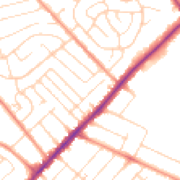
Daytime· 07:00 – 23:00
50.1dB

Night-time· 23:00 – 07:00
40.1dB