10 The Drive, Winthorpe, Newark, NG24 2NX
About 10 The Drive
10 The Drive is a detached house in Winthorpe, Newark, Newark (NG24 2NX). It has a recorded floor area of 86 m² (around 926 sq ft), construction records dating it to before 1900 and council tax band D. The latest certificate (November 2020) shows a D (score 60), on the cusp of jumping into the C band. The recommended improvements would lift it to B (score 86), a 2-band jump.
4 planning records sit against the property, 1 approved, 1 refused. Past consents include an extension, meaningful when judging how the property has evolved. On a £-per-square-foot basis, the last sale (£285/sq ft) was about 71.2% above the typical sold price in the postcode. At 86 m² it's 20% smaller than the typical home in the postcode (108 m² median across 4 EPCs). Sold January 2025 for £264,000.
Everything you need to know about 10 The Drive
The true value, the hidden risks and the full sale history, in one report.
Pick your report · from £14.99
One time fee only - money back guarantee

The data behind every report







Energy performance
Recommended upgrades on file would lift this property by multiple EPC bands.
EPC Rating
Certificate validity
Valid until 21 November 2030

Get a survey for this property
Level 3 Building Survey
Because the property was built before 1919 and has solid (non-cavity) walls, we believe a Level 3 building survey should be considered.
From £885 · Includes VAT
Planning history
A partial demolition application was refused at 10 The Drive in 2025.
4 applications on record at 10 The Drive, Winthorpe, Newark, NG24 2NX
1 live now- Mar 2025Tree WorksTreesOutcome in report
T1 - Yew tree, 5.2 metres (from ground level) crown lift over Holme Lane only to remove obstruction of Notts Highways signage and provide clearance for high sided vehicles. T2 - Yew Tree, 3 metres (from ground level) crown lift to provide clearance for vehicle access along The Drive. T3 - Norwegian Spruce, 3 metres crown lift from ground level and undertake up to 1.5mts lateral reduction to lowest branches only (provide natural lift and further clearance). T4 - Mature Apple Tree with rotten trunk to the extent a wedge can penetrate easily the full diameter of the trunk at 1.5 metres high. Remove as dangerous as it is leaning over the road. T7 - Mature apple tree in similar state of repair with the trunk totally rotten. Remove All other identified trees within the survey i.e. T5, T6, T8, T9, T10 and T11 no works to be undertaken.
- Documents
- 3 docs on file
- Reference
- 25/00113/TWCA
- More recent applications — locked
- ConditionsMar 2026Decision
- ExtensionMar 2026Decision
+ 1 more application in the report
Unlock 10 The Drive, Winthorpe, Newark, NG24 2NX's full planning history
You're seeing the shape of it. The report has the substance.
- Every decision — granted, refused or withdrawn (3 on record)
- All 4 applications on this property in full, plus 9 notable nearby
- The 35 documents, officer reports & conditions
- What the pattern means for extending or converting here
One time fee only - money back guarantee
Sales history & valuation
£254,000
Modelled from EPC, postcode comparables.
£264,000
Recorded with HM Land Registry.
Sales timeline
6 January 2025Most recent
£264,000
Median price across the last 5 sales in NG24 2NX: £261,000 (2023–2013).
Versus other The Drive homes
Years Held for 10 The Drive lags the street by a wide margin.
Price per m²
£3,070
Street avg £2,588
Floor Area
86 m²
Street avg 148 m²
Habitable Rooms
3 rooms
Street avg 6 rooms
CO₂ Emissions
4.6 t/year
Street avg 8.3 t/year
Everything you need to know about 10 The Drive
The true value, the hidden risks and the full sale history, in one report.
Pick your report · from £14.99
One time fee only - money back guarantee
The data behind every report
Similar properties nearby
1 Cambridge Meadows
NG24 2GU
1 Blatherwick Road
NG24 2JY
1 Beaumont Walk
NG24 2DD
1 Balmoral Drive
NG24 2FZ
1 Ashworth Close
NG24 2LJ
1 Brownlows Hill, Coddington
NG24 2QA
1 Bayford Drive
NG24 2GS
1 Beacon Heights
NG24 2JS
The neighbourhood at a glance
Crime
467/mo
Falling year-on-year across the wider district.
Nearest stop
0.1 km
Demand Responsive Area — bus stop.
Closest school
0.6 km
Winthorpe Primary School. 4 schools nearby.
Go deeper on the local area
A Local Area report breaks down crime, transport links, schools and air quality in depth.
Road noise across the postcode
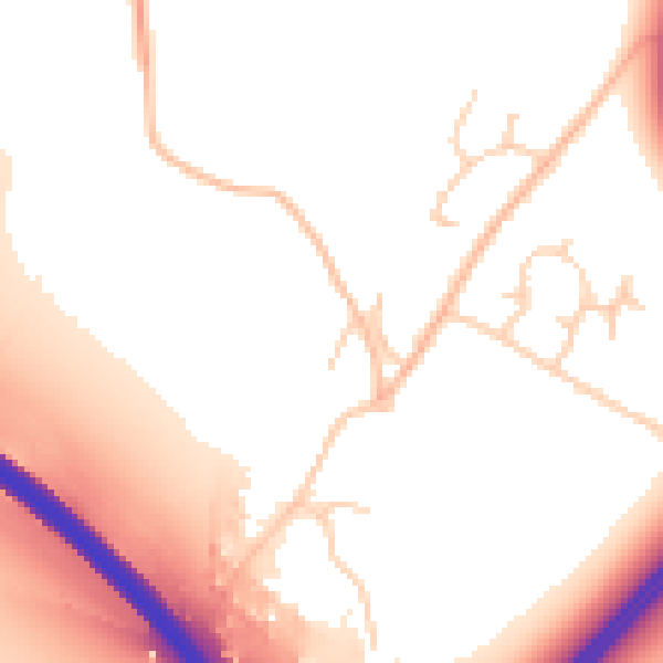
Daytime· 07:00 – 23:00
53.8dB

Night-time· 23:00 – 07:00
48.2dB