4 Carding Close, Farnsfield, Newark, NG22 8FD
About 4 Carding Close
4 Carding Close is a three-bedroom detached house in Farnsfield, Newark, Newark (NG22 8FD). It has a recorded floor area of 90 m² (around 969 sq ft), construction records dating it to 1996-2002 and council tax band E. The latest certificate (October 2025) shows a C (score 72). When first surveyed in June 2015 the rating was D, the property has climbed 1 band since. Between certificates, hot-water efficiency went from Very Poor to Good and lighting went from Very Poor to Good. Other recorded features include a conservatory. The home occupies a cul-de-sac position.
Last changed hands 9 years ago, in June 2017. Across the public record there are 4 sales, relatively high churn for a single property. Across 2000–2017, sale prices on this property compounded at 4.7% per year. Today's modelled estimate of £372,000 is 32.9% above the 2017 sale price. On a £-per-square-foot basis, the last sale (£289/sq ft) was about 50.7% above the typical sold price in the postcode. At 90 m² it's 17.4% smaller than the typical home in the postcode (109 m² median across 5 EPCs).
What this property has
Inside
- Bedrooms3
- Bathrooms2
- Open-plan layoutYes
- Dining roomYes
- EnsuiteYes
- ConservatoryYes
Outside
- Private gardenYes
- GarageYes
- Cul-de-sacYes
Everything you need to know about 4 Carding Close
The true value, the hidden risks and the full sale history, in one report.
Pick your report · every report is £14.99
One time fee only - money back guarantee

The data behind every report


Energy performance
EPC Rating
Property Improvements
Changes detected from historical EPC data
Hot water system upgraded
More low energy lighting installed
Get a survey for this property
Level 2 HomeBuyer Report
We've checked 10 risk factors against the available data for this property and believe a Level 2 HomeBuyer Report could be a suitable option for you.
From £595 · Includes VAT
Planning history
4 Carding Close has no planning applications on record.
A planning report still maps activity across the surrounding area and reads this property's extension & conversion potential.
Sales history & valuation
Sale price has at least doubled since 2000.
£372,000
Modelled from EPC, postcode comparables and a sale-price growth of 4.7% per year over 17 years.
£280,000
Growth on file: 4.7% per year over 17 years.
Sales timeline
22 June 2017Most recent
£280,000
+7.7%over 1 year27 August 2015
£259,950
+68.8%over 13 years16 May 2002
£154,000
+18.5%over 1 year28 September 2000
£129,950
Median price across the last 5 sales in NG22 8FD: £295,000 (2022–2013).
Nearby sales in NG22 8FD
6 Carding Close, Farnsfield, Newark, NG22 8FD
Sold Mar 2022
£425,0001 Carding Close, Farnsfield, Newark, NG22 8FD
Sold Jun 2021
£465,00011 Carding Close, Farnsfield, Newark, NG22 8FD
Sold Jul 2017
£295,0002 Carding Close, Farnsfield, Newark, NG22 8FD
Sold Nov 2005
£248,0007 Carding Close, Farnsfield, Newark, NG22 8FD
Sold Oct 2003
£260,000
Versus other Carding Close homes
CO₂ Emissions for 4 Carding Close runs comfortably ahead of the street norm.
Price per m²
£3,111
Street avg £2,646
Floor Area
90 m²
Street avg 115 m²
Habitable Rooms
5 rooms
Street avg 7 rooms
CO₂ Emissions
2.9 t/year
Street avg 4.0 t/year
Everything you need to know about 4 Carding Close
The true value, the hidden risks and the full sale history, in one report.
Pick your report · every report is £14.99
One time fee only - money back guarantee
The data behind every report
Similar properties nearby
1 Cedar Close, Farnsfield
NG22 8FW
1 Alexander Road, Farnsfield
NG22 8LH
1 Bracken Court, Bilsthorpe
NG22 8UP
1 Church View, Bilsthorpe
NG22 8TB
1 Carding Close, Farnsfield
NG22 8FD
1 Chapel Court, Edingley
NG22 8BD
1 Church Side, Farnsfield
NG22 8ET
1 Archers Drive, Bilsthorpe
NG22 8SD
The neighbourhood at a glance
Daytime road noise here sits well below conversation level — a quiet pocket of the postcode.
Crime
3/mo
Steady year-on-year across the wider district.
Nearest stop
0.2 km
The Ridgeway — bus stop.
Closest school
0.6 km
Farnsfield St Michael's Church of England Primary School. 2 schools nearby.
Go deeper on the local area
A Local Area report breaks down crime, transport links, schools and air quality in depth.
Road noise across the postcode
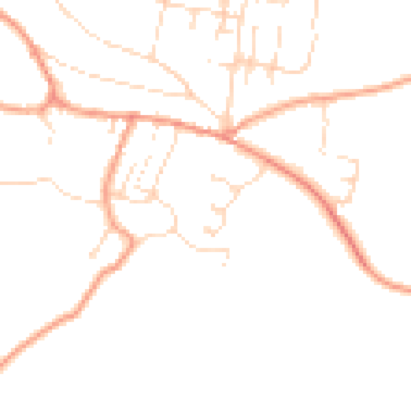
Daytime· 07:00 – 23:00
45.9dB

Night-time· 23:00 – 07:00
36.6dB