4 Arundel Drive, Mansfield, NG19 6AP
About 4 Arundel Drive
4 Arundel Drive is a two-bedroom end-of-terrace house in Mansfield (NG19 6AP). It has a recorded floor area of 76 m² (around 818 sq ft), construction records dating it to 1900-1929 and council tax band A. The latest certificate (February 2022) shows a D (score 60), on the cusp of jumping into the C band. When first surveyed in January 2010 the rating was E, the property has climbed 1 band since. Between certificates, window efficiency went from Poor to Average and lighting went from Average to Very Good; while roof efficiency dropped from Average to Very Poor. The recommended improvements would lift it to B (score 82), a 2-band jump.
Untraded for 20 years, with the last transfer in October 2006. Across 2003–2006, sale prices on this property compounded at 16.2% per year. Today's modelled estimate of £116,000 sits 58.9% above the 2006 sale of £73,000.
What this property has
Inside
- Bedrooms2
Everything you need to know about 4 Arundel Drive
The true value, the hidden risks and the full sale history, in one report.
Pick your report · every report is £14.99
One time fee only - money back guarantee

The data behind every report


Energy performance
Recommended upgrades on file would lift this property by multiple EPC bands.
EPC Rating
Property Improvements
Changes detected from historical EPC data
Windows upgraded, improving insulation
Heating controls changed
More low energy lighting installed
Get a survey for this property
Level 3 Building Survey
Because the property was built before 1919 and has solid (non-cavity) walls, we believe a Level 3 building survey should be considered.
From £820 · Includes VAT
Planning history
4 Arundel Drive has no planning applications on record.
A planning report still maps activity across the surrounding area and reads this property's extension & conversion potential.
Sales history & valuation
4 Arundel Drive valuation sits well clear of the typical sold price in this postcode.
£116,000
Modelled from EPC, postcode comparables and a sale-price growth of 16.2% per year over 3 years.
£73,000
Growth on file: 16.2% per year over 3 years.
Sales timeline
31 October 2006Most recent
£73,000
+62.2%over 3 years14 August 2003
£45,000
Median price across the last 5 sales in NG19 6AP: £120,000 (2025–2024).
Nearby sales in NG19 6AP
Versus other Arundel Drive homes
4 Arundel Drive is notably below the street on floor area.
Price per m²
£961
Street avg £1,119
Floor Area
76 m²
Street avg 78 m²
Habitable Rooms
4 rooms
Street avg 4 rooms
CO₂ Emissions
4.3 t/year
Street avg 3.7 t/year
Everything you need to know about 4 Arundel Drive
The true value, the hidden risks and the full sale history, in one report.
Pick your report · every report is £14.99
One time fee only - money back guarantee
The data behind every report
Similar properties nearby
The neighbourhood at a glance
Crime
3/mo
Steady year-on-year across the wider district.
Nearest stop
0.1 km
Surrey Drive — bus stop.
Closest school
0.3 km
All Saints' Catholic Voluntary Academy. 24 schools nearby.
Go deeper on the local area
A Local Area report breaks down crime, transport links, schools and air quality in depth.
Road noise across the postcode
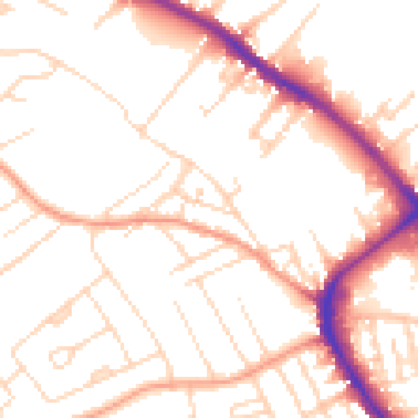
Daytime· 07:00 – 23:00
51.8dB

Night-time· 23:00 – 07:00
41.4dB