1 Abbott Street, Long Eaton, Nottingham, NG10 1DF
About 1 Abbott Street
1 Abbott Street is a four-bedroom detached house in Long Eaton, Nottingham, Nottingham (NG10 1DF). It has a recorded floor area of 167 m² (around 1798 sq ft), construction records dating it to 1900-1929 and council tax band D. The latest certificate (September 2012) shows an E (score 47), well below the UK norm with real room to improve. The recommended improvements would lift it to C (score 77), a 2-band jump. The latest certificate is from September 2012, so improvements made since then won't be reflected.
It hasn't traded since February 1997, a hold of 29 years that's notably long for the area. Only one transfer is on record with HM Land Registry, suggesting it has stayed in the same hands for a long time. At 167 m² the property is well over the postcode median (66 m² across 15 EPCs), placing it in the larger end of the local stock. It lags the bulk of the postcode on energy efficiency (less efficient than 80% of similar EPCs). Today's modelled estimate of £306,000 sits 436.8% above the 1997 sale of £57,000. On a £-per-square-foot basis, the last sale (£32/sq ft) was about 76% below the postcode norm. One planning record on file: an extension approved in 2026. Past consents include an extension and a conservatory, meaningful when judging how the property has evolved.
Know exactly what you're buying at 1 Abbott Street
Before you offer, see what the listing won't tell you, the true value, the red flags and the full history.
Already flagged here
Valuation
against the asking price
Risks
planning & flood
Sold prices
similar homes nearby
Trends
the local market
What this property has
Inside
- Bedrooms4
Energy performance
1 Abbott Street's carbon output runs well above what efficient homes in the postcode produce.
EPC Expired
This certificate is over 10 years old and is no longer valid.Expired 04 Sept 2022
EPC Rating
Planning history
1 Abbott Street has an approved rear extension on the planning record.
- Jan 2026ConservatoryFullIn report
Extension: Rear of property
Rear Conservatory Extension.
Extension- Documents
- 9 docs on file
- Reference
- ERE/038738
We flagged 2 things worth checking at 1 Abbott Street
Independent checks surfaced things a buyer would want to understand before offering. The report explains each one in full, with the underlying data and what to ask.
- Signs of HMO activity in the area
- Larger development activity nearby
30-day money-back guarantee
Sales history & valuation
1 Abbott Street's modelled value sits at over four times its earliest registered sale price (1997).
£306,000
Modelled from EPC, postcode comparables.
£57,000
Recorded with HM Land Registry.
Sales timeline
28 February 1997Most recent
£57,000
Median price across the last 5 sales in NG10 1DF: £162,000 (2022–2019).
Nearby sales in NG10 1DF
10 Abbott Street, Long Eaton, Nottingham, NG10 1DF
Sold Jun 2022
£162,0008 Abbott Street, Long Eaton, Nottingham, NG10 1DF
Sold May 2022
£165,00014 Abbott Street, Long Eaton, Nottingham, NG10 1DF
Sold Mar 2022
£177,50018 Abbott Street, Long Eaton, Nottingham, NG10 1DF
Sold Sept 2017
£129,9953 Abbott Street, Long Eaton, Nottingham, NG10 1DF
Sold May 2015
£210,000
Everything we know about 1 Abbott Street, in one report
What it's really worth, what could be wrong, and the planning, sales and area data in full.
What we flagged
- Signs of HMO activity in the area
- Larger development activity nearby

Versus other Abbott Street homes
Price per m² for 1 Abbott Street lags the street by a wide margin.
Price per m²
£341
Street avg £2,049
Floor Area
167 m²
Street avg 65 m²
Habitable Rooms
7 rooms
Street avg 3 rooms
CO₂ Emissions
9.9 t/year
Street avg 3.4 t/year
Similar properties nearby
1 Broad Street, Long Eaton
NG10 1JH
1 Frisby Avenue, Long Eaton
NG10 1FL
1 Craig Street, Long Eaton
NG10 1ET
1 Belfield Gardens, Long Eaton
NG10 1HB
1 Belvoir Close, Long Eaton
NG10 1NW
1 Farm Close, Long Eaton
NG10 1PL
1 Acton Road, Long Eaton
NG10 1FR
1 Dale Avenue, Long Eaton
NG10 1NP
The neighbourhood at a glance
Daytime road noise here sits well below conversation level — a quiet pocket of the postcode.
Crime
6/mo
Steady year-on-year across the wider district.
Nearest stop
0.2 km
Nelson Street — bus stop.
Closest school
0.2 km
St Laurence CofE Primary School. 16 schools nearby.
Go deeper on the local area
The full report breaks down crime, transport links, schools and air quality in depth.
Road noise across the postcode
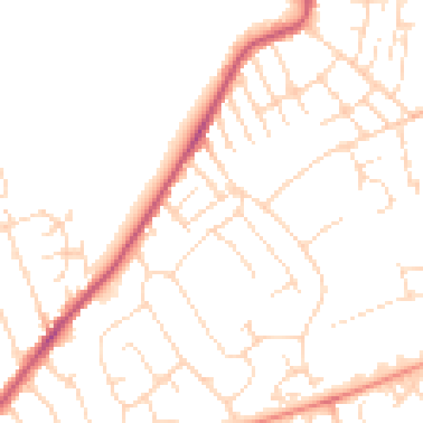
Daytime· 07:00 – 23:00
49.0dB

Night-time· 23:00 – 07:00
38.9dB