14 Bluecoat Close, Nottingham, NG1 4DP
About 14 Bluecoat Close
14 Bluecoat Close is a two-bedroom mid-terrace house in Nottingham (NG1 4DP). It has a recorded floor area of 58 m² (around 624 sq ft), construction records dating it to 1983-1990 and council tax band B. The latest certificate (September 2022) shows a C (score 74). When first surveyed in May 2011 the rating was D, the property has climbed 1 band since. Between certificates, wall efficiency went from Average to Good, hot-water efficiency went from Average to Good and main heating went from Average to Good. The recommended improvements would push it to B (score 89).
On the market in October 2013 and unlisted since — roughly 13 years. Across the public record there are 4 sales, relatively high churn for a single property. Across 1995–2013, sale prices on this property compounded at 6.3% per year. Today's modelled estimate of £179,000 is 27.9% above the 2013 sale price. On a £-per-square-foot basis, the last sale (£224/sq ft) was about 30.7% above the typical sold price in the postcode. At 58 m² it's 18.3% smaller than the typical home in the postcode (71 m² median across 30 EPCs).
What this property has
Inside
- Bedrooms2
- Bathrooms1
Everything you need to know about 14 Bluecoat Close
The true value, the hidden risks and the full sale history, in one report.
Pick your report · every report is £14.99
One time fee only - money back guarantee

The data behind every report


Energy performance
EPC Rating
Property Improvements
Changes detected from historical EPC data
Changed to a more efficient fuel source
Hot water efficiency improved
Wall insulation upgraded
Roof insulation improved
Get a survey for this property
Level 2 HomeBuyer Report
We've checked 10 risk factors against the available data for this property and believe a Level 2 HomeBuyer Report could be a suitable option for you.
From £495 · Includes VAT
Planning history
14 Bluecoat Close has no planning applications on record.
But the area is active
16 notable applications nearby — larger schemes and conversions that could reshape the street. The report maps them all.
Sales history & valuation
14 Bluecoat Close has more than tripled in price since its earliest registered sale in 1995.
£179,000
Modelled from EPC, postcode comparables and a sale-price growth of 6.3% per year over 18 years.
£139,950
Growth on file: 6.3% per year over 18 years.
Sales timeline
17 October 2013Most recent
£139,950
+12.0%over 6 years3 November 2006
£125,000
+92.3%over 7 years27 June 1999
£65,000
+39.8%over 3 years10 November 1995
£46,500
Median price across the last 5 sales in NG1 4DP: £170,000 (2023–2018).
Nearby sales in NG1 4DP
Versus other Bluecoat Close homes
On floor area, 14 Bluecoat Close runs well behind the street norm.
Price per m²
£2,413
Street avg £2,068
Floor Area
58 m²
Street avg 75 m²
Habitable Rooms
3 rooms
Street avg 4 rooms
CO₂ Emissions
1.8 t/year
Street avg 2.9 t/year
Everything you need to know about 14 Bluecoat Close
The true value, the hidden risks and the full sale history, in one report.
Pick your report · every report is £14.99
One time fee only - money back guarantee
The data behind every report
Similar properties nearby
The neighbourhood at a glance
Rail-style transport is unusually close for this postcode.
Crime
39/mo
Rising year-on-year across the wider district.
Nearest stop
0.1 km
Rose of England — bus stop.
Closest school
0.4 km
Huntingdon Academy. 45 schools nearby.
Go deeper on the local area
A Local Area report breaks down crime, transport links, schools and air quality in depth.
Road noise across the postcode
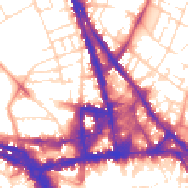
Daytime· 07:00 – 23:00
58.2dB
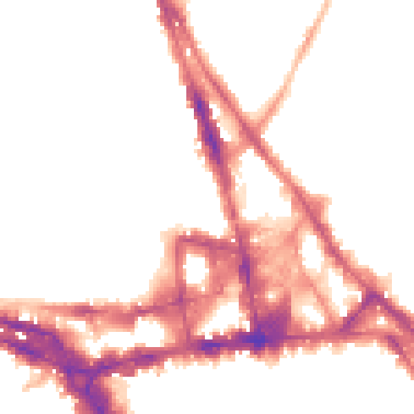
Night-time· 23:00 – 07:00
48.6dB