15 Bideford Road, Newcastle Upon Tyne, NE3 4UQ
About 15 Bideford Road
15 Bideford Road is an end-of-terrace house in Newcastle Upon Tyne (NE3 4UQ). It has a recorded floor area of 56 m² (around 603 sq ft), construction records dating it to 1950-1966 and council tax band A. At 56 m² this is the smallest unit on EPC record across the building (56–101 m²). The building's EPC ratings span E to C, with this unit at the top. The latest certificate (January 2025) shows a C (score 70).
At 56 m² it sits well below the postcode median (84 m² across 26 EPCs), making it one of the more compact homes locally.
Everything you need to know about 15 Bideford Road
The true value, the hidden risks and the full sale history, in one report.
30-day money-back guarantee

The data behind every report


Energy performance
EPC Rating
Planning history
15 Bideford Road has no planning applications on record.
Notable planning nearby
1applications of note in the surrounding area
We flagged 1 thing worth checking at 15 Bideford Road
Independent checks surfaced things a buyer would want to understand before offering. The report explains each one in full, with the underlying data and what to ask.
- Larger development activity nearby
30-day money-back guarantee
Sales history & valuation
15 Bideford Road has no Land Registry sales on file, suggesting it has stayed in the same hands since registration began.
£122,000
Modelled from EPC, postcode comparables.
No sales recorded with HM Land Registry
That can mean the property has never traded since the registry began publishing in 1995, was a new build that hasn't been registered yet, or is held in the same hands long-term.
Median price across the last 5 sales in NE3 4UQ: £125,000 (2025–2020).
Nearby sales in NE3 4UQ
2 Bideford Road, Newcastle Upon Tyne, NE3 4UQ
Sold Feb 2025
£180,00014 Bideford Road, Newcastle Upon Tyne, NE3 4UQ
Sold Nov 2024
£92,50062 Bideford Road, Newcastle Upon Tyne, NE3 4UQ
Sold Sept 2022
£125,00018 Bideford Road, Newcastle Upon Tyne, NE3 4UQ
Sold Nov 2020
£191,0001 Bideford Road, Newcastle Upon Tyne, NE3 4UQ
Sold Aug 2020
£125,500
Versus other Bideford Road homes
15 Bideford Road outperforms the street on epc rating by a wide margin.
EPC Rating
70 (C)
Street avg 66 (D)
Floor Area
56 m²
Street avg 63 m²
CO₂ Emissions
2.5 t/year
Street avg 2.9 t/year
Habitable Rooms
3 rooms
Street avg 3 rooms
Everything you need to know about 15 Bideford Road
The true value, the hidden risks and the full sale history, in one report.
30-day money-back guarantee
The data behind every report
Similar properties nearby
The neighbourhood at a glance
Crime
6/mo
Steady year-on-year across the wider district.
Nearest stop
0.0 km
Creighton Avenue — bus stop.
Closest school
0.3 km
Kenton School. 32 schools nearby.
Go deeper on the local area
The full report breaks down crime, transport links, schools and air quality in depth.
Road noise across the postcode
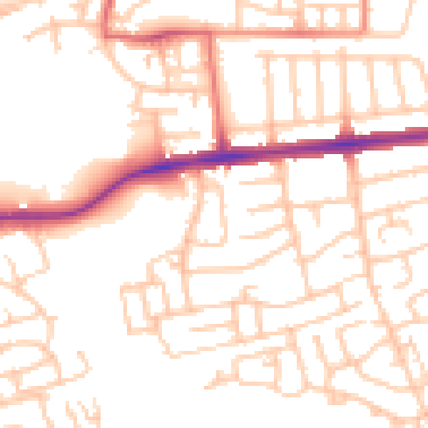
Daytime· 07:00 – 23:00
52.2dB

Night-time· 23:00 – 07:00
41.5dB