12 Broomfield Road, Newcastle Upon Tyne, NE3 4HH
About 12 Broomfield Road
12 Broomfield Road is a three-bedroom detached house in Newcastle Upon Tyne (NE3 4HH). It has a recorded floor area of 100 m² (around 1071 sq ft), construction records dating it to 1900-1929 and council tax band A. The latest certificate (December 2008) shows a D (score 67), on the cusp of jumping into the C band. The recommended improvements would push it to C (score 70). The latest certificate is from December 2008, so improvements made since then won't be reflected.
At 100 m² the property is well over the postcode median (66 m² across 49 EPCs), placing it in the larger end of the local stock. Last changed hands 12 years ago, in September 2014. Across the public record there are 4 sales, relatively high churn for a single property. 3 planning records sit against the property, 2 approved, 1 refused. Past consents include a loft conversion, meaningful when judging how the property has evolved. Across 1999–2014, sale prices on this property compounded at 8.3% per year. Today's modelled estimate of £193,000 is 12.2% above the 2014 sale price.
What this property has
Inside
- Bedrooms3
Everything you need to know about 12 Broomfield Road
The true value, the hidden risks and the full sale history, in one report.
30-day money-back guarantee

The data behind every report


Energy performance
12 Broomfield Road's EPC is over a decade old — improvements since won't be reflected.
EPC Expired
This certificate is over 10 years old and is no longer valid.Expired 04 Dec 2018
EPC Rating
Planning history
- Nov 2008Loft ConversionConditionsIn report
Submission of details of a scheme of sound attenuation to comply with condition 3 of permission 2008/1517/01/DET dated 30.09.08: Installation of 2 roof lights to front and 1 to rear to form bedrooms, shower room and storage in roofspace
- Documents
- 3 docs on file
- Reference
- 2008/1517/02/DCC
- Sept 2008Loft ConversionFullIn report
Installation of 2 roof lights to front and 1 to rear to form bedrooms, shower room and storage in roof space
- Documents
- 8 docs on file
- Reference
- 2008/1517/01/DET
We flagged 2 things worth checking at 12 Broomfield Road
Independent checks surfaced things a buyer would want to understand before offering. The report explains each one in full, with the underlying data and what to ask.
- Larger development activity nearby
- Recent ownership pattern worth a look
30-day money-back guarantee
Sales history & valuation
Sale price has grown by over 3x since 1999.
£193,000
Modelled from EPC, postcode comparables and a sale-price growth of 8.3% per year over 15 years.
£172,000
Growth on file: 8.3% per year over 15 years.
Sales timeline
15 September 2014Most recent
£172,000
+21.1%7 August 2014
£142,000
+70.1%over 12 years22 March 2002
£83,500
+60.6%over 2 years30 September 1999
£52,000
Median price across the last 5 sales in NE3 4HH: £148,000 (2025–2022).
Nearby sales in NE3 4HH
2 Broomfield Road, Newcastle Upon Tyne, NE3 4HH
Sold Sept 2025
£145,00051 Broomfield Road, Newcastle Upon Tyne, NE3 4HH
Sold Mar 2025
£220,00033 Broomfield Road, Newcastle Upon Tyne, NE3 4HH
Sold Mar 2023
£148,00035 Broomfield Road, Newcastle Upon Tyne, NE3 4HH
Sold Mar 2023
£148,00024 Broomfield Road, Newcastle Upon Tyne, NE3 4HH
Sold Dec 2022
£172,500
Versus other Broomfield Road homes
Floor Area for 12 Broomfield Road runs comfortably ahead of the street norm.
Price per m²
£1,728
Street avg £1,994
Floor Area
100 m²
Street avg 66 m²
Habitable Rooms
4 rooms
Street avg 3 rooms
CO₂ Emissions
3.9 t/year
Street avg 3.1 t/year
Everything you need to know about 12 Broomfield Road
The true value, the hidden risks and the full sale history, in one report.
30-day money-back guarantee
The data behind every report
Similar properties nearby
1 Broad Meadows
NE3 4PZ
1 Ashbrooke Street
NE3 4UH
1 Braebridge Place
NE3 4PX
1 Arlington Avenue
NE3 4TS
1 Beechcroft, Kenton Road
NE3 4NB
1 Bideford Road
NE3 4UQ
1 Beech Court, Linden Road, Gosforth
NE3 4HB
1 Briardene Crescent
NE3 4RX
The neighbourhood at a glance
Rail-style transport is unusually close for this postcode.
Crime
6/mo
Steady year-on-year across the wider district.
Nearest stop
0.1 km
Salters Road-Jubilee Road — bus stop.
Closest school
0.2 km
Archibald First School. 26 schools nearby.
Go deeper on the local area
The full report breaks down crime, transport links, schools and air quality in depth.
Road noise across the postcode
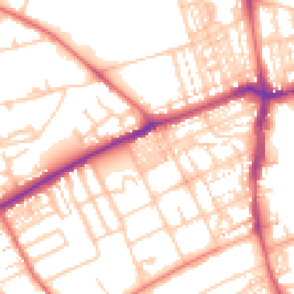
Daytime· 07:00 – 23:00
53.7dB

Night-time· 23:00 – 07:00
42.3dB