11 Amble Grove, Newcastle Upon Tyne, NE2 1NY
About 11 Amble Grove
11 Amble Grove is a mid-terrace house in Newcastle Upon Tyne (NE2 1NY). It has a recorded floor area of 100 m² (around 1076 sq ft), construction records dating it to 1900-1929 and council tax band A. At 100 m² this is the 29th smallest of 39 units on EPC record in the building, where floor areas span 55–168 m². The building's EPC ratings span E to C, with this unit at the top. On EPC score it ranks first in the building (76 versus a worst of 47). The latest certificate (January 2021) shows a C (score 76), near the top of the C band. When first surveyed in June 2015 the rating was E, the property has climbed 2 bands since. Between certificates, roof efficiency went from Poor to Good, window efficiency went from Very Poor to Good and hot-water efficiency went from Poor to Good.
Across 2019–2022, sale prices on this property compounded at 27.2% per year. Today's modelled estimate of £198,000 is 25.3% below the 2022 sale of £265,000, below the original sale price, which typically signals condition or completion-status changes worth verifying. On a £-per-square-foot basis, the last sale (£246/sq ft) was about 56.8% above the typical sold price in the postcode. At 100 m² the property is well over the postcode median (66 m² across 38 EPCs), placing it in the larger end of the local stock. Most recent transfer: June 2022 at £265,000. That sale was during the post-pandemic price surge, when transactions cleared materially above pre-2020 trend.
Know exactly what you're buying at 11 Amble Grove
Before you offer, see what the listing won't tell you, the true value, the red flags and the full history.
Already flagged here
Valuation
against the asking price
Risks
planning & flood
Sold prices
similar homes nearby
Trends
the local market
Energy performance
EPC Rating
Property Improvements
Changes detected from historical EPC data
Heating controls upgraded for better temperature management
Hot water system upgraded
Single glazing replaced with double or better glazing
Roof insulation improved
More low energy lighting installed
Planning history
11 Amble Grove has no planning applications on record.
Notable planning nearby
4applications of note in the surrounding area
We flagged 1 thing worth checking at 11 Amble Grove
Independent checks surfaced things a buyer would want to understand before offering. The report explains each one in full, with the underlying data and what to ask.
- Signs of HMO activity in the area
30-day money-back guarantee
Sales history & valuation
11 Amble Grove has more than doubled in price since the earliest registered sale in 2019.
£198,000
Modelled from EPC, postcode comparables and a sale-price growth of 27.2% per year over 3 years.
£265,000
Growth on file: 27.2% per year over 3 years.
Sales timeline
14 June 2022Most recent
£265,000
+122.7%over 3 years14 February 2019
£119,000
Median price across the last 5 sales in NE2 1NY: £205,000 (2025–2024).
Nearby sales in NE2 1NY
50 Amble Grove, Newcastle Upon Tyne, NE2 1NY
Sold Aug 2025
£322,00036 Amble Grove, Newcastle Upon Tyne, NE2 1NY
Sold Jul 2025
£210,00035 Amble Grove, Newcastle Upon Tyne, NE2 1NY
Sold Apr 2024
£205,00051 Amble Grove, Newcastle Upon Tyne, NE2 1NY
Sold Mar 2024
£180,00049 Amble Grove, Newcastle Upon Tyne, NE2 1NY
Sold Mar 2024
£180,000
Everything we know about 11 Amble Grove, in one report
What it's really worth, what could be wrong, and the planning, sales and area data in full.
What we flagged
- Signs of HMO activity in the area

Versus other Amble Grove homes
On epc rating, 11 Amble Grove stands well clear of the street.
Price per m²
£2,650
Street avg £1,886
Floor Area
100 m²
Street avg 73 m²
Habitable Rooms
4 rooms
Street avg 4 rooms
CO₂ Emissions
2.8 t/year
Street avg 3.2 t/year
Similar properties nearby
1 Grosvenor Gardens
NE2 1HQ
1 Granville Court
NE2 1TQ
1 Chester Crescent
NE2 1DH
1 Milton Close
NE2 1YF
1 Beadnell Place
NE2 1YD
1 Brandling Court, Akenside Terrace
NE2 1TN
1 Helmsley Mews
NE2 1BE
1 Copland Terrace
NE2 1YB
The neighbourhood at a glance
Crime
5/mo
Steady year-on-year across the wider district.
Nearest stop
0.1 km
Dinsdale Road — bus stop.
Closest school
0.2 km
St Catherine's Catholic Primary School. 29 schools nearby.
Go deeper on the local area
The full report breaks down crime, transport links, schools and air quality in depth.
Road noise across the postcode
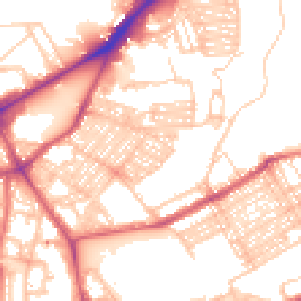
Daytime· 07:00 – 23:00
55.0dB

Night-time· 23:00 – 07:00
43.6dB