Are you a property professional?Get qualified leads from motivated homeowners.
Get started15 Rydon Street, Islington, London, N1 7AL
3 sales on record
About 15 Rydon Street
A plain-English summary derived from public records, EPC certificates, sold prices and local data.
15 Rydon Street is a two-bedroom mid-terrace house in Islington, London, London (N1 7AL). It has a recorded floor area of 88 m² (around 947 sq ft), construction records dating it to 1930-1949 and council tax band E. The latest certificate (September 2020) shows a C (score 72). When first surveyed in June 2013 the rating was E, the property has climbed 2 bands since. Between certificates, roof efficiency went from Very Poor to Average, window efficiency went from Very Poor to Good and lighting went from Poor to Very Good. The recommended improvements would push it to B (score 89). Period features are noted in the property record.
Sale prices here have outpaced London HPI: 7.5% per year against 0% for the wider region. On a £-per-square-foot basis, the last sale (£1,235/sq ft) was about 133.6% above the typical sold price in the postcode. At 88 m² it sits well below the postcode median (141 m² across 12 EPCs), making it one of the more compact homes locally. Its energy rating outperforms most of the postcode (better than 83% of similar EPCs). 4 planning records sit against the property, 2 approved, 0 refused. Past consents include new windows, meaningful when judging how the property has evolved. Last sale on file: £1,170,000 in March 2021. That sale was during the post-pandemic price surge, when transactions cleared materially above pre-2020 trend.
What this property has
Pulled from EPC certificates, claim submissions and our property model. Empty categories are hidden — we only show what's known.
Inside
- Bedrooms2
- Bathrooms1
- Dining roomYes
Outside
- Private garden
Energy performance
Every EPC certificate filed against this property — current rating, recorded improvements, and where there's headroom to reach a higher band.
Current Certificate(1 of 2)
Sept 2020
EPC Rating
A
B
C
C72
D
E
F
G
Main Heating
Gas
Main Fuel
Gas
Hot Water
Good
Windows
Good
CO2 Emissions
2.6 t/year
Occupancy
Owner Occupied
Planning history
Applications and permits filed against 15 Rydon Street, Islington, London, N1 7AL, sourced from the PlanIt planning register.
15 Rydon Street has 2 separate extension applications on the council record.
- Mar 2024ExtensionFullRefusal of permission
Extension: Single storey · Rear of property
Construction of second floor above existing two storey outrigger to the rear of the house.
Sales history & valuation
Recorded transactions, our model's current estimate, and a quick read on what neighbouring properties have sold for.
Price for 15 Rydon Street has grown more than fourfold since the 1999 starting point.
Current estimate
See how we calculated this£1,209,000
Modelled from EPC, postcode comparables and a sale-price growth of 7.5% per year over 22 years.
Last sold (2021)
£1,170,000
Growth on file: 7.5% per year over 22 years.
Sales timeline
Versus other Rydon Street homes
Four headline reads against 11 similar houses on this street, drawn from the latest EPC and Land Registry data.
On price per m², 15 Rydon Street stands well clear of the street.
Price per m²
£13,295
Street avg £8,413
Floor Area
88 m²
Street avg 134 m²
Habitable Rooms
4 rooms
Similar properties nearby
A handful of close matches in the same postcode area, ranked by likeness on bedrooms, type and floor area.
The neighbourhood at a glance
A condensed read of the local area. Each tile links through to the full breakdown on the London district page.
Rail-style transport is unusually close for this postcode.
Crime
10/mo
Rising year-on-year across the wider district.
Nearest stop
0.1 km
Basire Street — bus stop.
Road noise across the postcode
Modelled day and night-time noise levels around N1 7AL from Defra's strategic mapping. The pin marks this postcode's centroid.
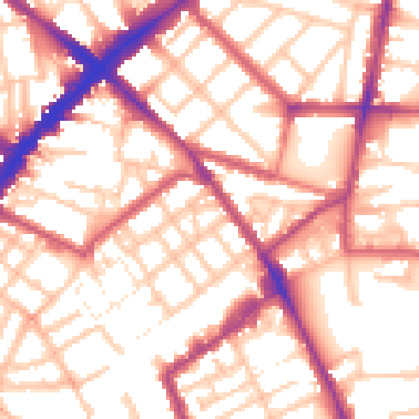
Daytime· 07:00 – 23:00
55.9dB

Everything within walking distance
Schools, transport stops and scenic spots near this property — 131 points of interest in total.
Beautiful places to visit nearby
Curated scenic spots within reach of this postcode, served by Beautifulplaces.ai. Photography and tagging come from their open dataset.
Common questions
The questions buyers, sellers and homeowners most often ask about 15 Rydon Street, Islington, London, N1 7AL. Each answer is also embedded as structured data for search engines.