89 Redding Grove, Crownhill, Milton Keynes, MK8 0BU
About 89 Redding Grove
89 Redding Grove is a three-bedroom semi-detached house in Crownhill, Milton Keynes, Milton Keynes (MK8 0BU). It has a recorded floor area of 68 m² (around 732 sq ft), construction records dating it to 1983-1990 and council tax band C. Period features are noted in the property record. The latest certificate (September 2025) shows a C (score 73).
It hasn't traded since October 1997, a hold of 29 years that's notably long for the area. Only one transfer is on record with HM Land Registry, suggesting it has stayed in the same hands for a long time. Today's modelled estimate of £319,000 sits 459.7% above the 1997 sale of £56,995. On a £-per-square-foot basis, the last sale (£78/sq ft) was about 57.4% below the postcode norm.
What this property has
Inside
- Bedrooms3
- Bathrooms1
Building
- Period featuresYes
Everything you need to know about 89 Redding Grove
The true value, the hidden risks and the full sale history, in one report.
30-day money-back guarantee

The data behind every report


Energy performance
EPC Rating
Planning history
89 Redding Grove has no planning applications on record.
The full report still covers planning activity across the surrounding area.
Sales history & valuation
89 Redding Grove's modelled value sits at over four times its earliest registered sale price (1997).
£319,000
Modelled from EPC, postcode comparables.
£56,995
Recorded with HM Land Registry.
Sales timeline
16 October 1997Most recent
£56,995
Median price across the last 5 sales in MK8 0BU: £345,000 (2024–2015).
Nearby sales in MK8 0BU
79 Redding Grove, Crownhill, Milton Keynes, MK8 0BU
Sold Oct 2024
£495,00093 Redding Grove, Crownhill, Milton Keynes, MK8 0BU
Sold May 2019
£305,00083 Redding Grove, Crownhill, Milton Keynes, MK8 0BU
Sold Jul 2017
£355,00091 Redding Grove, Crownhill, Milton Keynes, MK8 0BU
Sold Jun 2017
£292,750103 Redding Grove, Crownhill, Milton Keynes, MK8 0BU
Sold Jun 2015
£185,000
Versus other Redding Grove homes
On price per m², 89 Redding Grove runs well behind the street norm.
Price per m²
£838
Street avg £3,079
Floor Area
68 m²
Street avg 77 m²
Habitable Rooms
5 rooms
Street avg 5 rooms
CO₂ Emissions
2.1 t/year
Street avg 2.9 t/year
Everything you need to know about 89 Redding Grove
The true value, the hidden risks and the full sale history, in one report.
30-day money-back guarantee
The data behind every report
Similar properties nearby
1 Gainsborough Close, Grange Farm
MK8 0NA
1 Chevalier Grove, Crownhill
MK8 0EJ
1 Dunthorne Way, Grange Farm
MK8 0NJ
1 Cline Court, Crownhill
MK8 0DB
1 Fripp Gardens, Grange Farm
MK8 0NU
1 Fury Court, Crownhill
MK8 0AP
1 Eardley Place, Grange Farm
MK8 0PN
1 Gallagher Close, Crownhill
MK8 0LQ
The neighbourhood at a glance
Crime
3/mo
Steady year-on-year across the wider district.
Nearest stop
0.1 km
Monro Avenue — bus stop.
Closest school
0.5 km
Christ the Sower Ecumenical Primary School. 19 schools nearby.
Go deeper on the local area
The full report breaks down crime, transport links, schools and air quality in depth.
Road noise across the postcode
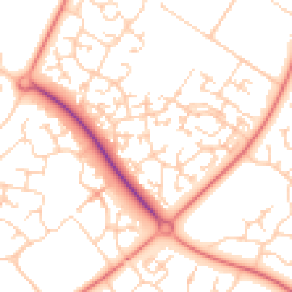
Daytime· 07:00 – 23:00
52.5dB

Night-time· 23:00 – 07:00
40.0dB