Flat 2, 243 Cardington Road, Bedford, MK42 0DA
About Flat 2
Flat 2 is a detached house in Bedford (MK42 0DA). It has a recorded floor area of 157 m² (around 1690 sq ft) and construction records dating it to 1976-1982. The latest certificate (January 2017) shows a C (score 69), just inside the C band. The recommended improvements would push it to B (score 81).
At 157 m² the property is well over the postcode median (90 m² across 25 EPCs), placing it in the larger end of the local stock.
Know exactly what you're buying at Flat 2
Before you offer, see what the listing won't tell you, the true value, the red flags and the full history.
Already flagged here
Valuation
against the asking price
Risks
planning & flood
Sold prices
similar homes nearby
Trends
the local market
Energy performance
EPC Rating
Planning history
Flat 2 has no planning applications on record.
Notable planning nearby
8applications of note in the surrounding area
We flagged 2 things worth checking at Flat 2
Independent checks surfaced things a buyer would want to understand before offering. The report explains each one in full, with the underlying data and what to ask.
- Signs of HMO activity in the area
- Larger development activity nearby
30-day money-back guarantee
Sales history & valuation
Flat 2 has no Land Registry sales on file, suggesting it has stayed in the same hands since registration began.
£508,000
Modelled from EPC, postcode comparables.
No sales recorded with HM Land Registry
That can mean the property has never traded since the registry began publishing in 1995, was a new build that hasn't been registered yet, or is held in the same hands long-term.
Median price across the last 5 sales in MK42 0DA: £320,000 (2023–2021).
Nearby sales in MK42 0DA
Everything we know about Flat 2, in one report
What it's really worth, what could be wrong, and the planning, sales and area data in full.
What we flagged
- Signs of HMO activity in the area
- Larger development activity nearby

Versus other Cardington Road homes
Flat 2 outperforms the street on habitable rooms by a wide margin.
EPC Rating
69 (C)
Street avg 66 (D)
Floor Area
157 m²
Street avg 100 m²
CO₂ Emissions
5.2 t/year
Street avg 4.0 t/year
Habitable Rooms
9 rooms
Street avg 5 rooms
Similar properties nearby
18a, Flat 5, St Marys Street
MK42 0AS
18a, Flat 7, St Marys Street
MK42 0AS
2a, Flat, Harrowden Lane
MK42 0RR
1 Holly Apartments, Alpine View
MK42 0YQ
2 Holly Apartments, Alpine View
MK42 0YQ
5 Holly Apartments, Alpine View
MK42 0YQ
6 Holly Apartments, Alpine View
MK42 0YQ
3 Holly Apartments, Alpine View
MK42 0YQ
The neighbourhood at a glance
Crime
6/mo
Steady year-on-year across the wider district.
Nearest stop
0.0 km
Goodmayes Close — bus stop.
Closest school
0.6 km
King's Oak Primary School. 17 schools nearby.
Go deeper on the local area
The full report breaks down crime, transport links, schools and air quality in depth.
Road noise across the postcode
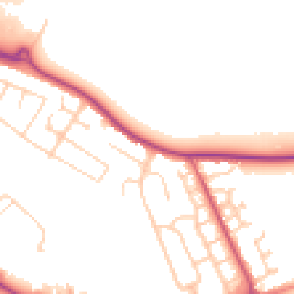
Daytime· 07:00 – 23:00
51.0dB
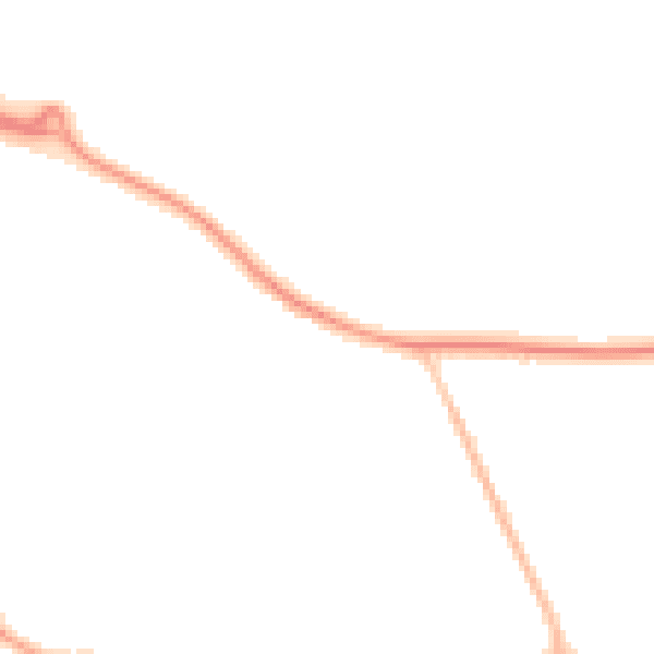
Night-time· 23:00 – 07:00
43.0dB