1 High View, Great Brickhill Lane, Little Brickhill, Milton Keynes, MK17 9NJ
About 1 High View
1 High View is an end-of-terrace house in Little Brickhill, Milton Keynes, Milton Keynes (MK17 9NJ). It has a recorded floor area of 77 m² (around 829 sq ft), construction records dating it to 1950-1966 and council tax band C. The latest certificate (February 2013) shows an E (score 54), well below the UK norm with real room to improve. Earlier certificates rated it D (December 2009); the latest reading is one band lower. Between certificates, lighting went from Very Poor to Average; while roof efficiency dropped from Very Good to Very Poor and window efficiency dropped from Good to Average. The recommended improvements would lift it to C (score 72), a 2-band jump. The latest certificate is from February 2013, so improvements made since then won't be reflected.
At 77 m² it's 17.2% smaller than the typical home in the postcode (93 m² median across 3 EPCs).
Everything you need to know about 1 High View
The true value, the hidden risks and the full sale history, in one report.
Pick your report · every report is £14.99
One time fee only - money back guarantee

The data behind every report


Energy performance
Recommended upgrades on file would lift this property by multiple EPC bands.
EPC Expired
This certificate is over 10 years old and is no longer valid.Expired 11 Feb 2023
EPC Rating
Property Improvements
Changes detected from historical EPC data
Hot water efficiency decreased
More low energy lighting installed
Get a survey for this property
Level 2 HomeBuyer Report
We've checked 10 risk factors against the available data for this property and believe a Level 2 HomeBuyer Report could be a suitable option for you.
From £595 · Includes VAT
Planning history
1 High View has no planning applications on record.
But the area is active
1 notable application nearby — larger schemes and conversions that could reshape the street. The report maps them all.
Sales history & valuation
1 High View has no Land Registry sales on file, suggesting it has stayed in the same hands since registration began.
£321,000
Modelled from EPC, postcode comparables.
No sales recorded with HM Land Registry
That can mean the property has never traded since the registry began publishing in 1995, was a new build that hasn't been registered yet, or is held in the same hands long-term.
Median price across the last 1 sales in MK17 9NJ: £186,000 (2002–2002).
Versus other High View homes
On habitable rooms, 1 High View stands well clear of the street.
EPC Rating
54 (E)
Street avg 54 (E)
Floor Area
77 m²
Street avg 88 m²
CO₂ Emissions
4.4 t/year
Street avg 4.4 t/year
Habitable Rooms
6 rooms
Street avg 5 rooms
Everything you need to know about 1 High View
The true value, the hidden risks and the full sale history, in one report.
Pick your report · every report is £14.99
One time fee only - money back guarantee
The data behind every report
Similar properties nearby
1 Fox Close, Woburn
MK17 9FJ
1 Church End, Milton Bryan
MK17 9HR
1 Chew Cottages, Watling Street, Little Brickhill
MK17 9LZ
1 Drakeloe Close, Woburn
MK17 9QF
1 Cross End, Great Brickhill
MK17 9BQ
1 Gadsden Court, Stoke Hammond
MK17 9EU
1 Crawley Road, Woburn
MK17 9QD
1 Barber Drive, Eaton Leys
MK17 9GP
The neighbourhood at a glance
Crime
5/mo
Steady year-on-year across the wider district.
Nearest stop
0.0 km
The George — bus stop.
Closest school
1.9 km
High Ash Church of England Primary School. 2 schools nearby.
Go deeper on the local area
A Local Area report breaks down crime, transport links, schools and air quality in depth.
Road noise across the postcode
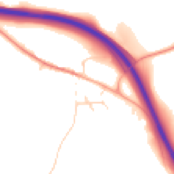
Daytime· 07:00 – 23:00
51.0dB

Night-time· 23:00 – 07:00
43.8dB