14 Burns Grove, Eagle Farm South, Milton Keynes, MK17 7EE
About 14 Burns Grove
14 Burns Grove is a detached house in Eagle Farm South, Milton Keynes, Milton Keynes (MK17 7EE). It has a recorded floor area of 137 m² (around 1475 sq ft) and construction records dating it to 2022. The latest certificate (July 2024) returns a B (score 84), comfortably above the UK average. The recommended improvements would push it to A (score 92).
Today's modelled estimate of £533,000 is 10.4% below the 2024 sale of £595,000, running counter to the wider postcode trend, which makes the EPC and condition history especially worth a look. Last sale on file: £595,000 in August 2024.
Everything you need to know about 14 Burns Grove
The true value, the hidden risks and the full sale history, in one report.
Pick your report · every report is £14.99
One time fee only - money back guarantee

The data behind every report


Energy performance
EPC Rating
Get a survey for this property
Level 2 HomeBuyer Report
We've checked 10 risk factors against the available data for this property and believe a Level 2 HomeBuyer Report could be a suitable option for you.
From £795 · Includes VAT
Planning history
14 Burns Grove has no planning applications on record.
But the area is active
1 notable application nearby — larger schemes and conversions that could reshape the street. The report maps them all.
Sales history & valuation
£533,000
Modelled from EPC, postcode comparables.
£595,000
Recorded with HM Land Registry.
Sales timeline
29 August 2024Most recent
£595,000
Median price across the last 1 sales in MK17 7EE: £530,000 (2024–2024).
Nearby sales in MK17 7EE
Everything you need to know about 14 Burns Grove
The true value, the hidden risks and the full sale history, in one report.
Pick your report · every report is £14.99
One time fee only - money back guarantee
The data behind every report
Similar properties nearby
1 Neale Close, Eagle Farm South
MK17 7EB
1 Burns Grove, Eagle Farm South
MK17 7EE
1 Chambers Close, Eagle Farm South
MK17 7EF
1 Cianchi Grove, Eagle Farm South
MK17 7EG
1 Friary Grove, Eagle Farm South
MK17 7FG
1 Johnson Croft, Eagle Farm South
MK17 7EL
1 Neweham Road, Eagle Farm South
MK17 7BR
1 Claridge Crescent, Eagle Farm South
MK17 7EH
The neighbourhood at a glance
Crime
5/mo
Steady year-on-year across the wider district.
Nearest stop
0.1 km
Claridge Crescent — bus stop.
Closest school
0.4 km
Glebe Farm School. 10 schools nearby.
Go deeper on the local area
A Local Area report breaks down crime, transport links, schools and air quality in depth.
Road noise across the postcode
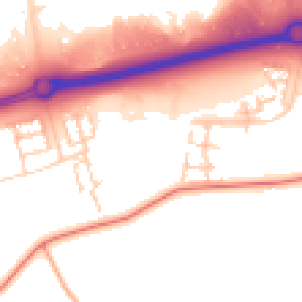
Daytime· 07:00 – 23:00
54.4dB

Night-time· 23:00 – 07:00
47.2dB