25 Hadrians Drive, Bancroft, Milton Keynes, MK13 0QB
About 25 Hadrians Drive
25 Hadrians Drive is a two-bedroom mid-terrace house in Bancroft, Milton Keynes, Milton Keynes (MK13 0QB). It has a recorded floor area of 82 m² (around 878 sq ft), construction records dating it to 1983-1990 and council tax band B. The latest certificate (June 2009) shows a C (score 73). The latest certificate is from June 2009, so improvements made since then won't be reflected.
It hasn't traded since November 2009, a hold of 17 years that's notably long for the area. That sale fell during the post-crash dip, which often skews comparisons against later neighbouring sales. At 82 m² the property is well over the postcode median (54 m² across 4 EPCs), placing it in the larger end of the local stock. Across 1999–2009, sale prices on this property compounded at 10.9% per year. Today's modelled estimate of £241,000 sits 65.1% above the 2009 sale of £146,000.
What this property has
Inside
- Bedrooms2
Everything you need to know about 25 Hadrians Drive
The true value, the hidden risks and the full sale history, in one report.
30-day money-back guarantee

The data behind every report


Energy performance
25 Hadrians Drive's EPC is over a decade old — improvements since won't be reflected.
EPC Expired
This certificate is over 10 years old and is no longer valid.Expired 16 Jun 2019
EPC Rating
Planning history
25 Hadrians Drive has no planning applications on record.
Notable planning nearby
2applications of note in the surrounding area
Sales history & valuation
25 Hadrians Drive has more than tripled in price since its earliest registered sale in 1999.
£241,000
Modelled from EPC, postcode comparables and a sale-price growth of 10.9% per year over 11 years.
£146,000
Growth on file: 10.9% per year over 11 years.
Sales timeline
13 November 2009Most recent
£146,000
+204.2%over 10 years26 February 1999
£48,000
Median price across the last 5 sales in MK13 0QB: £109,500 (2016–2004).
Nearby sales in MK13 0QB
Versus other Hadrians Drive homes
25 Hadrians Drive is notably below the street on price per m².
Price per m²
£1,789
Street avg £2,504
Floor Area
82 m²
Street avg 72 m²
Habitable Rooms
3 rooms
Street avg 5 rooms
CO₂ Emissions
2.6 t/year
Street avg 3.3 t/year
Everything you need to know about 25 Hadrians Drive
The true value, the hidden risks and the full sale history, in one report.
30-day money-back guarantee
The data behind every report
Similar properties nearby
1 Caledonian Road, New Bradwell
MK13 0AP
1 Glyn Street, New Bradwell
MK13 0DF
1 Harwood Street, New Bradwell
MK13 0EH
1 Haltonchesters, Bancroft
MK13 0PE
1 Church Street, New Bradwell
MK13 0DA
1 King Edward Street, New Bradwell
MK13 0BG
1 Bridgeway, New Bradwell
MK13 0ES
1 Bertram Close, New Bradwell
MK13 0DT
The neighbourhood at a glance
Crime
4/mo
Steady year-on-year across the wider district.
Nearest stop
0.3 km
Bancroft Roundabout West — bus stop.
Closest school
0.7 km
Priory Common School. 28 schools nearby.
Go deeper on the local area
The full report breaks down crime, transport links, schools and air quality in depth.
Road noise across the postcode
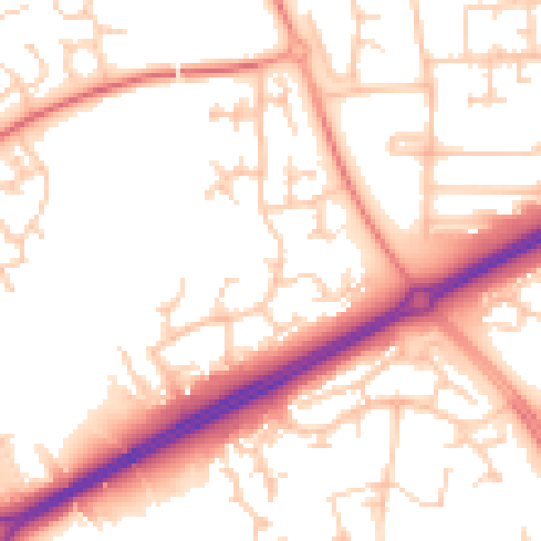
Daytime· 07:00 – 23:00
53.9dB

Night-time· 23:00 – 07:00
43.4dB