12 14, Flat A, High Street South, Dunstable, LU6 3HA
About 12 14
12 14 is a detached house in Dunstable (LU6 3HA). It has a recorded floor area of 28 m² (around 301 sq ft) and construction records dating it to 1900-1929. At 28 m² this is the 2nd smallest of 4 units on EPC record in 12 14, where floor areas span 25–36 m². The building's EPC ratings span D to C, with this unit at the top. On EPC score it ranks first in the building (71 versus a worst of 55). The latest certificate (February 2026) shows a C (score 71). The rating has held steady at C across 8 certificates since February 2014. Between certificates, roof efficiency went from Good to Very Good, window efficiency went from Very Poor to Average and hot-water efficiency went from Very Poor to Average. Main heating runs on electricity. This certificate was lodged in the last six months, so the rating reflects current condition.
2 planning records sit against the property, 1 approved, 1 refused. Past consents include change of use to residential, meaningful when judging how the property has evolved. At 28 m² it's 22.2% smaller than the typical home in the postcode (36 m² median across 7 EPCs). Its energy rating outperforms most of the postcode (better than 71% of similar EPCs).
Everything you need to know about 12 14
The true value, the hidden risks and the full sale history, in one report.
30-day money-back guarantee

The data behind every report


Energy performance
12 14's carbon output is low for the local stock.
EPC Rating
Property Improvements
Changes detected from historical EPC data
Single glazing replaced with double or better glazing
Heating controls changed
Hot water system upgraded
Windows upgraded, improving insulation
Loft insulation upgraded to recommended levels
Heating system upgraded to a more efficient system
Heating controls changed
Hot water efficiency improved
Heating system changed
Heating controls upgraded for better temperature management
Hot water system changed
Wall insulation improved
Loft insulation upgraded to recommended levels
Hot water system upgraded
Planning history
- Apr 2013Change of UseFullIn report
First floor change of use to 4 No residential studio flats.
- Reference
- CB/13/00540/FULL
- Jan 2013Change of UseFullIn report
First floor change of use from office to 4 residential studio flats.
- Reference
- CB/12/04161/FULL
We flagged 2 things worth checking at 12 14
Independent checks surfaced things a buyer would want to understand before offering. The report explains each one in full, with the underlying data and what to ask.
- Signs of HMO activity in the area
- Larger development activity nearby
30-day money-back guarantee
Sales history & valuation
12 14 has no Land Registry sales on file, suggesting it has stayed in the same hands since registration began.
£154,000
Modelled from EPC, postcode comparables.
No sales recorded with HM Land Registry
That can mean the property has never traded since the registry began publishing in 1995, was a new build that hasn't been registered yet, or is held in the same hands long-term.
Median price across the last 5 sales in LU6 3HA: £157,500 (2022–2005).
Versus other High Street South homes
12 14 outperforms the street on co₂ emissions by a wide margin.
EPC Rating
71 (C)
Street avg 64 (D)
Floor Area
28 m²
Street avg 37 m²
CO₂ Emissions
0.5 t/year
Street avg 2.5 t/year
Habitable Rooms
1 rooms
Street avg 2 rooms
Everything you need to know about 12 14
The true value, the hidden risks and the full sale history, in one report.
30-day money-back guarantee
The data behind every report
Similar properties nearby
28a, Flat, High Street South
LU6 3HA
12 14, Flat D, High Street South
LU6 3HA
19a, Flat 4, High Street South
LU6 3RZ
19a, Flat 2, High Street South
LU6 3RZ
19a, Flat 3, High Street South
LU6 3RZ
19a, Flat 8, High Street South
LU6 3RZ
12 14, Flat C, High Street South
LU6 3HA
6 Brittany Court, Top Flat, High Street South
LU6 3HR
The neighbourhood at a glance
Crime
3/mo
Steady year-on-year across the wider district.
Nearest stop
0.1 km
West Street — bus stop.
Closest school
0.4 km
Dunstable Icknield Lower School. 25 schools nearby.
Go deeper on the local area
The full report breaks down crime, transport links, schools and air quality in depth.
Road noise across the postcode
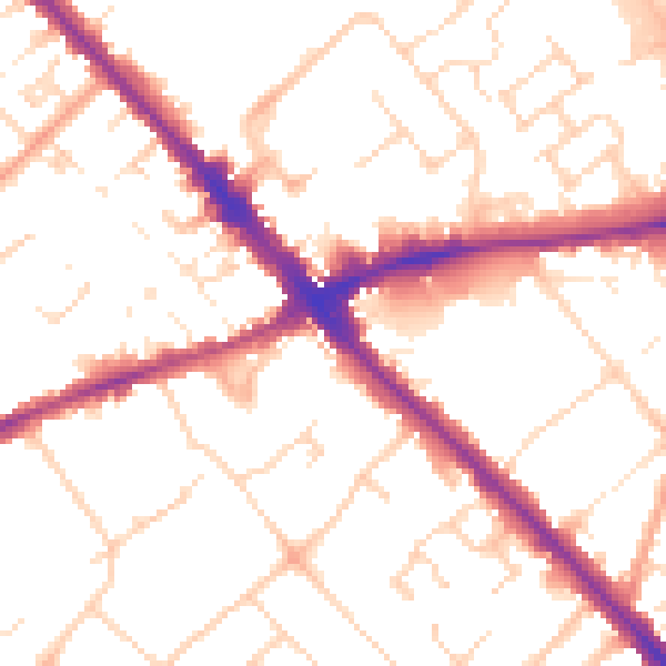
Daytime· 07:00 – 23:00
52.0dB

Night-time· 23:00 – 07:00
42.1dB