9 Cooper Lane, Ratby, Leicester, LE6 0QG
About 9 Cooper Lane
9 Cooper Lane is a four-bedroom semi-detached house in Ratby, Leicester, Leicester (LE6 0QG). It has a recorded floor area of 100 m² (around 1076 sq ft), construction records dating it to 2003-2006 and council tax band C. The latest certificate (April 2017) shows a C (score 75), near the top of the C band. The recommended improvements would push it to B (score 87).
It hasn't traded since February 2003, a hold of 23 years that's notably long for the area. Today's modelled estimate of £324,000 sits 149.3% above the 2003 sale of £129,950. On a £-per-square-foot basis, the last sale (£121/sq ft) was about 32.2% below the postcode norm. At 100 m² it's 16.9% smaller than the typical home in the postcode (120 m² median across 8 EPCs). One historical planning record sits against the property in 2004.
What this property has
Inside
- Bedrooms4
- Bathrooms2
- Dining roomYes
Outside
- Private gardenRear
- GarageDouble, Detached
Building
- RefurbishedYes
Everything you need to know about 9 Cooper Lane
The true value, the hidden risks and the full sale history, in one report.
30-day money-back guarantee

The data behind every report


Energy performance
EPC Rating
Planning history
- Apr 2004ExtensionFullIn report
Extension: Single storey · Side of property
FIRST FLOOR SIDE EXTENSION
- Reference
- 04/00232/FUL
What's in 9 Cooper Lane, Ratby, Leicester, LE6 0QG's planning history?
Refusals, disputes and full decisions on this property and nearby, in the report.
Sales history & valuation
£324,000
Modelled from EPC, postcode comparables.
£129,950
Recorded with HM Land Registry.
Sales timeline
14 February 2003Most recent
£129,950
Median price across the last 5 sales in LE6 0QG: £330,000 (2025–2015).
Nearby sales in LE6 0QG
11 Cooper Lane, Ratby, Leicester, LE6 0QG
Sold Mar 2025
£280,0005 Cooper Lane, Ratby, Leicester, LE6 0QG
Sold Jun 2020
£340,0007 Cooper Lane, Ratby, Leicester, LE6 0QG
Sold Jan 2020
£355,00010 Cooper Lane, Ratby, Leicester, LE6 0QG
Sold Oct 2015
£330,0002 Cooper Lane, Ratby, Leicester, LE6 0QG
Sold Jun 2014
£275,000
Versus other Cooper Lane homes
On price per m², 9 Cooper Lane runs well behind the street norm.
Price per m²
£1,300
Street avg £2,268
Floor Area
100 m²
Street avg 116 m²
Habitable Rooms
6 rooms
Street avg 6 rooms
CO₂ Emissions
2.8 t/year
Street avg 3.4 t/year
Everything you need to know about 9 Cooper Lane
The true value, the hidden risks and the full sale history, in one report.
30-day money-back guarantee
The data behind every report
Similar properties nearby
1 Astill Close, Ratby
LE6 0SA
1 Buttercup Grove, Ratby
LE6 0PE
1 Buckingham Close, Groby
LE6 0YX
1 Bluebell Drive, Groby
LE6 0AX
1 Butler Close, Ratby
LE6 0GD
1 Brook Drive, Ratby
LE6 0AQ
1 Castle Rise, Groby
LE6 0YQ
1 Ash Court, Groby
LE6 0EH
The neighbourhood at a glance
Crime
2/mo
Steady year-on-year across the wider district.
Nearest stop
0.2 km
Meadow Close — bus stop.
Closest school
0.7 km
Ratby Primary School. 8 schools nearby.
Go deeper on the local area
The full report breaks down crime, transport links, schools and air quality in depth.
Road noise across the postcode
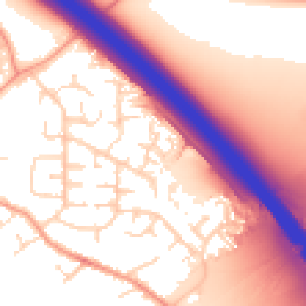
Daytime· 07:00 – 23:00
57.6dB
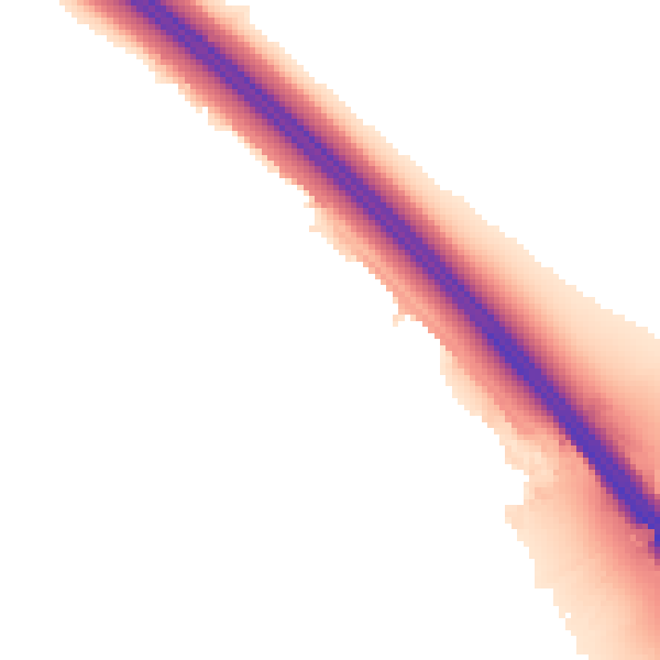
Night-time· 23:00 – 07:00
50.1dB