1 Percival Way, Groby, Leicester, LE6 0AU
About 1 Percival Way
1 Percival Way is a four-bedroom detached house in Groby, Leicester, Leicester (LE6 0AU). It has a recorded floor area of 114 m² (around 1227 sq ft), construction records dating it to 2007-2011 and council tax band E. The latest certificate (May 2022) shows a C (score 79), near the top of the C band. The recommended improvements would push it to B (score 88). The home occupies a cul-de-sac position.
Untraded for 17 years, with the last transfer in April 2009. That sale fell during the post-crash dip, which often skews comparisons against later neighbouring sales. At 114 m² the property is well over the postcode median (78 m² across 43 EPCs), placing it in the larger end of the local stock. Today's modelled estimate of £356,000 sits 79.8% above the 2009 sale of £198,000. On a £-per-square-foot basis, the last sale (£161/sq ft) was about 19% below the postcode norm.
What this property has
Inside
- Bedrooms4
- Bathrooms3
- Dining roomYes
- EnsuiteYes
Outside
- GarageDetached
- Cul-de-sacYes
Everything you need to know about 1 Percival Way
The true value, the hidden risks and the full sale history, in one report.
30-day money-back guarantee

The data behind every report


Energy performance
EPC Rating
Planning history
1 Percival Way has no planning applications on record.
The full report still covers planning activity across the surrounding area.
Sales history & valuation
The latest sale fell during the post-2008 dip, often a low-water mark in price comparisons.
£356,000
Modelled from EPC, postcode comparables.
£198,000
Recorded with HM Land Registry.
Sales timeline
23 April 2009Most recent
£198,000
Median price across the last 5 sales in LE6 0AU: £258,000 (2025–2024).
Nearby sales in LE6 0AU
22 Percival Way, Groby, Leicester, LE6 0AU
Sold Nov 2025
£258,00030 Percival Way, Groby, Leicester, LE6 0AU
Sold Feb 2025
£260,00034 Percival Way, Groby, Leicester, LE6 0AU
Sold Feb 2025
£235,00024 Percival Way, Groby, Leicester, LE6 0AU
Sold Oct 2024
£263,00036 Percival Way, Groby, Leicester, LE6 0AU
Sold Sept 2024
£240,000
Versus other Percival Way homes
Habitable Rooms for 1 Percival Way runs comfortably ahead of the street norm.
Price per m²
£1,737
Street avg £2,334
Floor Area
114 m²
Street avg 87 m²
Habitable Rooms
7 rooms
Street avg 5 rooms
CO₂ Emissions
2.6 t/year
Street avg 2.2 t/year
Everything you need to know about 1 Percival Way
The true value, the hidden risks and the full sale history, in one report.
30-day money-back guarantee
The data behind every report
Similar properties nearby
1 Astill Close, Ratby
LE6 0SA
1 Buttercup Grove, Ratby
LE6 0PE
1 Buckingham Close, Groby
LE6 0YX
1 Bluebell Drive, Groby
LE6 0AX
1 Butler Close, Ratby
LE6 0GD
1 Brook Drive, Ratby
LE6 0AQ
1 Castle Rise, Groby
LE6 0YQ
1 Ash Court, Groby
LE6 0EH
The neighbourhood at a glance
Crime
2/mo
Steady year-on-year across the wider district.
Nearest stop
0.3 km
Anstey Lane Roundabout — bus stop.
Closest school
1.3 km
Elizabeth Woodville Primary School. 15 schools nearby.
Go deeper on the local area
The full report breaks down crime, transport links, schools and air quality in depth.
Road noise across the postcode
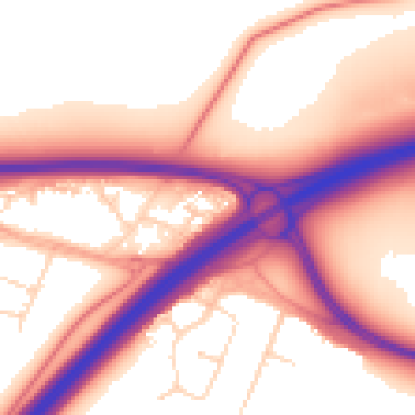
Daytime· 07:00 – 23:00
58.2dB

Night-time· 23:00 – 07:00
49.9dB