3 Bromell Grove, Husbands Bosworth, Lutterworth, LE17 6RD
About 3 Bromell Grove
3 Bromell Grove is a detached house in Husbands Bosworth, Lutterworth, Lutterworth (LE17 6RD). It has a recorded floor area of 234 m² (around 2519 sq ft). The latest certificate (June 2019) returns a B (score 84), comfortably above the UK average. Main heating runs on electricity: electricity, unspecified tariff.
At 234 m² it's 15.6% larger than the typical home in the postcode (203 m² median across 4 EPCs). Today's modelled estimate of £757,000 is 19.2% above the 2019 sale price. Last sale on file: £635,000 in September 2019.
Everything you need to know about 3 Bromell Grove
The true value, the hidden risks and the full sale history, in one report.
30-day money-back guarantee

The data behind every report


Energy performance
Achieving this rating across a home of this size is uncommon — larger homes typically score lower.
EPC Rating
Planning history
3 Bromell Grove has no planning applications on record.
Notable planning nearby
2applications of note in the surrounding area
We flagged 1 thing worth checking at 3 Bromell Grove
Independent checks surfaced things a buyer would want to understand before offering. The report explains each one in full, with the underlying data and what to ask.
- Larger development activity nearby
30-day money-back guarantee
Sales history & valuation
3 Bromell Grove valuation sits well clear of the typical sold price in this postcode.
£757,000
Modelled from EPC, postcode comparables.
£635,000
Recorded with HM Land Registry.
Sales timeline
19 September 2019Most recent
£635,000
Median price across the last 5 sales in LE17 6RD: £550,000 (2019–2018).
Nearby sales in LE17 6RD
5 Bromell Grove, Husbands Bosworth, Lutterworth, LE17 6RD
Sold Nov 2019
£580,0002 Bromell Grove, Husbands Bosworth, Lutterworth, LE17 6RD
Sold Nov 2019
£515,1004 Bromell Grove, Husbands Bosworth, Lutterworth, LE17 6RD
Sold Aug 2019
£550,0001 Bromell Grove, Husbands Bosworth, Lutterworth, LE17 6RD
Sold Jul 2018
£499,000
Versus other Bromell Grove homes
3 Bromell Grove is notably below the street on co₂ emissions.
Price per m²
£2,714
Street avg £2,798
Floor Area
234 m²
Street avg 196 m²
CO₂ Emissions
2.6 t/year
Street avg 2.3 t/year
Years Held
7 years
Street avg 7 years
Everything you need to know about 3 Bromell Grove
The true value, the hidden risks and the full sale history, in one report.
30-day money-back guarantee
The data behind every report
Similar properties nearby
1 Bromell Grove, Husbands Bosworth
LE17 6RD
1 Furrow Lane, North Kilworth
LE17 6FJ
1 Church Walk, Swinford
LE17 6AY
1 Catthorpe Road, Shawell
LE17 6AQ
1 Foxglove Drive, Swinford
LE17 6EN
1 Beech Cottages, Main Street, Theddingworth
LE17 6QZ
1 Braye Cottages, Stanford Road, Swinford
LE17 6BJ
1 Elizabeth Cottages, Lutterworth Road, Shawell
LE17 6AE
The neighbourhood at a glance
Daytime road noise here sits well below conversation level — a quiet pocket of the postcode.
Crime
2/mo
Steady year-on-year across the wider district.
Nearest stop
0.3 km
Primary School — bus stop.
Closest school
0.2 km
Husbands Bosworth Church of England Primary School. 1 school nearby.
Go deeper on the local area
The full report breaks down crime, transport links, schools and air quality in depth.
Road noise across the postcode
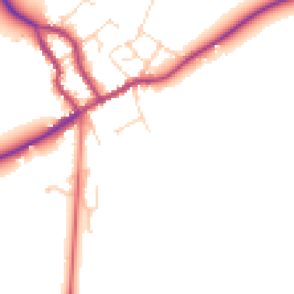
Daytime· 07:00 – 23:00
47.9dB

Night-time· 23:00 – 07:00
40.8dB