6 Roehampton Drive, Liverpool, L23 7XD
About 6 Roehampton Drive
6 Roehampton Drive is a four-bedroom detached house in Liverpool (L23 7XD). It has a recorded floor area of 288 m² (around 3100 sq ft), construction records dating it to 1930-1949 and council tax band G. The latest certificate (November 2025) returns a high B (score 90), putting the home a stone's throw from an A rating. When first surveyed in September 2015 the rating was D, the property has climbed 2 bands since. Between certificates, wall efficiency went from Poor to Good, window efficiency went from Average to Good and lighting went from Average to Very Good; while hot-water efficiency dropped from Good to Average. Main heating runs on electricity. Our model identifies extension potential, subject to local planning policy.
At 288 m² the property is well over the postcode median (206 m² across 16 EPCs), placing it in the larger end of the local stock. On energy efficiency it sits in the top 10% of properties in this postcode. 2 planning records sit against the property, 2 approved, 0 refused. Past consents include an extension, partial demolition and a conservatory, meaningful when judging how the property has evolved. Across 1999–2021, sale prices on this property compounded at 6.6% per year. Today's modelled estimate of £889,000 is 33.7% above the 2021 sale price. Most recent transfer: November 2021 at £665,000. That sale was during the post-pandemic price surge, when transactions cleared materially above pre-2020 trend.
What this property has
Inside
- Bedrooms4
- Bathrooms2
- Open-plan layoutYes
- Dining roomYes
- EnsuiteYes
Outside
- Private gardenSouth-facing
- GarageYes
Building
- RefurbishedYes
- Extension potentialPossible
Everything you need to know about 6 Roehampton Drive
The true value, the hidden risks and the full sale history, in one report.
Pick your report · from £14.99
One time fee only - money back guarantee

The data behind every report







Energy performance
6 Roehampton Drive ranks among the most efficient homes in the postcode for energy use.
EPC Rating
Certificate validity
Valid until 28 November 2035
Property Improvements
Changes detected from historical EPC data
Heat pump installed, significantly improving energy efficiency
Changed to a more efficient fuel source
Heating controls upgraded for better temperature management
Hot water efficiency decreased
High performance glazing installed
Wall insulation improved
Floor insulation added or improved
More low energy lighting installed

Get a survey for this property
Level 3 Building Survey
Because the property has been extended more than once, has no mains gas supply, and has solid (non-cavity) walls, we believe a Level 3 building survey should be considered.
From £1,360 · Includes VAT
Planning history
Planning history includes recorded demolition works, indicating a major rebuild phase at this address.
2 applications on record at 6 Roehampton Drive, Liverpool, L23 7XD
- Aug 2000ConservatoryFullOutcome in report
Extension: Rear of property
Erection of a conservatory at the rear of the dwellinghouse.
Extension- Reference
- S/2000/0512
- More recent applications — locked
- DemolitionJun 2022Decision
Unlock 6 Roehampton Drive, Liverpool, L23 7XD's full planning history
You're seeing the shape of it. The report has the substance.
- Every decision — granted, refused or withdrawn (2 on record)
- All 2 applications on this property in full
- The 9 documents, officer reports & conditions
- What the pattern means for extending or converting here
One time fee only - money back guarantee
Sales history & valuation
6 Roehampton Drive has more than quadrupled in price since its earliest registered sale in 1999.
£889,000
Modelled from EPC, postcode comparables and a sale-price growth of 6.6% per year over 23 years.
£665,000
Growth on file: 6.6% per year over 23 years.
Sales timeline
17 November 2021Most recent
£665,000
+334.6%over 22 years8 January 1999
£153,000
Median price across the last 5 sales in L23 7XD: £700,000 (2025–2021).
Nearby sales in L23 7XD
Versus other Roehampton Drive homes
On epc rating, 6 Roehampton Drive stands well clear of the street.
Price per m²
£2,309
Street avg £2,825
Floor Area
288 m²
Street avg 203 m²
Habitable Rooms
7 rooms
Street avg 8 rooms
CO₂ Emissions
0.6 t/year
Street avg 10.2 t/year
Everything you need to know about 6 Roehampton Drive
The true value, the hidden risks and the full sale history, in one report.
Pick your report · from £14.99
One time fee only - money back guarantee
The data behind every report
Similar properties nearby
1 St Andrews Road
L23 7UP
1 Prestwick Drive
L23 7XB
1 St Andrews Drive, Crosby
L23 7UX
1 Berwick Drive
L23 7UH
1 Cambridge Drive, Crosby
L23 7UB
1 Fairways, Crosby
L23 7YD
1 Boundary Drive, Crosby
L23 7UY
1 Sherwood Avenue
L23 7YG
The neighbourhood at a glance
Rail-style transport is unusually close for this postcode.
Crime
132/mo
Falling year-on-year across the wider district.
Nearest stop
0.1 km
Cambridge Road — bus stop.
Closest school
0.3 km
St Michaels Church of England Academy. 16 schools nearby.
Go deeper on the local area
A Local Area report breaks down crime, transport links, schools and air quality in depth.
Road noise across the postcode
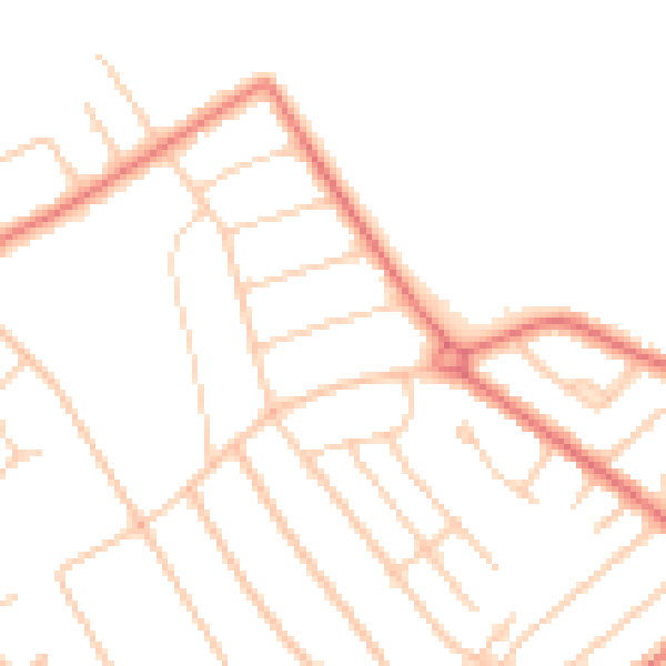
Daytime· 07:00 – 23:00
46.8dB

Night-time· 23:00 – 07:00
37.2dB